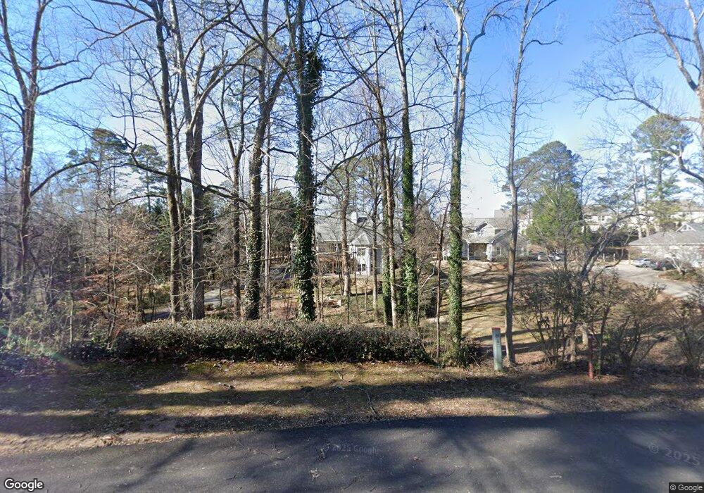
2905 Canon Ct Cumming, GA 30041
Estimated Value: $586,000 - $679,000
4
Beds
4
Baths
2,633
Sq Ft
$238/Sq Ft
Est. Value
About This Home
This home is located at 2905 Canon Ct, Cumming, GA 30041 and is currently estimated at $627,625, approximately $238 per square foot. 2905 Canon Ct is a home located in Forsyth County with nearby schools including Mashburn Elementary School, Lakeside Middle School, and Forsyth Central High School.
Ownership History
Date
Name
Owned For
Owner Type
Purchase Details
Closed on
Sep 15, 2023
Sold by
Smith Randy Le
Bought by
Randall And Karen Smith Living Trust and Smith
Current Estimated Value
Purchase Details
Closed on
Jan 27, 2022
Sold by
Smith Jessica Gwen and Smith Matthew Everett
Bought by
Wolfe Robin Bradley
Purchase Details
Closed on
Aug 4, 1995
Sold by
Cumming Investm Ents #1 L P
Bought by
Smith Randy Karen
Create a Home Valuation Report for This Property
The Home Valuation Report is an in-depth analysis detailing your home's value as well as a comparison with similar homes in the area
Home Values in the Area
Average Home Value in this Area
Purchase History
| Date | Buyer | Sale Price | Title Company |
|---|---|---|---|
| Randall And Karen Smith Living Trust | -- | None Listed On Document | |
| Wolfe Robin Bradley | -- | None Listed On Document | |
| Wolfe Robin Bradley | -- | None Listed On Document | |
| Smith Randy Karen | $30,000 | -- |
Source: Public Records
Tax History Compared to Growth
Tax History
| Year | Tax Paid | Tax Assessment Tax Assessment Total Assessment is a certain percentage of the fair market value that is determined by local assessors to be the total taxable value of land and additions on the property. | Land | Improvement |
|---|---|---|---|---|
| 2025 | $988 | $275,952 | $59,520 | $216,432 |
| 2024 | $988 | $271,076 | $52,080 | $218,996 |
| 2023 | $894 | $248,972 | $40,920 | $208,052 |
| 2022 | $977 | $123,400 | $26,040 | $97,360 |
| 2021 | $902 | $123,400 | $26,040 | $97,360 |
| 2020 | $3,343 | $121,080 | $28,000 | $93,080 |
| 2019 | $3,358 | $121,440 | $20,000 | $101,440 |
| 2018 | $3,103 | $112,200 | $26,000 | $86,200 |
| 2017 | $3,020 | $108,800 | $26,000 | $82,800 |
| 2016 | $2,853 | $102,800 | $20,000 | $82,800 |
| 2015 | $2,969 | $106,800 | $24,000 | $82,800 |
| 2014 | $2,639 | $99,680 | $0 | $0 |
Source: Public Records
Map
Nearby Homes
- 2765 Port Bow Ln
- 2575 Maple Park Place
- 2735 Hanson Ct
- 2935 Cobblestone Dr
- 2840 Waverly Walk Point
- 2730 Brook Valley Dr
- LOT 51 Brook Valley Dr
- LOT 50 Brook Valley Dr
- LOT 48 Brook Valley Dr
- LOT 52 Brook Valley Dr
- LOT 47 Brook Valley Dr
- LOT 54 Brook Valley Dr
- 1950 Buford Dam Rd Unit 202
- 1950 Buford Dam Rd Unit 801
- 3235 Southshore Ct
- 2802 Buford Dam Rd
- 2935 Hamilton Rd Unit IV
- 4050 Samples Rd
- 1820 Ridge Rd
- 2995 Hamilton Rd
- 2915 Canon Ct
- 2924 Samples Rd
- 2925 Canon Ct
- 2930 Samples Rd
- 2935 Bowline Dr
- 2915 Bowline Dr
- 2925 Bowline Dr
- 2875 Bowline Dr
- 0 Canon Ct Unit 7408250
- 0 Canon Ct Unit 8158912
- 0 Canon Ct Unit 7357831
- 2945 Bowline Dr
- 2940 Bowline Dr
- 2920 Bowline Dr
- 2945 Canon Ct
- 2920 Samples Rd
- 2920 Samples Rd Unit 3
- 3015 Bowline Dr
- 2910 Canon Ct
- 2910 Bowline Dr