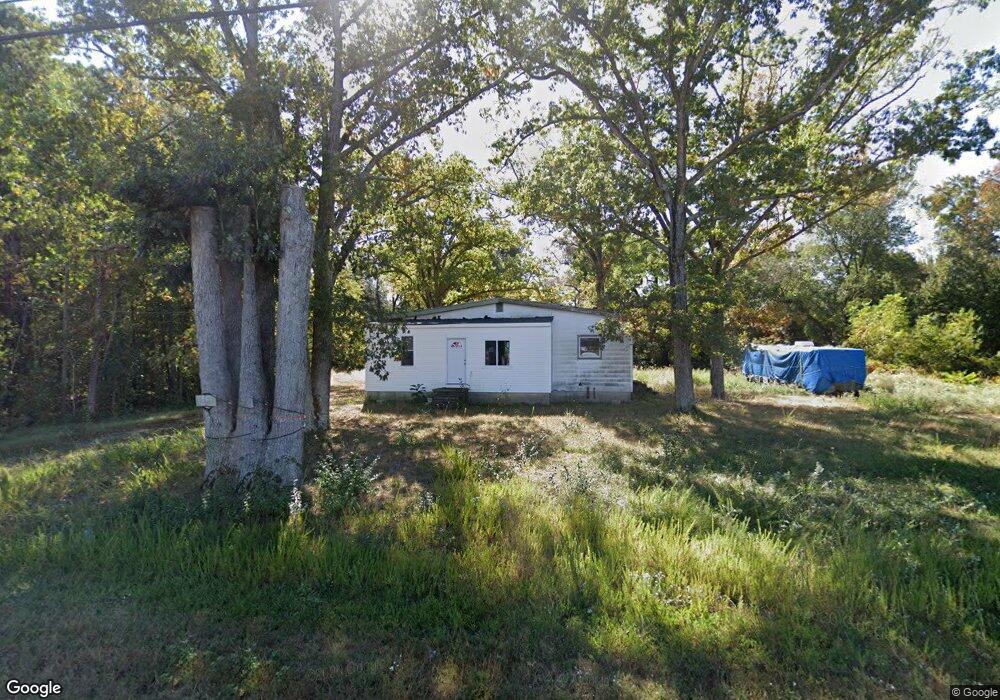
2905 Vine Rd Vineland, NJ 08360
Estimated Value: $192,028 - $303,000
--
Bed
--
Bath
1,286
Sq Ft
$199/Sq Ft
Est. Value
About This Home
This home is located at 2905 Vine Rd, Vineland, NJ 08360 and is currently estimated at $256,009, approximately $199 per square foot. 2905 Vine Rd is a home located in Atlantic County with nearby schools including Buena Regional Middle School, Buena Regional High School, and Emmanuel Day School.
Ownership History
Date
Name
Owned For
Owner Type
Purchase Details
Closed on
Jun 10, 2005
Sold by
Mazzoni Andrew
Bought by
Patel Kantilal and Hajariwala Bhavin
Current Estimated Value
Purchase Details
Closed on
Dec 21, 2004
Sold by
Mazzoni Andrew
Bought by
Mazzoni Andrew
Purchase Details
Closed on
Dec 18, 1990
Sold by
Mazzoni Catherine and Mazzoni Henry
Bought by
Mazzoni Andrew and Mazzoni Philip
Create a Home Valuation Report for This Property
The Home Valuation Report is an in-depth analysis detailing your home's value as well as a comparison with similar homes in the area
Home Values in the Area
Average Home Value in this Area
Purchase History
| Date | Buyer | Sale Price | Title Company |
|---|---|---|---|
| Patel Kantilal | $165,000 | Lawyers Title Ins | |
| Mazzoni Andrew | -- | -- | |
| Mazzoni Andrew | -- | -- | |
| Mazzoni Andrew | -- | -- | |
| Mazzoni Andrew | $150,000 | -- |
Source: Public Records
Tax History Compared to Growth
Tax History
| Year | Tax Paid | Tax Assessment Tax Assessment Total Assessment is a certain percentage of the fair market value that is determined by local assessors to be the total taxable value of land and additions on the property. | Land | Improvement |
|---|---|---|---|---|
| 2025 | $2,676 | $85,900 | $60,000 | $25,900 |
| 2024 | $2,676 | $85,900 | $60,000 | $25,900 |
| 2023 | $2,574 | $85,900 | $60,000 | $25,900 |
| 2022 | $2,574 | $85,900 | $60,000 | $25,900 |
| 2021 | $4,329 | $147,400 | $121,500 | $25,900 |
| 2020 | $4,188 | $147,400 | $121,500 | $25,900 |
| 2019 | $4,023 | $147,400 | $121,500 | $25,900 |
| 2018 | $3,984 | $147,400 | $121,500 | $25,900 |
| 2017 | $5,117 | $191,000 | $121,500 | $69,500 |
| 2016 | $4,953 | $191,000 | $121,500 | $69,500 |
| 2015 | $4,859 | $191,000 | $121,500 | $69,500 |
| 2014 | $4,838 | $191,000 | $121,500 | $69,500 |
Source: Public Records
Map
Nearby Homes
- 2818 Vine Rd
- 3020 E Oak Rd
- Block 173 Lot 40.03 Wheat Rd
- 383 Wheat Rd
- 1404 S Central Ave
- 1402 S Central Ave
- 1402 Central
- 3635 Maple Ave
- 866 N Brewster Rd
- 104 N West Ave
- 105 N West Ave
- 508 Martinelli Ave
- 3258 E Landis Ave
- 1790 Southwest Blvd
- 2102 E Oak Rd Unit 6
- 191 Redcrest St
- 117 Redcrest St
- 104 S Franklin St
- 100 Country Ln Unit 100
- 1872 Galli Dr