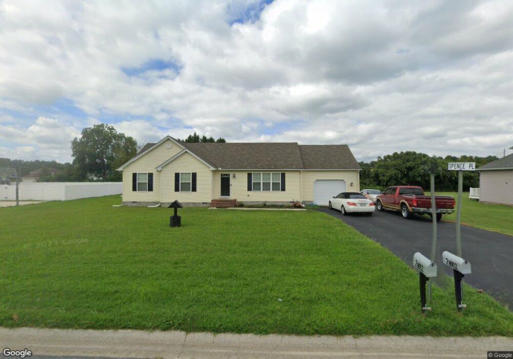
29052 Adventist Dr Salisbury, MD 21801
North Salisbury NeighborhoodEstimated Value: $231,910 - $319,000
3
Beds
2
Baths
1,226
Sq Ft
$221/Sq Ft
Est. Value
About This Home
This home is located at 29052 Adventist Dr, Salisbury, MD 21801 and is currently estimated at $270,728, approximately $220 per square foot. 29052 Adventist Dr is a home located in Wicomico County with nearby schools including West Salisbury Elementary School, North Salisbury Elementary School, and Salisbury Middle School.
Ownership History
Date
Name
Owned For
Owner Type
Purchase Details
Closed on
Dec 31, 2018
Sold by
The Ramia Investments Llc
Bought by
Spence Wayne and Spence Charlene J
Current Estimated Value
Home Financials for this Owner
Home Financials are based on the most recent Mortgage that was taken out on this home.
Original Mortgage
$161,912
Outstanding Balance
$143,123
Interest Rate
4.87%
Mortgage Type
FHA
Estimated Equity
$127,605
Purchase Details
Closed on
May 2, 2012
Sold by
The Bank Of Delmarva
Bought by
Ramia Investments Llc
Create a Home Valuation Report for This Property
The Home Valuation Report is an in-depth analysis detailing your home's value as well as a comparison with similar homes in the area
Home Values in the Area
Average Home Value in this Area
Purchase History
| Date | Buyer | Sale Price | Title Company |
|---|---|---|---|
| Spence Wayne | $164,900 | Amrock | |
| Ramia Investments Llc | $25,000 | None Available |
Source: Public Records
Mortgage History
| Date | Status | Borrower | Loan Amount |
|---|---|---|---|
| Open | Spence Wayne | $161,912 |
Source: Public Records
Tax History Compared to Growth
Tax History
| Year | Tax Paid | Tax Assessment Tax Assessment Total Assessment is a certain percentage of the fair market value that is determined by local assessors to be the total taxable value of land and additions on the property. | Land | Improvement |
|---|---|---|---|---|
| 2025 | $1,363 | $151,300 | $0 | $0 |
| 2024 | $1,363 | $140,100 | $0 | $0 |
| 2023 | $1,334 | $128,900 | $19,900 | $109,000 |
| 2022 | $1,359 | $127,433 | $0 | $0 |
| 2021 | $1,346 | $125,967 | $0 | $0 |
| 2020 | $1,344 | $124,500 | $19,900 | $104,600 |
| 2019 | $1,292 | $123,400 | $0 | $0 |
| 2018 | $1,335 | $122,300 | $0 | $0 |
| 2017 | $1,328 | $121,200 | $0 | $0 |
| 2016 | -- | $119,200 | $0 | $0 |
| 2015 | $282 | $117,200 | $0 | $0 |
| 2014 | $282 | $115,200 | $0 | $0 |
Source: Public Records
Map
Nearby Homes
- 29015 Adventist Dr
- 650 Suffolk Ct
- 29007 Adventist Dr
- 1505 Jersey Rd
- 0 Queen Ave Unit MDWC2006982
- 822 Mersey Ln
- JEFFERSON Plan at Sassafras Meadows
- 830 Mersey Ln
- 516 Purnell St
- 832 Mersey Ln
- 834 Mersey Ln
- 842 Mersey Ln
- 1712 Severn St
- 504 Swan Rd
- 1618 West Rd
- 907 Marquis Ave
- 1621 Waconia Dr
- 1201 Kiowa Ave
- 1817 Ocean Shore Ln
- 1710 Wilson Ln Unit 1
- 29064 Adventist Dr
- 29042 Adventist Dr
- Lot 3 Adventist Dr
- 642 Suffolk Ct
- 644 Suffolk Ct
- 29020 Adventist Dr
- Lot 2 Adventist Dr
- 640 Suffolk Ct
- 646 Suffolk Ct
- 638 Suffolk Ct
- 29041 Adventist Dr
- 29021 Adventist Dr
- 29008 Adventist Dr
- 636 Suffolk Ct
- 637 Suffolk Ct
- 637 Suffolk Ct
- 648 Suffolk Ct
- 634 Suffolk Ct
- 645 Suffolk Ct
- 632 Suffolk Ct