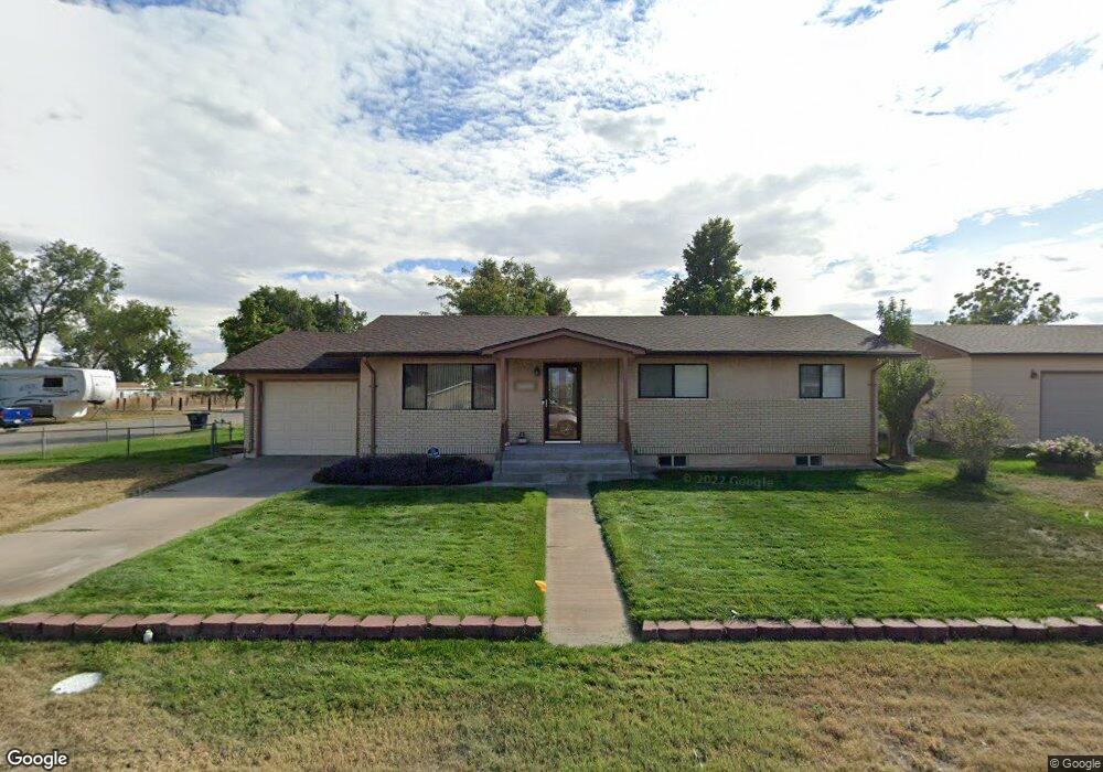
29054 Parrish Rd Pueblo, CO 81006
Estimated Value: $257,329 - $390,000
4
Beds
1
Bath
1,040
Sq Ft
$334/Sq Ft
Est. Value
About This Home
This home is located at 29054 Parrish Rd, Pueblo, CO 81006 and is currently estimated at $347,082, approximately $333 per square foot. 29054 Parrish Rd is a home located in Pueblo County with nearby schools including Vineland Elementary School, Vineland Middle School, and Pueblo County High School.
Ownership History
Date
Name
Owned For
Owner Type
Purchase Details
Closed on
Aug 12, 2002
Sold by
Martinez Roger + Sandra
Bought by
Martinez Roger M + Sandra R
Current Estimated Value
Purchase Details
Closed on
Sep 16, 1992
Sold by
Falkenstein William
Bought by
Martinez Roger + Sandra
Purchase Details
Closed on
Apr 29, 1991
Sold by
Baca Nepumoceno + Flora J
Bought by
Falkenstein William
Purchase Details
Closed on
Apr 26, 1978
Sold by
Griffin William A + Mary E
Bought by
Baca Nepumoceno + Flora J
Create a Home Valuation Report for This Property
The Home Valuation Report is an in-depth analysis detailing your home's value as well as a comparison with similar homes in the area
Home Values in the Area
Average Home Value in this Area
Purchase History
| Date | Buyer | Sale Price | Title Company |
|---|---|---|---|
| Martinez Roger M + Sandra R | -- | -- | |
| Martinez Roger + Sandra | $69,900 | -- | |
| Falkenstein William | $54,500 | -- | |
| Baca Nepumoceno + Flora J | $35,000 | -- |
Source: Public Records
Tax History Compared to Growth
Tax History
| Year | Tax Paid | Tax Assessment Tax Assessment Total Assessment is a certain percentage of the fair market value that is determined by local assessors to be the total taxable value of land and additions on the property. | Land | Improvement |
|---|---|---|---|---|
| 2024 | $949 | $15,570 | -- | -- |
| 2023 | $960 | $19,260 | $1,840 | $17,420 |
| 2022 | $940 | $15,760 | $2,260 | $13,500 |
| 2021 | $1,740 | $16,220 | $2,330 | $13,890 |
| 2020 | $1,394 | $12,970 | $2,150 | $10,820 |
| 2019 | $1,367 | $12,965 | $2,145 | $10,820 |
| 2018 | $1,185 | $11,233 | $2,160 | $9,073 |
| 2017 | $1,214 | $11,233 | $2,160 | $9,073 |
| 2016 | $1,211 | $11,195 | $2,388 | $8,807 |
| 2015 | $1,204 | $11,195 | $2,388 | $8,807 |
| 2014 | $1,105 | $10,276 | $2,388 | $7,888 |
Source: Public Records
Map
Nearby Homes
- TBD Hillside Rd
- 28513 Hillside Rd
- 1145 Wago Dr
- 28421 E US Highway 50
- 29380 Windrow Dr
- 1040 28th Ln
- 945 29th Ln
- 1339 28th Ln
- 28922 Everett Rd
- 27875 County Farm Rd
- 29767 Preston Rd
- 1419 27 1 2 Ln
- 1470 Villa Spanada St
- 27810 Spaccamonti Ct
- 27193 County Farm Rd
- TBD 27th Ln
- 760 28 1 2 Ln
- 27111 Preston Rd
- 843 Baxter Rd
- 32006 Ford Rd
- 29122 Parrish Rd
- 29053 Parrish Rd
- 28981 Hillside Rd
- 1187 29th Ln
- 29121 Parrish Rd
- 29074 Hillside Rd
- 1187 Lane 29
- 1179 29th Ln
- 1207 29th Ln
- 1207 29th Ln
- 29048 Karen Rd
- 3717 70th Ave E
- 29118 Karen Rd
- 1222 29th Ln
- 1175 29th Ln
- 29172 Karen Rd
- 1224 29th Ln
- 28896 Hillside Rd
- 28881 Hillside Rd
- 1159 29th Ln