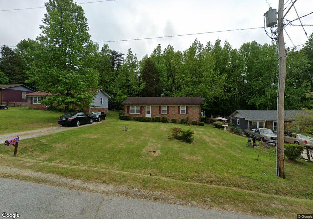
2906 Lowe Ave High Point, NC 27260
Greater High Point NeighborhoodEstimated Value: $153,873 - $186,000
3
Beds
2
Baths
1,100
Sq Ft
$152/Sq Ft
Est. Value
About This Home
This home is located at 2906 Lowe Ave, High Point, NC 27260 and is currently estimated at $167,468, approximately $152 per square foot. 2906 Lowe Ave is a home located in Guilford County with nearby schools including Union Hill Elementary School, Jamestown Middle School, and Ragsdale High School.
Ownership History
Date
Name
Owned For
Owner Type
Purchase Details
Closed on
Aug 12, 2004
Sold by
Titus Samuel
Bought by
Walker Ada Mae
Current Estimated Value
Purchase Details
Closed on
Jun 11, 1999
Sold by
Church William H and Church Elizabeth G
Bought by
Titus Samulel and Titus Dorothy M
Purchase Details
Closed on
Oct 23, 1998
Sold by
Hud
Bought by
Church William H and Church Elizabeth G
Home Financials for this Owner
Home Financials are based on the most recent Mortgage that was taken out on this home.
Original Mortgage
$43,000
Interest Rate
6.61%
Purchase Details
Closed on
Jan 5, 1998
Sold by
Walden Carla R
Bought by
Hud
Create a Home Valuation Report for This Property
The Home Valuation Report is an in-depth analysis detailing your home's value as well as a comparison with similar homes in the area
Home Values in the Area
Average Home Value in this Area
Purchase History
| Date | Buyer | Sale Price | Title Company |
|---|---|---|---|
| Walker Ada Mae | -- | None Available | |
| Titus Samulel | $66,000 | -- | |
| Church William H | -- | -- | |
| Hud | $61,503 | -- |
Source: Public Records
Mortgage History
| Date | Status | Borrower | Loan Amount |
|---|---|---|---|
| Previous Owner | Church William H | $43,000 |
Source: Public Records
Tax History
| Year | Tax Paid | Tax Assessment Tax Assessment Total Assessment is a certain percentage of the fair market value that is determined by local assessors to be the total taxable value of land and additions on the property. | Land | Improvement |
|---|---|---|---|---|
| 2025 | $1,065 | $77,300 | $15,000 | $62,300 |
| 2024 | $1,065 | $77,300 | $15,000 | $62,300 |
| 2023 | $1,065 | $77,300 | $15,000 | $62,300 |
| 2022 | $1,042 | $77,300 | $15,000 | $62,300 |
| 2021 | $914 | $66,300 | $10,000 | $56,300 |
| 2020 | $914 | $66,300 | $10,000 | $56,300 |
| 2019 | $914 | $66,300 | $0 | $0 |
| 2018 | $909 | $66,300 | $0 | $0 |
| 2017 | $909 | $66,300 | $0 | $0 |
| 2016 | $938 | $66,900 | $0 | $0 |
| 2015 | $943 | $66,900 | $0 | $0 |
| 2014 | $959 | $66,900 | $0 | $0 |
Source: Public Records
Map
Nearby Homes
- 2814 Triangle Lake Rd
- 709 Habersham Rd
- 430 New St
- 1111 Winslow St
- 2317 Purdy Ave
- 1806 Franklin Ave
- 1809 Franklin Ave
- 2715 Central Ave
- 1914 E Russell Ave
- 1110 Worth St
- 928 Marlboro St
- 210 Paramount St
- 811 Worth St
- 1908 Leonard Ave
- 931 Marlboro St
- 3003 #REAR Oakcrest Ave
- 930 & 928 R1 Marlboro St
- 640 Wesley Dr
- 650 Wesley Dr
- 3304 Central Ave
Your Personal Tour Guide
Ask me questions while you tour the home.