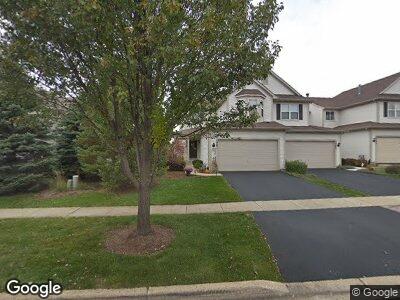
2907 Langston Cir Saint Charles, IL 60175
Harvest Hills NeighborhoodEstimated Value: $351,000 - $385,000
2
Beds
3
Baths
1,868
Sq Ft
$195/Sq Ft
Est. Value
About This Home
This home is located at 2907 Langston Cir, Saint Charles, IL 60175 and is currently estimated at $364,049, approximately $194 per square foot. 2907 Langston Cir is a home located in Kane County with nearby schools including Richmond Intermediate School, Davis Primary School, and Thompson Middle School.
Ownership History
Date
Name
Owned For
Owner Type
Purchase Details
Closed on
May 29, 2003
Sold by
Pinnacle Corp
Bought by
Manski Christopher and Manski Laura F
Current Estimated Value
Home Financials for this Owner
Home Financials are based on the most recent Mortgage that was taken out on this home.
Original Mortgage
$193,400
Interest Rate
5.51%
Mortgage Type
Purchase Money Mortgage
Create a Home Valuation Report for This Property
The Home Valuation Report is an in-depth analysis detailing your home's value as well as a comparison with similar homes in the area
Home Values in the Area
Average Home Value in this Area
Purchase History
| Date | Buyer | Sale Price | Title Company |
|---|---|---|---|
| Manski Christopher | $242,000 | Chicago Title Insurance Comp |
Source: Public Records
Mortgage History
| Date | Status | Borrower | Loan Amount |
|---|---|---|---|
| Open | Manski Laura F | $157,000 | |
| Closed | Manski Christopher | $193,400 |
Source: Public Records
Tax History Compared to Growth
Tax History
| Year | Tax Paid | Tax Assessment Tax Assessment Total Assessment is a certain percentage of the fair market value that is determined by local assessors to be the total taxable value of land and additions on the property. | Land | Improvement |
|---|---|---|---|---|
| 2023 | $7,712 | $96,364 | $22,664 | $73,700 |
| 2022 | $6,636 | $82,189 | $22,778 | $59,411 |
| 2021 | $6,389 | $78,342 | $21,712 | $56,630 |
| 2020 | $6,327 | $76,881 | $21,307 | $55,574 |
| 2019 | $6,220 | $75,359 | $20,885 | $54,474 |
| 2018 | $5,935 | $71,556 | $20,500 | $51,056 |
| 2017 | $5,791 | $69,109 | $19,799 | $49,310 |
| 2016 | $5,544 | $66,682 | $19,104 | $47,578 |
| 2015 | -- | $63,864 | $18,898 | $44,966 |
| 2014 | -- | $60,889 | $18,898 | $41,991 |
| 2013 | -- | $66,972 | $17,572 | $49,400 |
Source: Public Records
Map
Nearby Homes
- 317 Tower Hill Dr
- 531 Red Sky Dr
- 211 Grand Ridge Rd
- 2958 Renard Ln Unit 2
- 3122 W Main St
- 128 Walnut Dr Unit 7
- 257 Kennedy Dr
- 2627 Camden St
- 3341 Hillcrest Rd
- 320 Hamilton Rd
- 322 Larsdotter Ln
- 1607 Oak St
- 2262 Rockefeller Dr
- 334 Willowbrook Way
- 2218 Rockefeller Dr Unit 2218
- 2730 Lorraine Cir
- 301 Willowbrook Way
- 261 Willowbrook Way Unit 2
- 318 S 13th St
- 38W512 E Mary Ln
- 2907 Langston Cir
- 2905 Langston Cir
- 2903 Langston Cir
- 2901 Langston Cir
- 2908 Langston Cir
- 2906 Langston Cir
- 2904 Langston Cir Unit 4
- 2902 Langston Cir
- 2914 Langston Cir
- 2916 Langston Cir Unit 4
- 2916 Langston Cir Unit 2916
- 2917 Langston Cir Unit 4
- 2911 Langston Cir
- 2915 Langston Cir
- 2909 Langston Cir
- 2912 Langston Cir
- 2910 Langston Cir
- 510 Heritage Ct
- 506 Heritage Ct
- 504 Heritage Ct