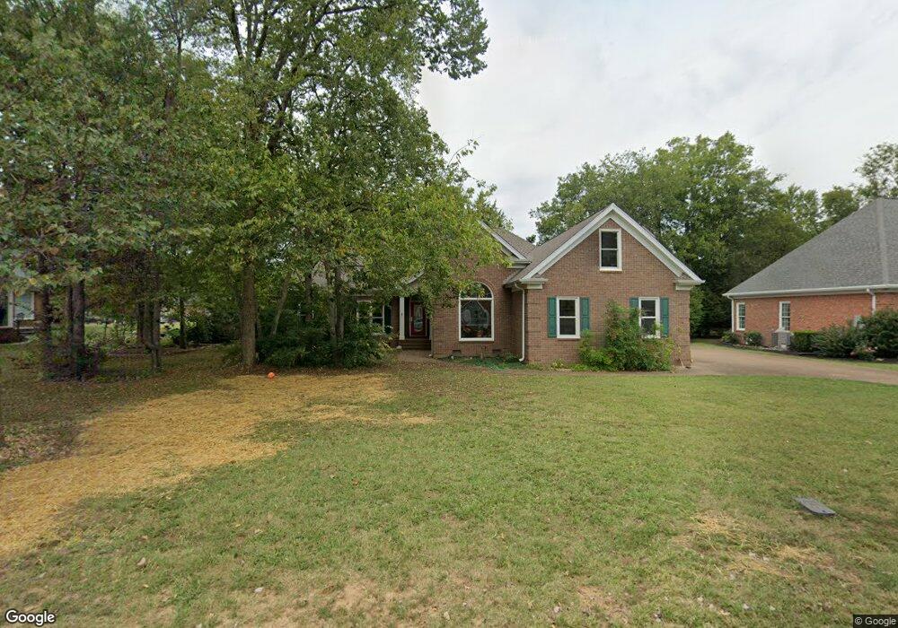
2907 Parsons Ct Murfreesboro, TN 37129
Estimated Value: $581,831 - $699,000
Studio
5
Baths
2,829
Sq Ft
$219/Sq Ft
Est. Value
About This Home
This home is located at 2907 Parsons Ct, Murfreesboro, TN 37129 and is currently estimated at $620,708, approximately $219 per square foot. 2907 Parsons Ct is a home located in Rutherford County with nearby schools including Erma Siegel Elementary School, Siegel Middle School, and Siegel High School.
Ownership History
Date
Name
Owned For
Owner Type
Purchase Details
Closed on
Jun 14, 2013
Sold by
Moore Timothy A
Bought by
Leander Erik Aronld Rache
Current Estimated Value
Purchase Details
Closed on
Nov 16, 1993
Sold by
Hunter Willis L
Bought by
Moore Timothy A
Create a Home Valuation Report for This Property
The Home Valuation Report is an in-depth analysis detailing your home's value as well as a comparison with similar homes in the area
Home Values in the Area
Average Home Value in this Area
Purchase History
| Date | Buyer | Sale Price | Title Company |
|---|---|---|---|
| Leander Erik Aronld Rache | $305,000 | -- | |
| Moore Timothy A | $25,000 | -- |
Source: Public Records
Tax History
| Year | Tax Paid | Tax Assessment Tax Assessment Total Assessment is a certain percentage of the fair market value that is determined by local assessors to be the total taxable value of land and additions on the property. | Land | Improvement |
|---|---|---|---|---|
| 2025 | $3,352 | $118,475 | $17,500 | $100,975 |
| 2024 | $3,352 | $118,475 | $17,500 | $100,975 |
| 2023 | $2,223 | $118,475 | $17,500 | $100,975 |
| 2022 | $1,915 | $118,475 | $17,500 | $100,975 |
| 2021 | $1,819 | $81,950 | $13,750 | $68,200 |
| 2020 | $1,819 | $81,950 | $13,750 | $68,200 |
| 2019 | $1,819 | $81,950 | $13,750 | $68,200 |
| 2018 | $2,498 | $81,950 | $0 | $0 |
| 2017 | $2,712 | $69,775 | $0 | $0 |
| 2016 | $2,712 | $69,775 | $0 | $0 |
| 2015 | $2,712 | $69,775 | $0 | $0 |
| 2014 | $1,735 | $69,775 | $0 | $0 |
| 2013 | -- | $72,200 | $0 | $0 |
Source: Public Records
Map
Nearby Homes
- 903 Thames Ct
- 2923 Regenwood Dr
- 707 Banner Dr
- 3289 Siegel Rd
- 0 Eyak Ln
- 2519 Regency Park Dr
- 2911 Chetco Way
- 618 Palisade Dr
- 2707 Bertram Ct
- 2802 Morgan Rd
- 306 Eyak Ln
- 0 Biloxi Ct Unit RTC3147595
- 2932 Biloxi Ct
- 402 Richard Rd
- 2331 Ravenwood Dr
- 3131 Park Hill Rd
- 1602 Balsawood Ln
- 2910 Sulphur Springs Rd
- 1606 Balsawood Ln
- 1407 Ottawa Place
- 2911 Parsons Ct
- 822 Banner Dr
- 903 Duchess Cir
- 826 Banner Dr
- 2906 Parsons Ct
- 907 Duchess Cir
- 2915 Parsons Ct
- 2910 Parsons Ct
- 2902 Parsons Ct
- 902 Duchess Cir
- 2919 Parsons Ct
- 827 Banner Dr
- 2914 Parsons Ct
- 823 Banner Dr
- 911 Duchess Cir
- 2918 Parsons Ct
- 2806 Bowers Ln
- 2902 Bowers Ln
- 831 Banner Dr
- 2915 Throne St
Your Personal Tour Guide
Ask me questions while you tour the home.