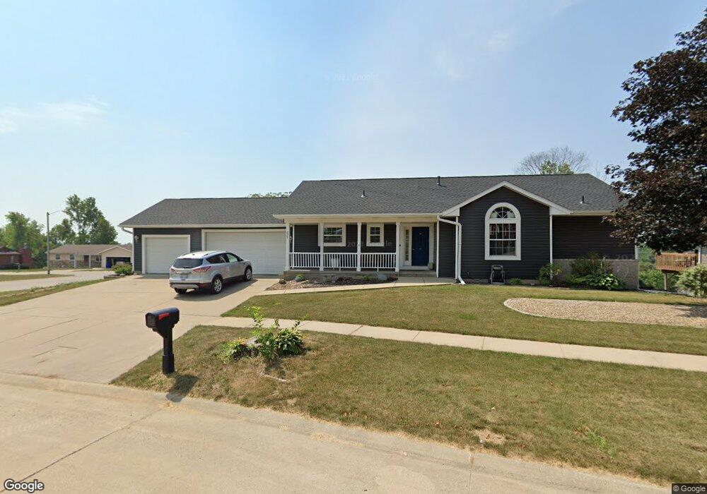
2907 Q Ave NW Cedar Rapids, IA 52405
Estimated Value: $296,319 - $313,000
3
Beds
3
Baths
1,568
Sq Ft
$195/Sq Ft
Est. Value
About This Home
This home is located at 2907 Q Ave NW, Cedar Rapids, IA 52405 and is currently estimated at $305,830, approximately $195 per square foot. 2907 Q Ave NW is a home located in Linn County with nearby schools including Kentucky Tech - Ashland Reg Tech Center, Ponderosa Elementary School, and Madison Elementary School.
Ownership History
Date
Name
Owned For
Owner Type
Purchase Details
Closed on
Jul 16, 2007
Sold by
Ruedy Michael E and Ruedy Carol V
Bought by
Fossum Diane
Current Estimated Value
Create a Home Valuation Report for This Property
The Home Valuation Report is an in-depth analysis detailing your home's value as well as a comparison with similar homes in the area
Home Values in the Area
Average Home Value in this Area
Purchase History
| Date | Buyer | Sale Price | Title Company |
|---|---|---|---|
| Fossum Diane | $191,000 | None Available |
Source: Public Records
Tax History Compared to Growth
Tax History
| Year | Tax Paid | Tax Assessment Tax Assessment Total Assessment is a certain percentage of the fair market value that is determined by local assessors to be the total taxable value of land and additions on the property. | Land | Improvement |
|---|---|---|---|---|
| 2025 | $4,376 | $273,900 | $55,300 | $218,600 |
| 2024 | $4,716 | $268,800 | $51,300 | $217,500 |
| 2023 | $4,716 | $257,700 | $51,300 | $206,400 |
| 2022 | $4,230 | $232,500 | $51,300 | $181,200 |
| 2021 | $4,292 | $213,200 | $39,500 | $173,700 |
| 2020 | $4,292 | $203,100 | $39,500 | $163,600 |
| 2019 | $3,938 | $191,200 | $31,600 | $159,600 |
| 2018 | $3,824 | $191,200 | $31,600 | $159,600 |
| 2017 | $4,031 | $194,900 | $31,600 | $163,300 |
| 2016 | $4,031 | $189,700 | $31,600 | $158,100 |
| 2015 | $4,211 | $197,873 | $31,590 | $166,283 |
| 2014 | $4,026 | $197,873 | $31,590 | $166,283 |
| 2013 | $3,934 | $197,873 | $31,590 | $166,283 |
Source: Public Records
Map
Nearby Homes
- 1733 Hillside Dr NW
- 1613 Southview Dr NW
- 327* Edgewood Rd NW
- 2520 N Ave NW
- 2825 Schultz Dr NW
- 2801 Schultz Dr NW
- 2210 O Ave NW
- 2143 Sugar Creek Dr NW
- 2147 Sugar Creek Dr NW
- 0 River Bluffs Dr
- 1322 Woodside Dr NW
- S River Bluffs Dr Unit S of River Bluffs Dr
- 3802 Richland Dr NW
- 0 O Ave NW
- 3313 Crestwood Dr NW
- 1724 O Ave NW
- 2623 Iris Ave NW
- 912 29th St NW
- 949 Westwood Dr NW
- 1608 Morris Ave NW
- 2915 Q Ave NW
- 1752 29th St NW
- 2906 Q Ave NW
- 2826 Q Ave NW
- 2921 Q Ave NW
- 1748 29th St NW
- 2821 Q Ave NW
- 2914 Q Ave NW
- 1807 29th St NW
- 2820 Q Ave NW
- 2929 Q Ave NW
- 2827 Oak Crest Ct NW
- 1757 Woodside Ct NW
- 1753 29th St NW
- 1742 29th St NW
- 2922 Q Ave NW
- 1751 Woodside Ct NW
- 2814 Q Ave NW
- 2815 Q Ave NW
- 3003 Q Ave NW