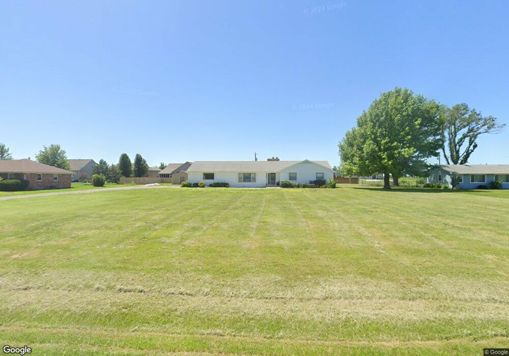
2907 SW Auburn Rd Topeka, KS 66614
Estimated Value: $274,000 - $302,000
3
Beds
3
Baths
1,888
Sq Ft
$152/Sq Ft
Est. Value
About This Home
This home is located at 2907 SW Auburn Rd, Topeka, KS 66614 and is currently estimated at $287,672, approximately $152 per square foot. 2907 SW Auburn Rd is a home located in Shawnee County with nearby schools including Auburn Elementary School, Washburn Rural Middle School, and Washburn Rural High School.
Ownership History
Date
Name
Owned For
Owner Type
Purchase Details
Closed on
Jul 14, 2020
Sold by
Hd John H and Holloway Rozanne
Bought by
Hays Investments Llc
Current Estimated Value
Purchase Details
Closed on
Aug 27, 2019
Sold by
Chamberlain James R and Chamberlain Kathryn G
Bought by
Holloway John and Holloway Rozanne G
Purchase Details
Closed on
Jul 23, 2008
Sold by
Chamnerlain James R and Chamberlain Kathryn G
Bought by
Chamberlain James R and Chamberlain Kathryn G
Purchase Details
Closed on
Jul 13, 2008
Sold by
Pardee Fred E and Will Of Marilyn J Pardee
Bought by
Chamberlain James R
Create a Home Valuation Report for This Property
The Home Valuation Report is an in-depth analysis detailing your home's value as well as a comparison with similar homes in the area
Home Values in the Area
Average Home Value in this Area
Purchase History
| Date | Buyer | Sale Price | Title Company |
|---|---|---|---|
| Hays Investments Llc | -- | None Available | |
| Holloway John | -- | None Available | |
| Chamberlain James R | -- | None Available | |
| Chamberlain James R | -- | None Available |
Source: Public Records
Tax History Compared to Growth
Tax History
| Year | Tax Paid | Tax Assessment Tax Assessment Total Assessment is a certain percentage of the fair market value that is determined by local assessors to be the total taxable value of land and additions on the property. | Land | Improvement |
|---|---|---|---|---|
| 2025 | $3,490 | $27,093 | -- | -- |
| 2023 | $3,490 | $25,049 | $0 | $0 |
| 2022 | $2,905 | $22,365 | $0 | $0 |
| 2021 | $2,526 | $19,793 | $0 | $0 |
| 2020 | $2,353 | $18,850 | $0 | $0 |
| 2019 | $2,314 | $18,301 | $0 | $0 |
| 2018 | $2,093 | $17,768 | $0 | $0 |
| 2017 | $2,198 | $17,419 | $0 | $0 |
| 2014 | $2,200 | $17,078 | $0 | $0 |
Source: Public Records
Map
Nearby Homes
- 2632 SW Sherwood Park Dr Unit Lot 2, Block B
- 2747 SW Lagito Dr
- 2628 SW Sherwood Park Dr
- 2620 SW Sherwood Park Dr
- Blake Plan at Sherwood Park - Sherwood
- Olivia Plan at Sherwood Park - Sherwood
- Xavier Plan at Sherwood Park - Sherwood
- Heidi Plan at Sherwood Park - Sherwood
- Karlyn Plan at Sherwood Park - Sherwood
- Liam Plan at Sherwood Park - Sherwood
- Kate Plan at Sherwood Park - Sherwood
- Noah Plan at Sherwood Park - Sherwood
- Porter Plan at Sherwood Park - Sherwood
- Adalyn Plan at Sherwood Park - Sherwood
- Jaylee Plan at Sherwood Park - Sherwood
- Bee Plan at Sherwood Park - Sherwood
- Madeline Plan at Sherwood Park - Sherwood
- Bridgeport II Plan at Sherwood Park - Sherwood
- Colton Plan at Sherwood Park - Sherwood
- Scorpio Plan at Sherwood Park - Sherwood
- 2911 SW Auburn Rd
- 2903 SW Auburn Rd
- 2910 SW Greenridge St
- 2908 SW Greenridge St
- 2912 SW Greenridge St
- 8445 SW 29th St
- Lot 8 Greenridge St
- Blk A, Lot Greenridge St
- Blk D, Lot Greenridge St
- Blk C, Lot Greenridge St
- Blk E, Lot Greenridge St
- 2914 SW Greenridge St
- 2915 SW Auburn Rd
- 2916 SW Greenridge St
- 8502 SW 29th Terrace
- 2903 SW Greenridge St
- Blk C, Lot 7 SW Greenridge St
- Blk C, Lot 6 SW Greenridge St
- Blk C, Lot 5 SW Greenridge St