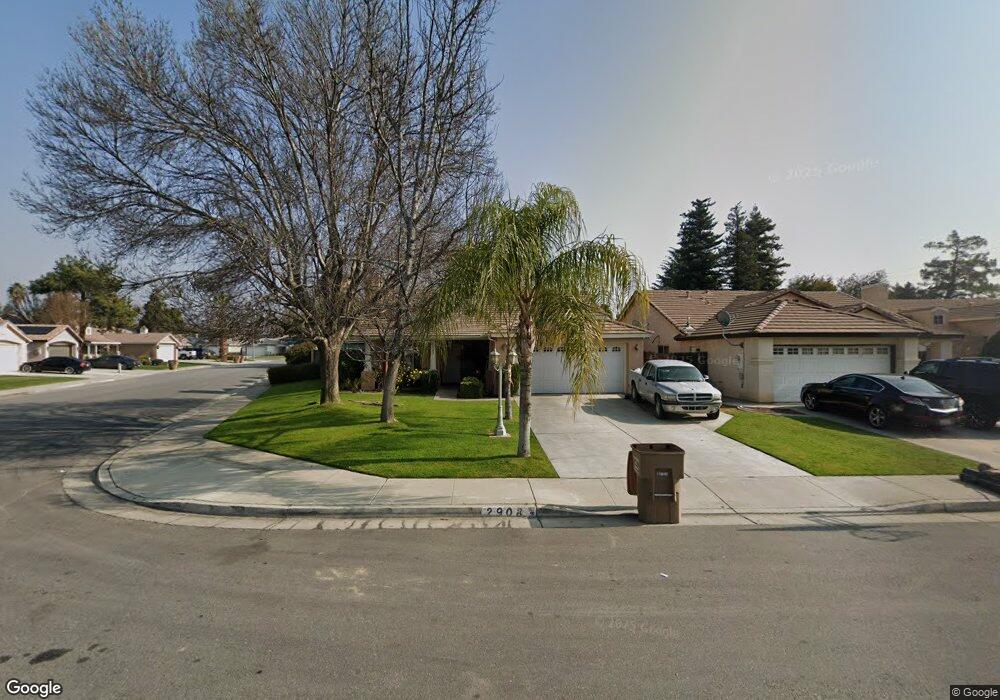
2908 Moxee Ct Bakersfield, CA 93312
Calloway Country NeighborhoodEstimated Value: $387,000 - $417,000
4
Beds
2
Baths
1,726
Sq Ft
$233/Sq Ft
Est. Value
About This Home
This home is located at 2908 Moxee Ct, Bakersfield, CA 93312 and is currently estimated at $401,701, approximately $232 per square foot. 2908 Moxee Ct is a home located in Kern County with nearby schools including Endeavour Elementary School, Centennial High School, and Country Christian School.
Ownership History
Date
Name
Owned For
Owner Type
Purchase Details
Closed on
Dec 16, 1996
Sold by
G W Homes Inc
Bought by
Lack Yolanda
Current Estimated Value
Home Financials for this Owner
Home Financials are based on the most recent Mortgage that was taken out on this home.
Original Mortgage
$87,700
Outstanding Balance
$8,778
Interest Rate
7.53%
Estimated Equity
$392,923
Purchase Details
Closed on
Dec 14, 1995
Sold by
The Dewalt Group Inc
Bought by
G W Homes Inc
Home Financials for this Owner
Home Financials are based on the most recent Mortgage that was taken out on this home.
Original Mortgage
$84,000
Interest Rate
7.18%
Create a Home Valuation Report for This Property
The Home Valuation Report is an in-depth analysis detailing your home's value as well as a comparison with similar homes in the area
Home Values in the Area
Average Home Value in this Area
Purchase History
| Date | Buyer | Sale Price | Title Company |
|---|---|---|---|
| Lack Yolanda | $117,000 | First American Title Ins Co | |
| G W Homes Inc | $20,000 | Nations Title |
Source: Public Records
Mortgage History
| Date | Status | Borrower | Loan Amount |
|---|---|---|---|
| Open | Lack Yolanda | $87,700 | |
| Previous Owner | G W Homes Inc | $84,000 |
Source: Public Records
Tax History
| Year | Tax Paid | Tax Assessment Tax Assessment Total Assessment is a certain percentage of the fair market value that is determined by local assessors to be the total taxable value of land and additions on the property. | Land | Improvement |
|---|---|---|---|---|
| 2025 | $2,948 | $190,513 | $35,817 | $154,696 |
| 2024 | $2,893 | $186,778 | $35,115 | $151,663 |
| 2023 | $2,893 | $183,117 | $34,427 | $148,690 |
| 2022 | $2,840 | $179,527 | $33,752 | $145,775 |
| 2021 | $2,732 | $176,008 | $33,091 | $142,917 |
| 2020 | $2,717 | $174,204 | $32,752 | $141,452 |
| 2019 | $2,598 | $174,204 | $32,752 | $141,452 |
| 2018 | $2,611 | $167,441 | $31,481 | $135,960 |
| 2017 | $2,551 | $164,159 | $30,864 | $133,295 |
| 2016 | $2,391 | $160,941 | $30,259 | $130,682 |
| 2015 | $2,368 | $158,525 | $29,805 | $128,720 |
| 2014 | $2,318 | $155,421 | $29,222 | $126,199 |
Source: Public Records
Map
Nearby Homes
- 9116 Chattaroy St
- 3015 Neah Bay Dr
- 8806 Rollingbay Dr
- 9323 Alki Ct
- 9021 Rosedale Hwy
- 9131 Rosedale Hwy Unit 65
- 9131 Rosedale Hwy Unit 54
- 8512 Shoal Ct
- 8400 Winlock St
- 2515 Wheeler St
- 3015 Calloway Dr Unit D6
- 3817 Southpass Dr
- 9217 Totem Ave
- 9010 Wolf River Ave
- 9831 Rosedale Hwy
- 9101 Wolf River Ave
- 9313 Wolf River Ave
- 10012 Vanessa Ave
- 10200 Wayland Ct
- 10219 Planebrook Ave
- 2904 Moxee Ct
- 2900 Moxee Ct
- 2911 Colville Ave
- 2907 Colville Ave
- 2915 Colville Ave
- 9016 Jenna Kathryn Dr
- 9012 Jenna Kathryn Dr
- 9102 Jenna Kathryn Dr
- 2903 Colville Ave
- 9008 Jenna Kathryn Dr
- 9106 Jenna Kathryn Dr
- 2909 Moxee Ct
- 9004 Jenna Kathryn Dr
- 9110 Jenna Kathryn Dr
- 2905 Moxee Ct
- 9101 Chattaroy St
- 9023 Chattaroy St
- 9105 Chattaroy St
- 2901 Moxee Ct
- 9019 Chattaroy St
Your Personal Tour Guide
Ask me questions while you tour the home.