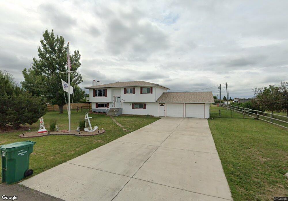
2908 Wells Fargo Dr Great Falls, MT 59404
Estimated Value: $297,000 - $424,000
3
Beds
2
Baths
3,316
Sq Ft
$114/Sq Ft
Est. Value
About This Home
This home is located at 2908 Wells Fargo Dr, Great Falls, MT 59404 and is currently estimated at $379,375, approximately $114 per square foot. 2908 Wells Fargo Dr is a home located in Cascade County with nearby schools including West Elementary School, North Middle School, and C.M. Russell High School.
Ownership History
Date
Name
Owned For
Owner Type
Purchase Details
Closed on
Jun 24, 2024
Sold by
Schuler David Wayne
Bought by
Schuler David Wayne and Schuler Vivian Kay
Current Estimated Value
Purchase Details
Closed on
Aug 29, 2008
Sold by
Unterseher Robert D and Unterseher Sharon D
Bought by
Schuler David Wayne
Home Financials for this Owner
Home Financials are based on the most recent Mortgage that was taken out on this home.
Original Mortgage
$193,982
Interest Rate
6.27%
Mortgage Type
VA
Create a Home Valuation Report for This Property
The Home Valuation Report is an in-depth analysis detailing your home's value as well as a comparison with similar homes in the area
Home Values in the Area
Average Home Value in this Area
Purchase History
| Date | Buyer | Sale Price | Title Company |
|---|---|---|---|
| Schuler David Wayne | -- | None Listed On Document | |
| Schuler David Wayne | -- | Stgf |
Source: Public Records
Mortgage History
| Date | Status | Borrower | Loan Amount |
|---|---|---|---|
| Previous Owner | Schuler David Wayne | $193,982 |
Source: Public Records
Tax History Compared to Growth
Tax History
| Year | Tax Paid | Tax Assessment Tax Assessment Total Assessment is a certain percentage of the fair market value that is determined by local assessors to be the total taxable value of land and additions on the property. | Land | Improvement |
|---|---|---|---|---|
| 2025 | $1,280 | $330,255 | $0 | $0 |
| 2024 | $2,304 | $287,000 | $0 | $0 |
| 2023 | $2,313 | $287,000 | $0 | $0 |
| 2022 | $2,191 | $248,000 | $0 | $0 |
| 2021 | $2,004 | $248,000 | $0 | $0 |
| 2020 | $2,314 | $252,400 | $0 | $0 |
| 2019 | $2,200 | $252,400 | $0 | $0 |
| 2018 | $2,139 | $238,900 | $0 | $0 |
| 2017 | $2,068 | $238,900 | $0 | $0 |
| 2016 | $1,819 | $225,800 | $0 | $0 |
| 2015 | $1,622 | $225,800 | $0 | $0 |
| 2014 | $1,664 | $109,509 | $0 | $0 |
Source: Public Records
Map
Nearby Homes
- 2520 Larkspur Ln
- 2215 Larkspur Ln
- 2110 Larkspur Ln
- 14 Florida Rd
- TBD 29th St SW
- 88 Marmot Ln
- Tbd Tbd
- 3404 Jasper Rd
- 3407 Huckleberry Dr
- 1 Arizona Rd
- tbd Jasper Rd
- 6301 Fox Farm Rd
- NHN Comanche Trail
- 2708 Jasper Rd
- 1905 Centennial Dr
- 38 Cheyenne Dr
- 2807 Huckleberry Dr
- 1321 Derby Dr
- Exit 277 Old Airport Rd
- 6201 62nd St SW
- 2828 Wells Fargo Dr
- 2928 Wells Fargo Dr
- 2909 Stagecoach Ave
- 2909 Wells Fargo Dr
- 2829 Wells Fargo Dr
- 2825 Stagecoach Ave
- 2808 Wells Fargo Dr
- 3008 Wells Fargo Dr
- 2929 Wells Fargo Dr
- 2809 Wells Fargo Dr
- 2809 Stagecoach Ave
- 3009 Wells Fargo Dr
- 3028 Wells Fargo Dr
- 2722 Wells Fargo Dr
- 2729 Wells Fargo Dr
- 3029 Stagecoach Ave
- 2900 Stagecoach Ave
- 2725 Stagecoach Ave
- 3029 Wells Fargo Dr
- 2820 Stagecoach Ave
