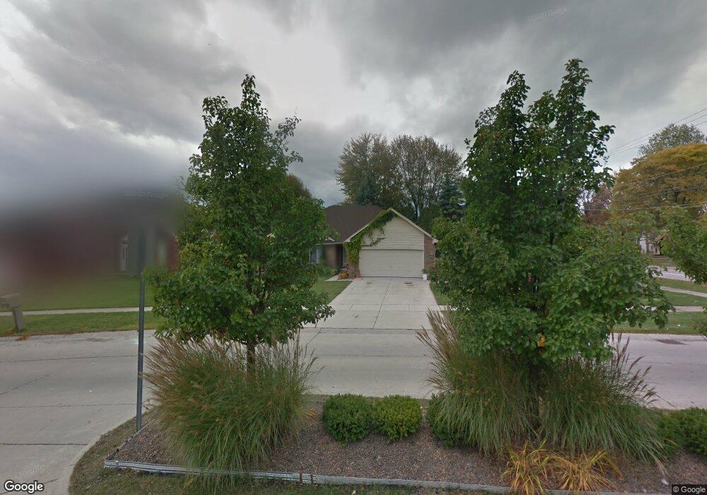
29082 Rachid Ln Chesterfield, MI 48047
Estimated Value: $369,000 - $426,000
3
Beds
3
Baths
1,651
Sq Ft
$242/Sq Ft
Est. Value
About This Home
This home is located at 29082 Rachid Ln, Chesterfield, MI 48047 and is currently estimated at $400,017, approximately $242 per square foot. 29082 Rachid Ln is a home located in Macomb County with nearby schools including Dean A. Naldrett School, Anchor Bay Middle School South, and Anchor Bay High School.
Ownership History
Date
Name
Owned For
Owner Type
Purchase Details
Closed on
Nov 14, 2008
Sold by
Mccarver Leslie and Mccarver Lori K
Bought by
Federal Home Loan Mortgage Corp
Current Estimated Value
Purchase Details
Closed on
Nov 21, 2001
Sold by
Village Building Co Inc
Bought by
Mccarver Leslie
Home Financials for this Owner
Home Financials are based on the most recent Mortgage that was taken out on this home.
Original Mortgage
$154,895
Interest Rate
7.24%
Create a Home Valuation Report for This Property
The Home Valuation Report is an in-depth analysis detailing your home's value as well as a comparison with similar homes in the area
Home Values in the Area
Average Home Value in this Area
Purchase History
| Date | Buyer | Sale Price | Title Company |
|---|---|---|---|
| Federal Home Loan Mortgage Corp | $154,382 | None Available | |
| Mccarver Leslie | $194,895 | -- |
Source: Public Records
Mortgage History
| Date | Status | Borrower | Loan Amount |
|---|---|---|---|
| Previous Owner | Mccarver Leslie | $154,895 |
Source: Public Records
Tax History Compared to Growth
Tax History
| Year | Tax Paid | Tax Assessment Tax Assessment Total Assessment is a certain percentage of the fair market value that is determined by local assessors to be the total taxable value of land and additions on the property. | Land | Improvement |
|---|---|---|---|---|
| 2025 | $4,311 | $189,000 | $0 | $0 |
| 2024 | $4,131 | $165,900 | $0 | $0 |
| 2023 | $2,205 | $149,000 | $0 | $0 |
| 2022 | $3,915 | $133,300 | $0 | $0 |
| 2021 | $3,679 | $128,700 | $0 | $0 |
| 2020 | $2,026 | $121,700 | $0 | $0 |
| 2019 | $3,162 | $114,700 | $0 | $0 |
| 2018 | $3,206 | $108,900 | $20,900 | $88,000 |
| 2017 | $3,168 | $104,350 | $20,900 | $83,450 |
| 2016 | $3,162 | $104,350 | $0 | $0 |
| 2015 | $1,476 | $97,150 | $0 | $0 |
| 2014 | $1,476 | $89,000 | $19,700 | $69,300 |
| 2012 | -- | $0 | $0 | $0 |
Source: Public Records
Map
Nearby Homes
- 47812 Forbes Dr
- 29371 Bayside Cir N
- 47460 Sugarbush Rd
- 47935 Remington Ct
- 29213 Rachid Ln
- 29126 Brooke Meadows Ct
- 47685 Jefferson Ave
- 28490 Cotton Rd Unit 3
- 28734 Yarmouth Ct Unit 18
- 28715 Portsmouth Ct Unit 32
- 29705 Alexandra Ln Unit 13
- 48345 Whittington Dr
- 48041 Sugarbush Rd
- 47900 Jefferson Ave
- 48713 Chelmsford Ct Unit 127
- 48832 Birmingham Dr
- 47978 Jefferson Ave
- 48117 Cotton Creek Blvd
- 29401 Wand Dr
- 47031 Jefferson Ave
- 29086 Rachid Ln
- 47634 Sugarbush Rd
- 29090 Rachid Ln
- 47700 Sugarbush Rd
- 47650 Sugarbush Rd
- 47673 Sugarbush Rd
- 47706 Sugarbush Rd
- 47621 Burlingame Dr
- 47619 Burlingame Dr
- 47617 Burlingame Dr
- 47655 Sugarbush Rd
- 47615 Burlingame Dr
- 47625 Burlingame Dr
- 47640 Sugarbush Rd
- 47689 Sugarbush Rd
- 47613 Burlingame Dr
- 47710 Sugarbush Rd
- 47627 Burlingame Dr
- 47611 Burlingame Dr
- 47629 Burlingame Dr