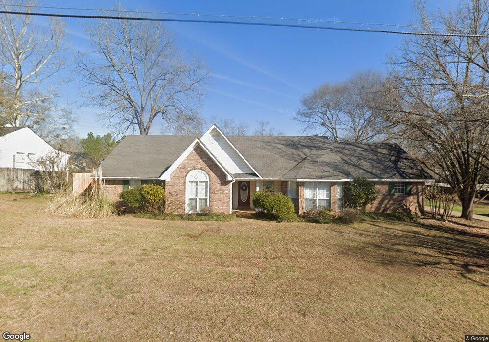
291 Crows Nest Cir Decatur, MS 39327
Estimated Value: $165,049 - $202,000
3
Beds
2
Baths
1,713
Sq Ft
$106/Sq Ft
Est. Value
About This Home
This home is located at 291 Crows Nest Cir, Decatur, MS 39327 and is currently estimated at $181,512, approximately $105 per square foot. 291 Crows Nest Cir is a home located in Newton County with nearby schools including Newton County Elementary School, Newton County High School, and Newton County Academy.
Ownership History
Date
Name
Owned For
Owner Type
Purchase Details
Closed on
May 30, 2024
Sold by
Belk Justin P and Burrell Mary C
Bought by
Slay John Taylor and Slay Lakyn Davis
Current Estimated Value
Home Financials for this Owner
Home Financials are based on the most recent Mortgage that was taken out on this home.
Original Mortgage
$181,649
Outstanding Balance
$179,081
Interest Rate
7.17%
Mortgage Type
FHA
Estimated Equity
$2,431
Create a Home Valuation Report for This Property
The Home Valuation Report is an in-depth analysis detailing your home's value as well as a comparison with similar homes in the area
Purchase History
| Date | Buyer | Sale Price | Title Company |
|---|---|---|---|
| Slay John Taylor | -- | None Listed On Document |
Source: Public Records
Mortgage History
| Date | Status | Borrower | Loan Amount |
|---|---|---|---|
| Open | Slay John Taylor | $181,649 |
Source: Public Records
Tax History
| Year | Tax Paid | Tax Assessment Tax Assessment Total Assessment is a certain percentage of the fair market value that is determined by local assessors to be the total taxable value of land and additions on the property. | Land | Improvement |
|---|---|---|---|---|
| 2025 | $3,075 | $19,641 | $0 | $0 |
| 2024 | $1,750 | $13,094 | $0 | $0 |
| 2023 | $1,725 | $13,094 | $0 | $0 |
| 2022 | $1,493 | $11,716 | $0 | $0 |
| 2021 | $1,390 | $10,979 | $0 | $0 |
| 2020 | $1,390 | $10,979 | $0 | $0 |
| 2019 | $1,398 | $10,979 | $0 | $0 |
| 2018 | $1,349 | $10,979 | $0 | $0 |
| 2017 | $1,255 | $10,428 | $0 | $0 |
| 2016 | $1,242 | $10,428 | $0 | $0 |
| 2015 | $918 | $10,428 | $0 | $0 |
| 2014 | $918 | $10,428 | $0 | $0 |
Source: Public Records
Map
Nearby Homes
- 15061 Mississippi 15
- 285 N 8th Ave
- 906 Fifth St
- 0 Turkey Creek Rd
- 12833 Mississippi 15
- 18159 Mississippi 15
- 18159 Highway 15
- 19763 Mississippi 15
- 307 Willis Rd
- 7749 Hickory Little Rock Rd
- 7933 Hickory Little Rock Rd
- 0 Newton Caney Creek Rd
- 0 Eastside Dr
- 107 Adeline Ln
- 000 Greenland Rd
- 000 Pleasant Ridge Rd
- 0 Edwards Rd
- 66 Pete Freeman Rd
- 4188 Greenland Rd
- 710 Decatur St
- 249 Crows Nest Cir
- 19 Crows Nest Cir
- 37 Crows Nest Cir
- 51 Crows Nest Cir
- 91 E Broad St
- 105 Crows Nest Cir
- 247 Crows Nest Cir
- 127 Crows Nest Cir
- 36 Crows Nest Cir
- 199 Crows Nest Cir
- 227 Crows Nest Cir
- 215 Crows Nest Cir
- 202 E Broad St
- 69 First Ave
- 87 Crows Nest Cir
- 292 Crows Nest Cir
- 46 Crows Nest Cir
- 153 Crows Nest Cir
- 58 Crows Nest Cir
- 68 Crows Nest Cir
Your Personal Tour Guide
Ask me questions while you tour the home.