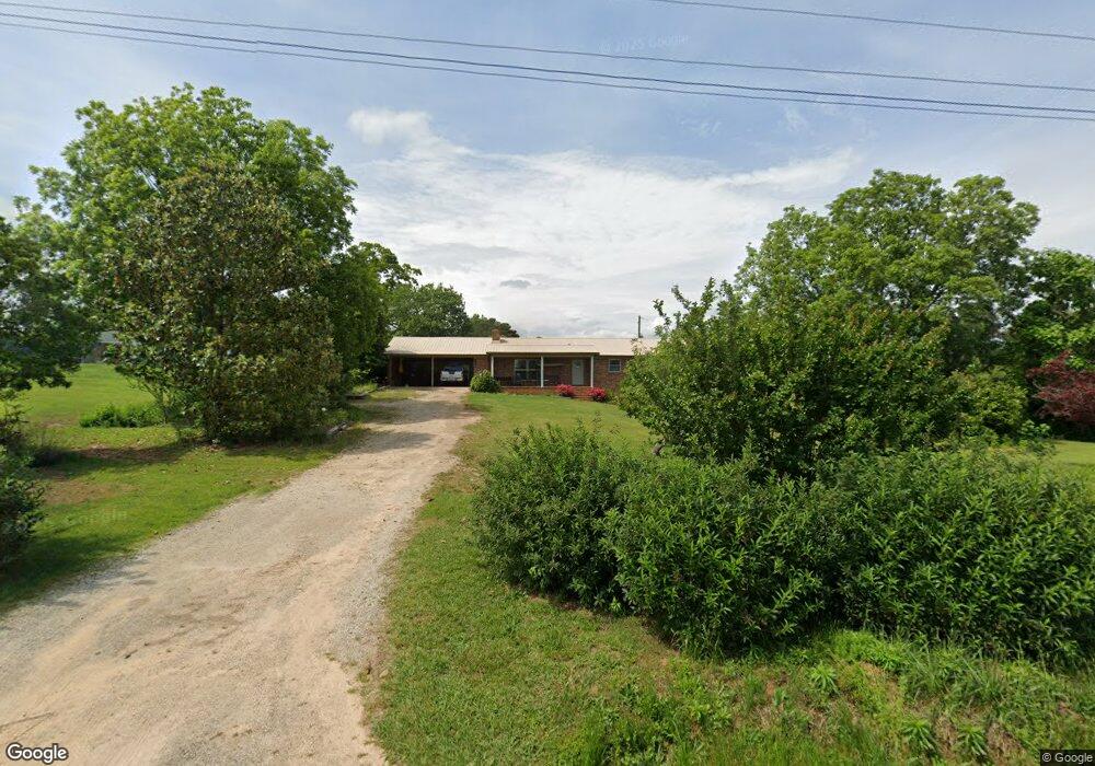
291 Phillip Lear Rd Westminster, SC 29693
Estimated Value: $264,000 - $294,000
3
Beds
2
Baths
1,522
Sq Ft
$183/Sq Ft
Est. Value
About This Home
This home is located at 291 Phillip Lear Rd, Westminster, SC 29693 and is currently estimated at $277,983, approximately $182 per square foot. 291 Phillip Lear Rd is a home located in Oconee County with nearby schools including Orchard Park Elementary School, West Oak Middle School, and West-Oak High School.
Ownership History
Date
Name
Owned For
Owner Type
Purchase Details
Closed on
Aug 6, 2024
Sold by
Bond Jerry T and Bond Terry K
Bought by
Wiewel Joseph Robert and Wiewel Lauren
Current Estimated Value
Home Financials for this Owner
Home Financials are based on the most recent Mortgage that was taken out on this home.
Original Mortgage
$247,920
Outstanding Balance
$244,658
Interest Rate
6.86%
Mortgage Type
VA
Estimated Equity
$33,325
Purchase Details
Closed on
Sep 8, 2023
Sold by
Bond Evelyn Ida
Bought by
Bond Terry K and Bond Sharon Kay
Purchase Details
Closed on
Aug 1, 2018
Sold by
Estate Of Furman Thomas Bondia
Bought by
Marcengill Bond Evelyn M and Marcengill Bond Evelyn Ida
Create a Home Valuation Report for This Property
The Home Valuation Report is an in-depth analysis detailing your home's value as well as a comparison with similar homes in the area
Home Values in the Area
Average Home Value in this Area
Purchase History
| Date | Buyer | Sale Price | Title Company |
|---|---|---|---|
| Wiewel Joseph Robert | $240,000 | None Listed On Document | |
| Bond Terry K | -- | None Listed On Document | |
| Marcengill Bond Evelyn M | -- | None Available |
Source: Public Records
Mortgage History
| Date | Status | Borrower | Loan Amount |
|---|---|---|---|
| Open | Wiewel Joseph Robert | $247,920 |
Source: Public Records
Tax History
| Year | Tax Paid | Tax Assessment Tax Assessment Total Assessment is a certain percentage of the fair market value that is determined by local assessors to be the total taxable value of land and additions on the property. | Land | Improvement |
|---|---|---|---|---|
| 2025 | $3,080 | $9,552 | $1,061 | $8,491 |
| 2024 | $1,825 | $5,658 | $696 | $4,962 |
| 2023 | $1,825 | $5,658 | $696 | $4,962 |
| 2022 | $389 | $5,658 | $696 | $4,962 |
| 2021 | $311 | $5,298 | $606 | $4,692 |
| 2020 | $367 | $5,298 | $606 | $4,692 |
| 2019 | $367 | $0 | $0 | $0 |
| 2018 | $1,176 | $0 | $0 | $0 |
| 2017 | $311 | $0 | $0 | $0 |
| 2016 | $311 | $0 | $0 | $0 |
| 2015 | -- | $0 | $0 | $0 |
| 2014 | -- | $4,961 | $760 | $4,202 |
| 2013 | -- | $0 | $0 | $0 |
Source: Public Records
Map
Nearby Homes
- 163 #A Dixon Rd
- 199 Johns Mill Rd
- 265 State Road S-37-141
- 179 Alice Ln Unit B
- Tract C Vine Rd
- Tract E Vine Rd
- LOT 7 Springview Dr
- 0 Springview Dr Unit 21515079
- 0 Springview Dr Unit 18549576
- Lot 9 Block A Brookside Dr
- 1 Brookside Dr
- 223 Brookside Dr
- 9B Lost Forest Dr
- 0 Lost Forest Dr
- Lot 34 Stillwater Place
- 333 Oliver Rd
- 140 Pickens Rd
- 120 Ridgemore Cir
- Lot 28 Lake Breeze Rd
- 120 Lonesome Valley Rd
- 291 Phillip Lear Rd
- 281 Phillip Lear Rd
- 297 Phillip Lear Rd
- 125 Ash Dr
- 151 Pittman Cir
- 161 Pittman Cir
- 331 Phillip Lear Rd
- 241 Phillip Lear Rd
- 211 Robert Grant Dr
- 710 Marcengill Hill Dr
- 221 Robert Grant Dr
- 198 Pittman Cir
- 140 Pittman Cir
- 140 Pittman Cir
- 41 Acres Robert Grant Dr
- 0 Robert Grant Dr
- 110 Pittman Cir
- 131 Pittman Cir
- 235 Robert Grant Dr
- 220 Robert Grant Dr
Your Personal Tour Guide
Ask me questions while you tour the home.