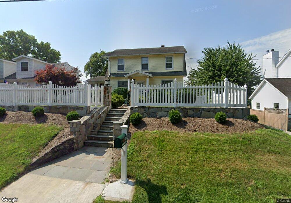
291 West Ave Darien, CT 06820
Estimated Value: $998,000 - $1,300,000
3
Beds
2
Baths
1,232
Sq Ft
$909/Sq Ft
Est. Value
About This Home
This home is located at 291 West Ave, Darien, CT 06820 and is currently estimated at $1,120,462, approximately $909 per square foot. 291 West Ave is a home located in Fairfield County with nearby schools including Holmes Elementary School, Middlesex Middle School, and Darien High School.
Ownership History
Date
Name
Owned For
Owner Type
Purchase Details
Closed on
Aug 24, 1998
Sold by
Gaffney Fanry
Bought by
Huertas Rosemary
Current Estimated Value
Home Financials for this Owner
Home Financials are based on the most recent Mortgage that was taken out on this home.
Original Mortgage
$225,000
Interest Rate
6.86%
Mortgage Type
Unknown
Create a Home Valuation Report for This Property
The Home Valuation Report is an in-depth analysis detailing your home's value as well as a comparison with similar homes in the area
Home Values in the Area
Average Home Value in this Area
Purchase History
| Date | Buyer | Sale Price | Title Company |
|---|---|---|---|
| Huertas Rosemary | $250,000 | -- |
Source: Public Records
Mortgage History
| Date | Status | Borrower | Loan Amount |
|---|---|---|---|
| Open | Huertas Rosemary | $410,000 | |
| Closed | Huertas Rosemary | $225,000 |
Source: Public Records
Tax History
| Year | Tax Paid | Tax Assessment Tax Assessment Total Assessment is a certain percentage of the fair market value that is determined by local assessors to be the total taxable value of land and additions on the property. | Land | Improvement |
|---|---|---|---|---|
| 2025 | $8,554 | $552,580 | $386,120 | $166,460 |
| 2024 | $8,117 | $552,580 | $386,120 | $166,460 |
| 2023 | $8,331 | $473,060 | $367,780 | $105,280 |
| 2022 | $8,151 | $473,060 | $367,780 | $105,280 |
| 2021 | $7,966 | $473,060 | $367,780 | $105,280 |
| 2020 | $4,149 | $473,060 | $367,780 | $105,280 |
| 2019 | $7,791 | $473,060 | $367,780 | $105,280 |
| 2018 | $4,210 | $399,070 | $285,810 | $113,260 |
| 2017 | $4,212 | $399,070 | $285,810 | $113,260 |
| 2016 | $6,293 | $399,070 | $285,810 | $113,260 |
| 2015 | $6,126 | $399,070 | $285,810 | $113,260 |
| 2014 | $5,990 | $399,070 | $285,810 | $113,260 |
Source: Public Records
Map
Nearby Homes
- 166 Hollow Tree Ridge Rd
- 13 Patton Dr
- 77 Maple St
- 32 Relihan Rd
- 223 Middlesex Rd
- 3 Salt Box Ln E
- 5 Shields Ln
- 22 Radio Place Unit 10
- 76 Deepwood Rd
- 100 Maple Tree Ave Unit 7
- 17 Sunnyside Ave
- 35 Maple Tree Ave Unit 1
- 29 Waterbury Ave
- 20 Outlook Dr
- 15 Waterbury Ln
- 151 Courtland Ave Unit 6
- 73 Courtland Ave Unit 163 ( 8)
- 23 Beach Dr
- 19 Georgian Ln
- 34 Crescent St Unit 2D
- 289 West Ave
- 293 West Ave
- 287 West Ave
- 295 West Ave
- 285 West Ave
- 288 West Ave
- 297 West Ave
- 340 Heights Rd Unit 319
- 340 Heights Rd Unit 320
- 340 Heights Rd Unit 313
- 340 Heights Rd Unit 302
- 340 Heights Rd Unit 305
- 340 Heights Rd Unit 321
- 340 Heights Rd Unit 310
- 340 Heights Rd Unit 308
- 340 Heights Rd Unit 304
- 340 Heights Rd Unit 209
- 340 Heights Rd Unit 312
- 340 Heights Rd Unit 309
- 340 Heights Rd Unit 213
Your Personal Tour Guide
Ask me questions while you tour the home.