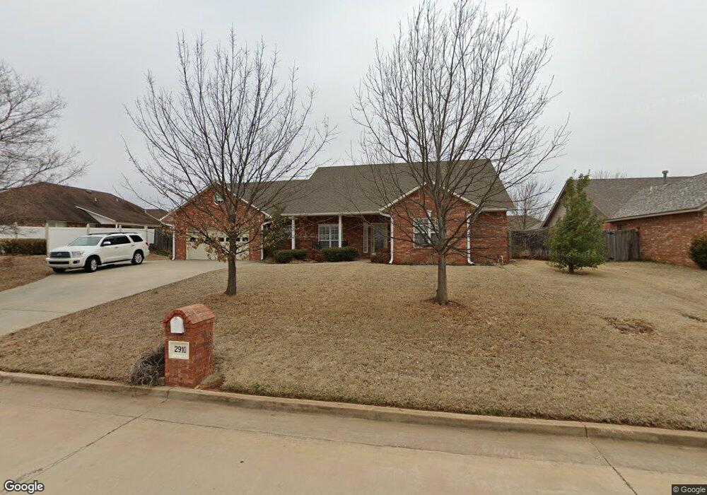
2910 Crown Point Shawnee, OK 74804
Estimated Value: $322,869 - $365,000
3
Beds
2
Baths
2,416
Sq Ft
$142/Sq Ft
Est. Value
About This Home
This home is located at 2910 Crown Point, Shawnee, OK 74804 and is currently estimated at $342,967, approximately $141 per square foot. 2910 Crown Point is a home located in Pottawatomie County.
Ownership History
Date
Name
Owned For
Owner Type
Purchase Details
Closed on
Jul 31, 2009
Sold by
Greer Earl S and Greer Dimity D
Bought by
Greer E Samual and Greer Dimity D
Current Estimated Value
Purchase Details
Closed on
Apr 27, 2007
Sold by
Greer E Samual and Greer Dimity D
Bought by
Greer E Samual and Greer Dimity D
Purchase Details
Closed on
Jul 18, 2005
Sold by
Mike D Little Construction Co Inc
Bought by
Greer Earl S and Greer Dimity D
Home Financials for this Owner
Home Financials are based on the most recent Mortgage that was taken out on this home.
Original Mortgage
$214,000
Outstanding Balance
$101,390
Interest Rate
4.25%
Mortgage Type
Adjustable Rate Mortgage/ARM
Estimated Equity
$241,577
Purchase Details
Closed on
Sep 13, 2004
Sold by
Shawnee Development Corp
Bought by
Mike Little Construction
Create a Home Valuation Report for This Property
The Home Valuation Report is an in-depth analysis detailing your home's value as well as a comparison with similar homes in the area
Home Values in the Area
Average Home Value in this Area
Purchase History
| Date | Buyer | Sale Price | Title Company |
|---|---|---|---|
| Greer E Samual | -- | None Available | |
| Greer E Samual | -- | None Available | |
| Greer Earl S | $238,500 | None Available | |
| Mike Little Construction | $26,500 | -- |
Source: Public Records
Mortgage History
| Date | Status | Borrower | Loan Amount |
|---|---|---|---|
| Open | Greer Earl S | $214,000 |
Source: Public Records
Tax History Compared to Growth
Tax History
| Year | Tax Paid | Tax Assessment Tax Assessment Total Assessment is a certain percentage of the fair market value that is determined by local assessors to be the total taxable value of land and additions on the property. | Land | Improvement |
|---|---|---|---|---|
| 2024 | $2,288 | $25,824 | $200 | $25,624 |
| 2023 | $2,288 | $25,072 | $2,940 | $22,132 |
| 2022 | $2,244 | $25,072 | $2,940 | $22,132 |
| 2021 | $2,265 | $25,072 | $2,940 | $22,132 |
| 2020 | $2,285 | $25,320 | $2,940 | $22,380 |
| 2019 | $2,334 | $25,569 | $2,940 | $22,629 |
| 2018 | $2,350 | $25,597 | $2,940 | $22,657 |
| 2017 | $2,354 | $25,842 | $2,940 | $22,902 |
| 2016 | $2,403 | $26,088 | $2,940 | $23,148 |
| 2015 | $2,108 | $25,930 | $2,940 | $22,990 |
| 2014 | $2,097 | $25,794 | $2,940 | $22,854 |
Source: Public Records
Map
Nearby Homes
- 1301 Manchester
- 1309 Nottingham Cir
- 1305 Castle Creek St
- 0000 N Rd
- 0000 N Ridge Road Block 2 Lot 4 Rd
- 0000 N Rd
- 0000 Maple Grove Avenue Block 2 Lot 29 Ave
- 0000 N Ridge Road Block 1 Lot 3 Rd
- 0000 Maple Grove Avenue Block 2 Lot 28 Ave
- 0000 Maple Grove Avenue Block 2 Lot 27 Ave
- 0000 N Ridge Road Block 1 Lot 4 Rd
- 0000 N Ridge Road Block 2 Lot 6 Rd
- 0000 N Rd
- 13 Brentwood Place
- 0000 N Ridge Road Block 1 Lot 6 Rd
- 1221 E 42nd St
- 64 Northridge Rd
- 43138 Rain Rd
- 43147 Rain Rd
- 1101 Magnolia Dr
- 1310 Cambridge Dr
- 2912 Crown Point
- 1309 Manchester
- 1308 Cambridge Dr
- 1400 Cambridge Ct
- 1407 Manchester
- 1307 Manchester
- 1306 Cambridge Dr
- 1401 Cambridge Ct
- 1401 Manchester
- 1308 Manchester
- 1305 Manchester
- 1311 Cambridge Dr
- 1310 Manchester
- 1304 Cambridge Dr
- 1402 Nottingham Place
- 1306 Manchester
- 1402 Cambridge Ct
- 1309 Cambridge Dr
- 1403 Cambridge Ct