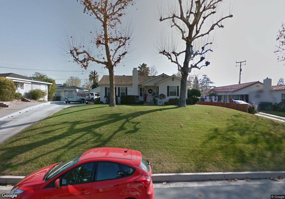
2911 La Cresta Dr Bakersfield, CA 93305
College Heights NeighborhoodEstimated Value: $202,000 - $323,000
3
Beds
2
Baths
1,264
Sq Ft
$216/Sq Ft
Est. Value
About This Home
This home is located at 2911 La Cresta Dr, Bakersfield, CA 93305 and is currently estimated at $273,399, approximately $216 per square foot. 2911 La Cresta Dr is a home located in Kern County with nearby schools including Myra A. Noble Elementary School, Washington Middle School, and East Bakersfield High School.
Ownership History
Date
Name
Owned For
Owner Type
Purchase Details
Closed on
Aug 27, 2021
Sold by
Jaggers Betty Louise
Bought by
Jaggers Leslie
Current Estimated Value
Home Financials for this Owner
Home Financials are based on the most recent Mortgage that was taken out on this home.
Original Mortgage
$112,000
Outstanding Balance
$101,912
Interest Rate
2.8%
Mortgage Type
New Conventional
Estimated Equity
$171,487
Purchase Details
Closed on
Aug 24, 2009
Sold by
Morris June
Bought by
Killingsworth Susan M
Purchase Details
Closed on
Apr 29, 2002
Sold by
Killingworth Susan M and Morris Eugene L
Bought by
Killingsworth Susan M and Morris June
Home Financials for this Owner
Home Financials are based on the most recent Mortgage that was taken out on this home.
Original Mortgage
$111,200
Interest Rate
6.89%
Purchase Details
Closed on
Sep 15, 2000
Sold by
Killingsworth Lawrence Stowe
Bought by
Killingsworth Susan M
Home Financials for this Owner
Home Financials are based on the most recent Mortgage that was taken out on this home.
Original Mortgage
$119,351
Interest Rate
7.96%
Mortgage Type
FHA
Purchase Details
Closed on
Sep 12, 2000
Sold by
Launspach Daniel V and Klassen Denise M
Bought by
Killingsworth Susan M and Morris Eugene L
Home Financials for this Owner
Home Financials are based on the most recent Mortgage that was taken out on this home.
Original Mortgage
$119,351
Interest Rate
7.96%
Mortgage Type
FHA
Purchase Details
Closed on
Jun 25, 1999
Sold by
Launspach Daniel V and Klassen Denise M
Bought by
Launspach Daniel V and Klassen Denise M
Home Financials for this Owner
Home Financials are based on the most recent Mortgage that was taken out on this home.
Original Mortgage
$73,600
Interest Rate
6.9%
Purchase Details
Closed on
May 26, 1999
Sold by
Barnes Revocable Living Trust and Donald E
Bought by
Launspach Daniel V and Klassen Denise M
Home Financials for this Owner
Home Financials are based on the most recent Mortgage that was taken out on this home.
Original Mortgage
$73,600
Interest Rate
6.9%
Create a Home Valuation Report for This Property
The Home Valuation Report is an in-depth analysis detailing your home's value as well as a comparison with similar homes in the area
Home Values in the Area
Average Home Value in this Area
Purchase History
| Date | Buyer | Sale Price | Title Company |
|---|---|---|---|
| Jaggers Leslie | $160,000 | Placer Title Company | |
| Killingsworth Susan M | -- | None Available | |
| Killingsworth Susan M | $56,000 | Stewart Title Of Ca Inc | |
| Killingsworth Susan M | -- | Commonwealth Land Title Co | |
| Killingsworth Susan M | $120,000 | Commonwealth Land Title Co | |
| Launspach Daniel V | -- | -- | |
| Launspach Daniel V | $92,000 | American Title Co |
Source: Public Records
Mortgage History
| Date | Status | Borrower | Loan Amount |
|---|---|---|---|
| Open | Jaggers Leslie | $112,000 | |
| Previous Owner | Killingsworth Susan M | $111,200 | |
| Previous Owner | Killingsworth Susan M | $119,351 | |
| Previous Owner | Launspach Daniel V | $73,600 |
Source: Public Records
Tax History
| Year | Tax Paid | Tax Assessment Tax Assessment Total Assessment is a certain percentage of the fair market value that is determined by local assessors to be the total taxable value of land and additions on the property. | Land | Improvement |
|---|---|---|---|---|
| 2025 | $2,629 | $149,689 | $30,176 | $119,513 |
| 2024 | $2,556 | $146,755 | $29,585 | $117,170 |
| 2023 | $2,556 | $143,878 | $29,005 | $114,873 |
| 2022 | $2,458 | $141,058 | $28,437 | $112,621 |
| 2021 | $2,471 | $141,058 | $28,437 | $112,621 |
| 2020 | $2,433 | $139,613 | $28,146 | $111,467 |
| 2019 | $2,362 | $139,613 | $28,146 | $111,467 |
| 2018 | $2,301 | $134,194 | $27,054 | $107,140 |
| 2017 | $2,280 | $131,564 | $26,524 | $105,040 |
| 2016 | $2,005 | $128,985 | $26,004 | $102,981 |
| 2015 | $2,002 | $127,049 | $25,614 | $101,435 |
| 2014 | $1,947 | $124,562 | $25,113 | $99,449 |
Source: Public Records
Map
Nearby Homes
- 2820 Alta Vista Dr
- 200 El Cielo Dr
- 2801 Alta Vista Dr
- 308 Acacia Ave
- 330 Poplar Ave
- 3010 Elmwood Ave
- 319 Poplar Ave
- 448 Poplar Ave
- 417 Poplar Ave
- 221 Columbus St
- 439 Poplar Ave
- 611 Walnut Ave
- 2516 Lomita Verde Dr
- 2516 Alta Vista Dr
- 418 Crawford St
- 2927 Skyline Blvd
- 326 Water St
- 2860 N Baker St
- 2415 Alta Vista Dr
- 311 Water St
- 2905 La Cresta Dr
- 2917 La Cresta Dr
- 2912 Alta Vista Dr
- 2916 Alta Vista Dr
- 2908 Alta Vista Dr
- 262 Monte Vista Dr
- 256 Monte Vista Dr
- 2920 Alta Vista Dr
- 2908 La Cresta Dr
- 2912 La Cresta Dr
- 2904 La Cresta Dr
- 250 Monte Vista Dr
- 2900 Alta Vista Dr
- 2921 La Cresta Dr
- 2914 La Cresta Dr
- 2900 La Cresta Dr
- 261 Hermosa Dr
- 255 Hermosa Dr
- 209 Las Flores Dr
- 2920 La Cresta Dr