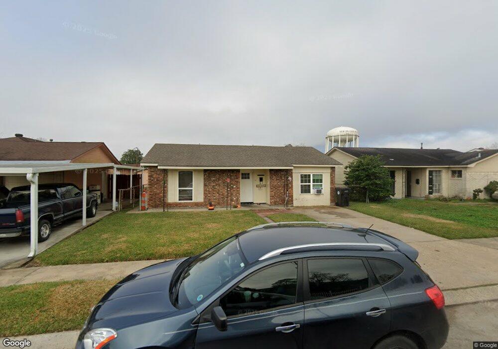
2911 Mansfield Ave New Orleans, LA 70131
New Aurora NeighborhoodEstimated Value: $119,670 - $201,000
3
Beds
2
Baths
1,764
Sq Ft
$85/Sq Ft
Est. Value
About This Home
This home is located at 2911 Mansfield Ave, New Orleans, LA 70131 and is currently estimated at $149,418, approximately $84 per square foot. 2911 Mansfield Ave is a home located in Orleans Parish with nearby schools including Belle Chasse Middle School, Belle Chasse High School, and Elan Academy Charter School.
Ownership History
Date
Name
Owned For
Owner Type
Purchase Details
Closed on
Oct 15, 2015
Sold by
Sanders Willie J and Sanders Jordan Ashley
Bought by
Sanders Duvuri R and Adams Roteshia
Current Estimated Value
Home Financials for this Owner
Home Financials are based on the most recent Mortgage that was taken out on this home.
Original Mortgage
$66,397
Outstanding Balance
$52,329
Interest Rate
3.93%
Mortgage Type
VA
Estimated Equity
$97,089
Create a Home Valuation Report for This Property
The Home Valuation Report is an in-depth analysis detailing your home's value as well as a comparison with similar homes in the area
Home Values in the Area
Average Home Value in this Area
Purchase History
| Date | Buyer | Sale Price | Title Company |
|---|---|---|---|
| Sanders Duvuri R | $65,000 | None Available |
Source: Public Records
Mortgage History
| Date | Status | Borrower | Loan Amount |
|---|---|---|---|
| Open | Sanders Duvuri R | $66,397 |
Source: Public Records
Tax History Compared to Growth
Tax History
| Year | Tax Paid | Tax Assessment Tax Assessment Total Assessment is a certain percentage of the fair market value that is determined by local assessors to be the total taxable value of land and additions on the property. | Land | Improvement |
|---|---|---|---|---|
| 2025 | $1,613 | $12,220 | $1,250 | $10,970 |
| 2024 | $1,638 | $12,220 | $1,250 | $10,970 |
| 2023 | $1,225 | $9,040 | $1,000 | $8,040 |
| 2022 | $1,225 | $8,640 | $1,000 | $7,640 |
| 2021 | $1,311 | $9,040 | $1,000 | $8,040 |
| 2020 | $1,324 | $9,040 | $1,000 | $8,040 |
| 2019 | $1,368 | $9,040 | $1,000 | $8,040 |
| 2018 | $1,395 | $9,040 | $1,000 | $8,040 |
| 2017 | $1,332 | $9,040 | $1,000 | $8,040 |
| 2016 | $1,306 | $8,960 | $1,000 | $7,960 |
| 2015 | $1,340 | $8,960 | $1,000 | $7,960 |
| 2014 | -- | $8,960 | $1,000 | $7,960 |
| 2013 | -- | $9,760 | $1,500 | $8,260 |
Source: Public Records
Map
Nearby Homes
- 2901 Mansfield Ave
- 2921 Mansfield Ave
- 2871 Mansfield Ave
- 2931 Mansfield Ave
- 2876 Kent Dr
- 2870 Kent Dr
- 2900 Kent Dr
- 2908 Kent Dr
- 2910 Mansfield Ave
- 2900 Mansfield Ave
- 2863 Mansfield Ave
- 2920 Mansfield Ave
- 2941 Mansfield Ave
- 2864 Kent Dr
- 2930 Mansfield Ave
- 2912 Kent Dr
- 2940 Mansfield Ave
- 2860 Mansfield Ave
- 2951 Mansfield Ave
- 2857 Mansfield Ave