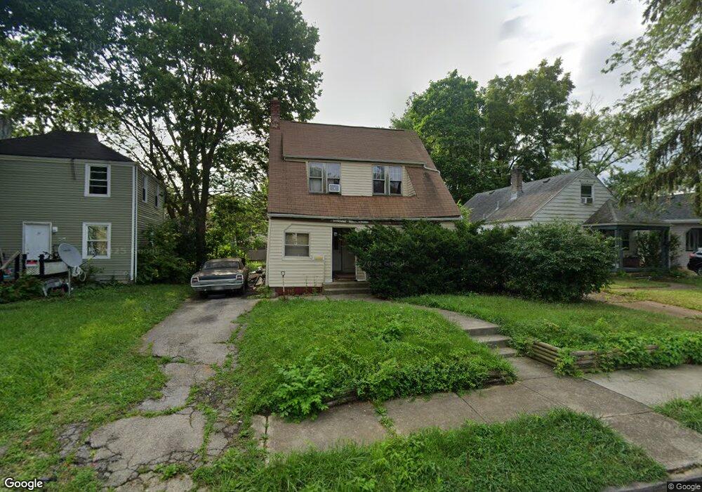
2912 Norwood St Columbus, OH 43224
North Linden NeighborhoodEstimated Value: $150,000 - $218,000
3
Beds
1
Bath
1,266
Sq Ft
$143/Sq Ft
Est. Value
About This Home
This home is located at 2912 Norwood St, Columbus, OH 43224 and is currently estimated at $180,999, approximately $142 per square foot. 2912 Norwood St is a home located in Franklin County with nearby schools including Como Elementary School, Dominion Middle School, and Whetstone High School.
Ownership History
Date
Name
Owned For
Owner Type
Purchase Details
Closed on
Jul 24, 2025
Sold by
Branham Lawrence D
Bought by
Branham Quynnis Lawrence
Current Estimated Value
Purchase Details
Closed on
Oct 16, 1995
Sold by
Ratliff John R
Bought by
Lawrence D Branham
Home Financials for this Owner
Home Financials are based on the most recent Mortgage that was taken out on this home.
Original Mortgage
$44,400
Interest Rate
8.38%
Mortgage Type
New Conventional
Purchase Details
Closed on
May 1, 1986
Create a Home Valuation Report for This Property
The Home Valuation Report is an in-depth analysis detailing your home's value as well as a comparison with similar homes in the area
Home Values in the Area
Average Home Value in this Area
Purchase History
| Date | Buyer | Sale Price | Title Company |
|---|---|---|---|
| Branham Quynnis Lawrence | $149,000 | None Listed On Document | |
| Lawrence D Branham | $55,500 | -- | |
| -- | $46,500 | -- |
Source: Public Records
Mortgage History
| Date | Status | Borrower | Loan Amount |
|---|---|---|---|
| Previous Owner | Lawrence D Branham | $44,400 |
Source: Public Records
Tax History Compared to Growth
Tax History
| Year | Tax Paid | Tax Assessment Tax Assessment Total Assessment is a certain percentage of the fair market value that is determined by local assessors to be the total taxable value of land and additions on the property. | Land | Improvement |
|---|---|---|---|---|
| 2024 | $2,575 | $52,160 | $14,250 | $37,910 |
| 2023 | $2,544 | $52,150 | $14,245 | $37,905 |
| 2022 | $1,944 | $32,480 | $6,650 | $25,830 |
| 2021 | $1,846 | $32,480 | $6,650 | $25,830 |
| 2020 | $1,965 | $32,480 | $6,650 | $25,830 |
| 2019 | $1,796 | $28,250 | $6,650 | $21,600 |
| 2018 | $1,880 | $28,250 | $6,650 | $21,600 |
| 2017 | $1,882 | $28,250 | $6,650 | $21,600 |
| 2016 | $1,885 | $28,460 | $5,570 | $22,890 |
| 2015 | $1,844 | $28,460 | $5,570 | $22,890 |
| 2014 | $1,716 | $28,460 | $5,570 | $22,890 |
| 2013 | $964 | $31,640 | $6,195 | $25,445 |
Source: Public Records
Map
Nearby Homes
- 2890 Medina Ave
- 2819 Norwood St
- 3058 Dresden St
- 3056 Medina Ave
- 1671 E Brighton Rd
- 2905 Ontario St
- 3086 Bremen St
- 1444 Manchester Ave
- 1591-1593 E Weber Rd
- 3134 Medina Ave
- 3131 Dresden St
- 2981 Gerbert Rd
- 2913 Gerbert Rd
- 2916 Hamilton Ave
- 1691 E Weber Rd
- 1461 Aberdeen Ave
- 1525 Aberdeen Ave
- 1669 Manchester Ave
- 1225 Sandlin Ave
- 3071 Karl Rd
- 2908 Norwood St
- 2916 Norwood St
- 2900 Norwood St
- 2922 Norwood St
- 2896 Norwood St
- 2926 Norwood St
- 2905 Dresden St
- 2899 Dresden St
- 2895 Dresden St
- 2932 Norwood St
- 2909 Norwood St
- 2915 Dresden St
- 2919 Norwood St
- 2889 Dresden St
- 2903 Norwood St
- 2925 Norwood St
- 2921 Dresden St
- 2899 Norwood St
- 2938 Norwood St
- 1490 Milford Ave