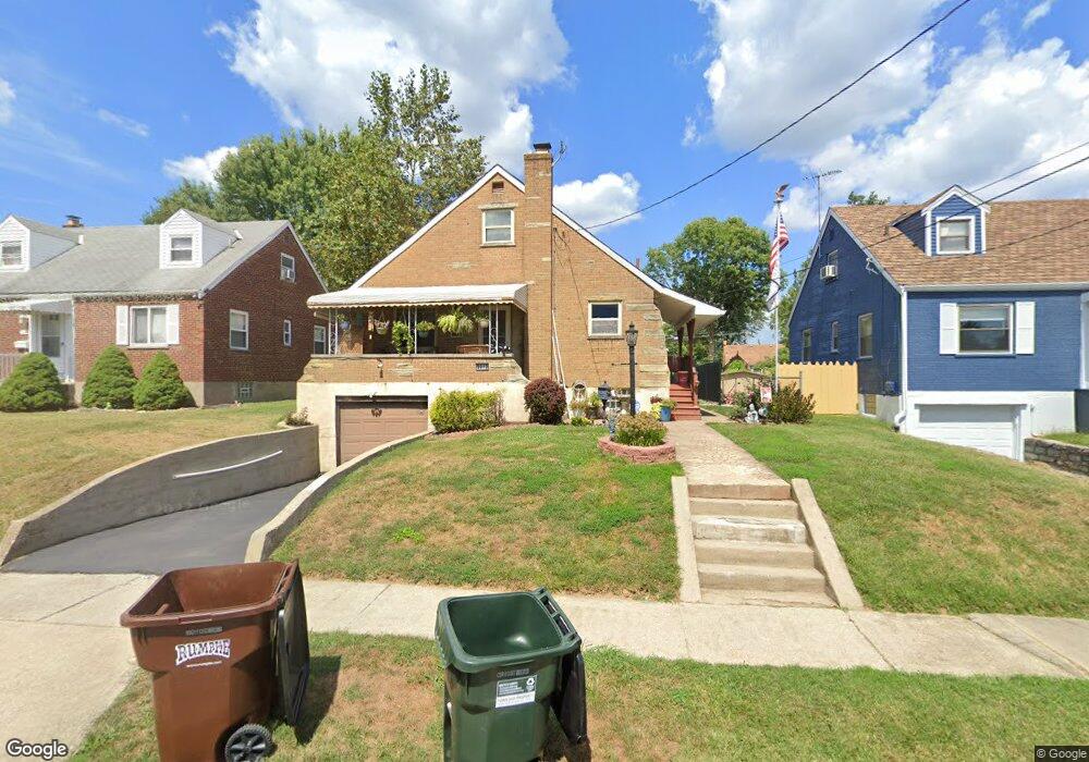
2912 Sheldon Ave Cincinnati, OH 45239
Estimated Value: $202,000 - $214,000
4
Beds
2
Baths
1,202
Sq Ft
$171/Sq Ft
Est. Value
About This Home
This home is located at 2912 Sheldon Ave, Cincinnati, OH 45239 and is currently estimated at $205,813, approximately $171 per square foot. 2912 Sheldon Ave is a home located in Hamilton County with nearby schools including White Oak Middle School, Colerain High School, and Cincinnati Achievement Academy.
Ownership History
Date
Name
Owned For
Owner Type
Purchase Details
Closed on
Sep 13, 2006
Sold by
Boris Larry A and Boris Andrea
Bought by
Chapman Scott M
Current Estimated Value
Home Financials for this Owner
Home Financials are based on the most recent Mortgage that was taken out on this home.
Original Mortgage
$90,320
Outstanding Balance
$52,876
Interest Rate
6.59%
Mortgage Type
Unknown
Estimated Equity
$152,937
Purchase Details
Closed on
Apr 16, 2003
Sold by
Salter Virginia T
Bought by
Boris Larry A
Home Financials for this Owner
Home Financials are based on the most recent Mortgage that was taken out on this home.
Original Mortgage
$108,047
Interest Rate
5.9%
Mortgage Type
VA
Create a Home Valuation Report for This Property
The Home Valuation Report is an in-depth analysis detailing your home's value as well as a comparison with similar homes in the area
Home Values in the Area
Average Home Value in this Area
Purchase History
| Date | Buyer | Sale Price | Title Company |
|---|---|---|---|
| Chapman Scott M | $112,900 | None Available | |
| Boris Larry A | $104,900 | -- |
Source: Public Records
Mortgage History
| Date | Status | Borrower | Loan Amount |
|---|---|---|---|
| Open | Chapman Scott M | $90,320 | |
| Previous Owner | Boris Larry A | $108,047 |
Source: Public Records
Tax History
| Year | Tax Paid | Tax Assessment Tax Assessment Total Assessment is a certain percentage of the fair market value that is determined by local assessors to be the total taxable value of land and additions on the property. | Land | Improvement |
|---|---|---|---|---|
| 2025 | $2,838 | $47,989 | $8,978 | $39,011 |
| 2023 | $2,584 | $47,989 | $8,978 | $39,011 |
| 2022 | $1,940 | $29,331 | $7,025 | $22,306 |
| 2021 | $1,923 | $29,331 | $7,025 | $22,306 |
| 2020 | $1,943 | $29,331 | $7,025 | $22,306 |
| 2019 | $1,765 | $24,858 | $5,954 | $18,904 |
| 2018 | $1,584 | $24,858 | $5,954 | $18,904 |
| 2017 | $1,500 | $24,858 | $5,954 | $18,904 |
| 2016 | $1,489 | $24,329 | $8,173 | $16,156 |
| 2015 | $1,503 | $24,329 | $8,173 | $16,156 |
| 2014 | $1,506 | $24,329 | $8,173 | $16,156 |
| 2013 | $1,556 | $26,443 | $8,883 | $17,560 |
Source: Public Records
Map
Nearby Homes
- 2922 Royal Glen Dr
- 2807 W Galbraith Rd
- 2750 W Galbraith Rd
- 2655 Barthas Place
- 8417 Royal Heights Dr
- 7864 Sequoia Ct
- 8265 Haskell Dr
- 2953 Commodore Ln
- 2896 Regal Ln
- 3150 Banning Rd
- 7170 Longwood Ct
- 2757 Banning Rd
- 3336 Nandale Dr
- 3069 Sovereign Dr
- 3329 Alexis Rd
- 3219 Banning Rd
- 2787 Rylan Dr
- 8628 Paisley Dr
- 3408 Rocker Dr
- 3397 Nandale Dr
- 2920 Sheldon Ave
- 2904 Sheldon Ave
- 2896 Sheldon Ave
- 2930 Sheldon Ave
- 2888 Sheldon Ave
- 2940 Sheldon Ave
- 2915 Sheldon Ave
- 2915 W Galbraith Rd
- 2925 W Galbraith Rd
- 2941 Galbraith Rd
- 2880 Sheldon Ave
- 2907 W Galbraith Rd
- 2907 Sheldon Ave
- 2923 Sheldon Ave
- 2899 Sheldon Ave
- 2897 W Galbraith Rd
- 2933 Sheldon Ave
- 2889 Sheldon Ave
- 2889 W Galbraith Rd
- 2941 Sheldon Ave Unit 12
Your Personal Tour Guide
Ask me questions while you tour the home.