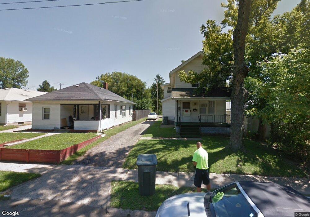
2914 Howey Rd Columbus, OH 43224
North Linden NeighborhoodEstimated Value: $183,000 - $214,000
4
Beds
2
Baths
1,448
Sq Ft
$139/Sq Ft
Est. Value
About This Home
This home is located at 2914 Howey Rd, Columbus, OH 43224 and is currently estimated at $201,409, approximately $139 per square foot. 2914 Howey Rd is a home located in Franklin County with nearby schools including Como Elementary School, Dominion Middle School, and Whetstone High School.
Ownership History
Date
Name
Owned For
Owner Type
Purchase Details
Closed on
Jul 30, 2024
Sold by
Swartz Lana Jean
Bought by
Dan E Swartz And Lana J Swartz Revocable Livi and Swartz
Current Estimated Value
Purchase Details
Closed on
May 26, 2022
Sold by
Joe Allen Jennings
Bought by
Swartz Lana Jean
Purchase Details
Closed on
Sep 29, 2021
Sold by
Joe Allen Jennings
Bought by
Swartz Lana Jean
Purchase Details
Closed on
Jun 5, 1968
Bought by
Allen Jennings J
Create a Home Valuation Report for This Property
The Home Valuation Report is an in-depth analysis detailing your home's value as well as a comparison with similar homes in the area
Home Values in the Area
Average Home Value in this Area
Purchase History
| Date | Buyer | Sale Price | Title Company |
|---|---|---|---|
| Dan E Swartz And Lana J Swartz Revocable Livi | -- | None Listed On Document | |
| Swartz Lana Jean | -- | Hendrix Robert S | |
| Swartz Lana Jean | -- | Hendrix Robert S | |
| Allen Jennings J | -- | -- |
Source: Public Records
Tax History Compared to Growth
Tax History
| Year | Tax Paid | Tax Assessment Tax Assessment Total Assessment is a certain percentage of the fair market value that is determined by local assessors to be the total taxable value of land and additions on the property. | Land | Improvement |
|---|---|---|---|---|
| 2024 | $5,415 | $56,950 | $11,660 | $45,290 |
| 2023 | $2,577 | $56,950 | $11,660 | $45,290 |
| 2022 | $1,501 | $28,250 | $5,250 | $23,000 |
| 2021 | $1,867 | $28,250 | $5,250 | $23,000 |
| 2020 | $1,506 | $28,250 | $5,250 | $23,000 |
| 2019 | $1,463 | $23,530 | $4,380 | $19,150 |
| 2018 | $1,264 | $23,530 | $4,380 | $19,150 |
| 2017 | $1,463 | $23,530 | $4,380 | $19,150 |
| 2016 | $1,173 | $17,260 | $3,850 | $13,410 |
| 2015 | $1,068 | $17,260 | $3,850 | $13,410 |
| 2014 | $1,070 | $17,260 | $3,850 | $13,410 |
| 2013 | $586 | $19,145 | $4,270 | $14,875 |
Source: Public Records
Map
Nearby Homes
- 2888 Howey Rd
- 2899 Howey Rd
- 2950 Grasmere Ave
- 2860 Grasmere Ave
- 2996 Atwood Terrace
- 2804 Grasmere Ave
- 2769 McGuffey Rd
- 1225 Sandlin Ave
- 3043 McGuffey Rd
- 2816 Azelda St
- 2810-2812 Azelda St
- 1247 Weldon Ave
- 3087 Hiawatha St
- 3105 Atwood Terrace
- 2767 Hiawatha St
- 2913 Gerbert Rd
- 2696 Grasmere Ave
- 3071 Karl Rd
- 2981 Gerbert Rd
- 3129 McGuffey Rd
- 2920 Howey Rd
- 2908 Howey Rd Unit 910
- 2924 Howey Rd Unit 926
- 2906 Howey Rd
- 2930 Howey Rd
- 2902 Howey Rd
- 2907 Grasmere Ave Unit 909
- 2913 Grasmere Ave
- 2934 Howey Rd
- 2898 Howey Rd
- 2919 Grasmere Ave
- 2917 Howey Rd
- 2909 Howey Rd
- 2893 Grasmere Ave
- 2923 Grasmere Ave
- 2923 Howey Rd
- 2905 Howey Rd
- 0 Howey Rd
- 2929 Grasmere Ave
- 2891 Grasmere Ave