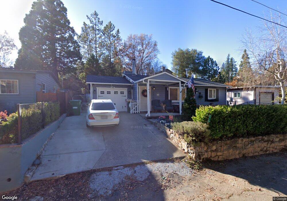
2915 Anderson Way Placerville, CA 95667
Estimated Value: $119,000 - $446,000
2
Beds
2
Baths
1,289
Sq Ft
$260/Sq Ft
Est. Value
About This Home
This home is located at 2915 Anderson Way, Placerville, CA 95667 and is currently estimated at $335,722, approximately $260 per square foot. 2915 Anderson Way is a home located in El Dorado County with nearby schools including El Dorado High School, Country Day Montessori, and El Dorado Adventist School.
Ownership History
Date
Name
Owned For
Owner Type
Purchase Details
Closed on
Dec 15, 2015
Sold by
Connell Barbara
Bought by
Connell Barbara Anna and The Barbara Anna Connell Revoc
Current Estimated Value
Purchase Details
Closed on
Sep 1, 2010
Sold by
Owb Reo Llc
Bought by
Connell Barbara
Purchase Details
Closed on
Mar 30, 2010
Sold by
Mclaughlin Stacie and Mclaughlin Mark
Bought by
Imb Reo Llc
Purchase Details
Closed on
Aug 26, 2002
Sold by
Mclaughlin Mark Gavin
Bought by
Mclaughlin Mark and Mclaughlin Stacie
Home Financials for this Owner
Home Financials are based on the most recent Mortgage that was taken out on this home.
Original Mortgage
$140,000
Interest Rate
6.43%
Purchase Details
Closed on
Nov 29, 1993
Sold by
Mclaughlin Stacie Marlee
Bought by
Mclaughlin Mark Gavin
Home Financials for this Owner
Home Financials are based on the most recent Mortgage that was taken out on this home.
Original Mortgage
$102,757
Interest Rate
6.85%
Mortgage Type
FHA
Create a Home Valuation Report for This Property
The Home Valuation Report is an in-depth analysis detailing your home's value as well as a comparison with similar homes in the area
Home Values in the Area
Average Home Value in this Area
Purchase History
| Date | Buyer | Sale Price | Title Company |
|---|---|---|---|
| Connell Barbara Anna | -- | None Available | |
| Connell Barbara | $89,500 | Lsi Title Company Ca | |
| Imb Reo Llc | $156,816 | Ticor Title | |
| Mclaughlin Mark | -- | First American Title Ins Co | |
| Mclaughlin Mark Gavin | -- | Placer Title Company |
Source: Public Records
Mortgage History
| Date | Status | Borrower | Loan Amount |
|---|---|---|---|
| Previous Owner | Mclaughlin Mark | $140,000 | |
| Previous Owner | Mclaughlin Mark Gavin | $102,757 |
Source: Public Records
Tax History Compared to Growth
Tax History
| Year | Tax Paid | Tax Assessment Tax Assessment Total Assessment is a certain percentage of the fair market value that is determined by local assessors to be the total taxable value of land and additions on the property. | Land | Improvement |
|---|---|---|---|---|
| 2025 | $1,220 | $114,650 | $38,430 | $76,220 |
| 2024 | $1,220 | $112,403 | $37,677 | $74,726 |
| 2023 | $1,207 | $110,200 | $36,939 | $73,261 |
| 2022 | $1,190 | $108,040 | $36,215 | $71,825 |
| 2021 | $1,177 | $105,922 | $35,505 | $70,417 |
| 2020 | $1,160 | $104,836 | $35,141 | $69,695 |
| 2019 | $1,146 | $102,781 | $34,452 | $68,329 |
| 2018 | $1,113 | $100,767 | $33,777 | $66,990 |
| 2017 | $1,097 | $98,792 | $33,115 | $65,677 |
| 2016 | $1,081 | $96,856 | $32,466 | $64,390 |
| 2015 | $1,051 | $95,403 | $31,979 | $63,424 |
| 2014 | $1,033 | $93,536 | $31,353 | $62,183 |
Source: Public Records
Map
Nearby Homes
- 2940 Anderson Way
- 2921 Miller Way
- 2977 Mosquito Rd
- 1017 Utah Dr
- 1001 Utah Dr
- 1015 Utah Dr
- 3022 Constellation Ave
- 1011 Utah Dr
- Plan 2 at Sutter’s Ridge
- 1284 Roxie Way
- 2771 Morrene Dr
- 678 Main St
- 2896 Clay St
- 2689 Morrene Dr
- 0 Lincoln Alley
- 944 Crawford Drift Ct
- 945 Crawford Drift Ct
- 0 Trails End Dr Unit 225117516
- 2-Acres Homestead Dr
- 3 Acres
- 2911 Anderson Way
- 2919 Anderson Way
- 2816 Pennsylvania Ct
- 2905 Anderson Way
- 2914 Anderson Way
- 1113 Anderson Ct
- 2910 Anderson Way
- 2901 Anderson Way
- 2904 Anderson Way
- 2810 Pennsylvania Ct
- 2811 Pennsylvania Ct
- 1117 Anderson Ct
- 2869 Willow St
- 2897 Anderson Way
- 1102 Anderson Ct
- 2930 Anderson Way
- 2925 Anderson Way
- 2802 Pennsylvania Ct
- 1108 Anderson Ct
- 2929 Anderson Way