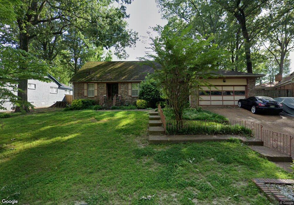
2915 Clearwood Rd Memphis, TN 38134
Estimated Value: $219,000 - $295,000
3
Beds
3
Baths
3,379
Sq Ft
$75/Sq Ft
Est. Value
About This Home
This home is located at 2915 Clearwood Rd, Memphis, TN 38134 and is currently estimated at $252,965, approximately $74 per square foot. 2915 Clearwood Rd is a home located in Shelby County with nearby schools including Raleigh-Bartlett Meadows School, Craigmont Middle School, and Craigmont High School.
Ownership History
Date
Name
Owned For
Owner Type
Purchase Details
Closed on
Aug 4, 2011
Sold by
Reed Michael R and Reed Victoria H
Bought by
Michael R Reed Llc
Current Estimated Value
Purchase Details
Closed on
Jul 26, 2011
Sold by
Anderson Sharon K
Bought by
Reed Michael R and Reed Victoria H
Purchase Details
Closed on
Aug 23, 2003
Sold by
Reed Michael R and Reed Victoria H
Bought by
Anderson Sharon K and 2915 Clearwood Road
Purchase Details
Closed on
Mar 30, 2000
Sold by
Dear Angela Eunice and Norris James A
Bought by
Hud
Home Financials for this Owner
Home Financials are based on the most recent Mortgage that was taken out on this home.
Original Mortgage
$149,796
Interest Rate
8.29%
Mortgage Type
FHA
Create a Home Valuation Report for This Property
The Home Valuation Report is an in-depth analysis detailing your home's value as well as a comparison with similar homes in the area
Home Values in the Area
Average Home Value in this Area
Purchase History
| Date | Buyer | Sale Price | Title Company |
|---|---|---|---|
| Michael R Reed Llc | -- | None Available | |
| Reed Michael R | -- | None Available | |
| Anderson Sharon K | -- | -- | |
| Hud | $163,036 | -- | |
| Dear Angela Eunice | $149,900 | -- |
Source: Public Records
Mortgage History
| Date | Status | Borrower | Loan Amount |
|---|---|---|---|
| Previous Owner | Dear Angela Eunice | $149,796 | |
| Closed | Dear Angela Eunice | $6,904 |
Source: Public Records
Tax History Compared to Growth
Tax History
| Year | Tax Paid | Tax Assessment Tax Assessment Total Assessment is a certain percentage of the fair market value that is determined by local assessors to be the total taxable value of land and additions on the property. | Land | Improvement |
|---|---|---|---|---|
| 2025 | $1,759 | $71,025 | $11,250 | $59,775 |
| 2024 | $1,759 | $51,900 | $4,225 | $47,675 |
| 2023 | $3,162 | $51,900 | $4,225 | $47,675 |
| 2022 | $3,162 | $51,900 | $4,225 | $47,675 |
| 2021 | $3,199 | $51,900 | $4,225 | $47,675 |
| 2020 | $2,317 | $31,975 | $4,225 | $27,750 |
| 2019 | $2,317 | $31,975 | $4,225 | $27,750 |
| 2018 | $2,317 | $31,975 | $4,225 | $27,750 |
| 2017 | $1,314 | $31,975 | $4,225 | $27,750 |
| 2016 | $1,338 | $30,625 | $0 | $0 |
| 2014 | $1,338 | $30,625 | $0 | $0 |
Source: Public Records
Map
Nearby Homes
- 2892 Clearwood Rd
- 2888 Clearwood Rd
- 5191 Yellowood Rd
- 2788 W Battle Creek Cove
- 2783 E Battle Creek Cove
- 5210 Wax Wing Ln
- 3064 Wood Thrush Dr
- 2739 Lynchburg St
- 2725 Covington Pike
- 2882 Springland St
- 5225 Oak Meadow Ave
- 3209 Canyon Rd
- 3213 Covington Pike
- 5167 Rolling Fields Dr
- 5282 Twin Woods Ave
- 3060 Ruskin Rd
- 3261 Gatewood Dr
- 2718 Stage Coach Dr
- 3099 Joslyn St
- 2659 Stage Park Dr
- 2921 Clearwood Rd
- 2903 Clearwood Rd
- 5117 Dovewood Rd
- 2889 Flowerwood Rd
- 2920 Clearwood Rd
- 2914 Clearwood Rd
- 2928 Clearwood Cove
- 2900 Clearwood Rd
- 2881 Flowerwood Rd
- 5111 Dovewood Rd
- 5120 Dovewood Rd
- 2932 Clearwood Cove
- 2890 Flowerwood Rd
- 2875 Flowerwood Rd
- 5110 Dovewood Rd
- 2892 Clearwood Cove
- 2874 Flowerwood Rd
- 2933 Clearwood Rd
- 2936 Clearwood Cove
- 2867 Flowerwood Rd