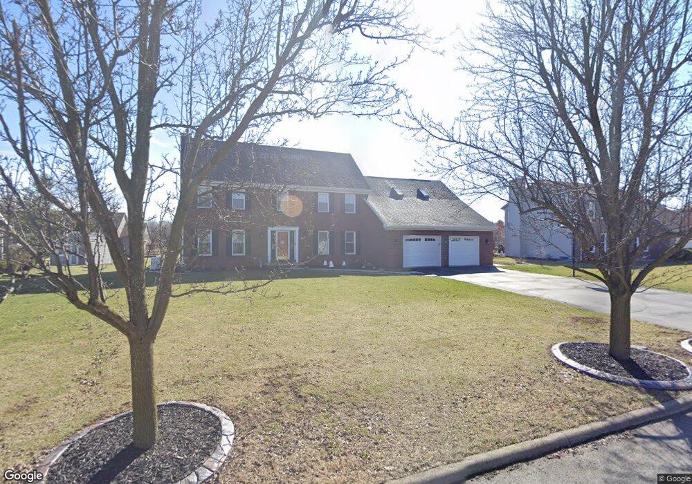
2915 Innisbrook Dr Findlay, OH 45840
Estimated Value: $413,000 - $532,000
About This Home
This home is located at 2915 Innisbrook Dr, Findlay, OH 45840 and is currently estimated at $482,533, approximately $153 per square foot. 2915 Innisbrook Dr is a home located in Hancock County with nearby schools including Liberty-Benton Elementary School, Liberty-Benton Middle School, and Liberty-Benton High School.
Ownership History
We collect this data history from publicly available records. To have your information removed, we recommend requesting removal directly through your county’s website.
Purchase Details
Purchase Details
Home Financials for this Owner
Home Financials are based on the most recent Mortgage that was taken out on this home.Purchase Details
Home Financials for this Owner
Home Financials are based on the most recent Mortgage that was taken out on this home.Purchase Details
Purchase Details
Purchase History
We collect this data history from publicly available records. To have your information removed, we recommend requesting removal directly through your county’s website.
| Date | Buyer | Sale Price | Title Company |
|---|---|---|---|
| -- | Mid Am Title | ||
| $278,000 | Mid Am Title Agency | ||
| $275,000 | Mid Am Title Agency | ||
| $23,000 | -- | ||
| -- | -- |
Mortgage History
We collect this data history from publicly available records. To have your information removed, we recommend requesting removal directly through your county’s website.
| Date | Status | Borrower | Loan Amount |
|---|---|---|---|
| Previous Owner | $287,174 | ||
| Previous Owner | $160,000 |
Tax History
We collect this data history from publicly available records. To have your information removed, we recommend requesting removal directly through your county’s website.
| Year | Tax Paid | Tax Assessment Tax Assessment Total Assessment is a certain percentage of the fair market value that is determined by local assessors to be the total taxable value of land and additions on the property. | Land | Improvement |
|---|---|---|---|---|
| 2025 | $5,596 | $157,720 | $22,160 | $135,560 |
| 2024 | $4,806 | $129,280 | $18,170 | $111,110 |
| 2023 | $4,692 | $129,280 | $18,170 | $111,110 |
| 2022 | $4,646 | $129,280 | $18,170 | $111,110 |
| 2021 | $4,333 | $106,430 | $18,180 | $88,250 |
| 2020 | $4,370 | $106,430 | $18,180 | $88,250 |
| 2019 | $4,193 | $106,430 | $18,180 | $88,250 |
| 2018 | $3,613 | $101,240 | $12,990 | $88,250 |
| 2017 | $1,864 | $101,240 | $12,990 | $88,250 |
| 2016 | $3,612 | $101,240 | $12,990 | $88,250 |
| 2015 | $3,199 | $87,360 | $12,250 | $75,110 |
| 2014 | $3,228 | $87,360 | $12,250 | $75,110 |
| 2012 | $3,371 | $87,360 | $12,250 | $75,110 |
Map
- 3006 Saddlebrook
- 2923 Gleneagle Dr
- 10321 Wheatfield Dr
- 3457 Chagrin Valley
- 3200 Jurnee Dr
- 0 County Road 95 Unit 6097574
- 0 Country Road 99 Unit 310360
- 914 W Melrose Ave
- 9560 Smokies Way
- 9894 Smokies Way
- 10036 Township Road 94
- 2411 Villa West Dr
- 0 County Road 140
- 724 Edith Ave
- 0 Bushwillow Dr Or Rock Candy Rd Unit Lot 157
- 0 Rock Candy Rd Or Bushwillow Dr Unit Lot 173
- 0 Rock Candy Rd Unit Lot 159
- 0 Rock Candy Rd Unit Lot 170
- 0 Rock Candy Rd Unit Lot 172 206819
- 0 Rock Candy Rd Unit Lot 162
- 2909 Innisbrook Dr
- 2921 Innisbrook Dr
- 2940 Saddlebrook
- 3000 Saddlebrook
- 2934 Saddlebrook
- 2927 Innisbrook Dr
- 2901 Innisbrook Dr
- 2918 Innisbrook Dr
- 2912 Innisbrook Dr
- 2906 Saddlebrook
- 2924 Innisbrook Dr
- 2906 Innisbrook Dr
- 2928 Saddlebrook
- 2935 Innisbrook Dr
- 2900 Innisbrook Dr
- 2932 Innisbrook Dr
- 3012 Saddlebrook
- 2939 Saddlebrook
- 3001 Innisbrook Dr
- 2915 Turnberry Dr
Ask me questions while you tour the home.