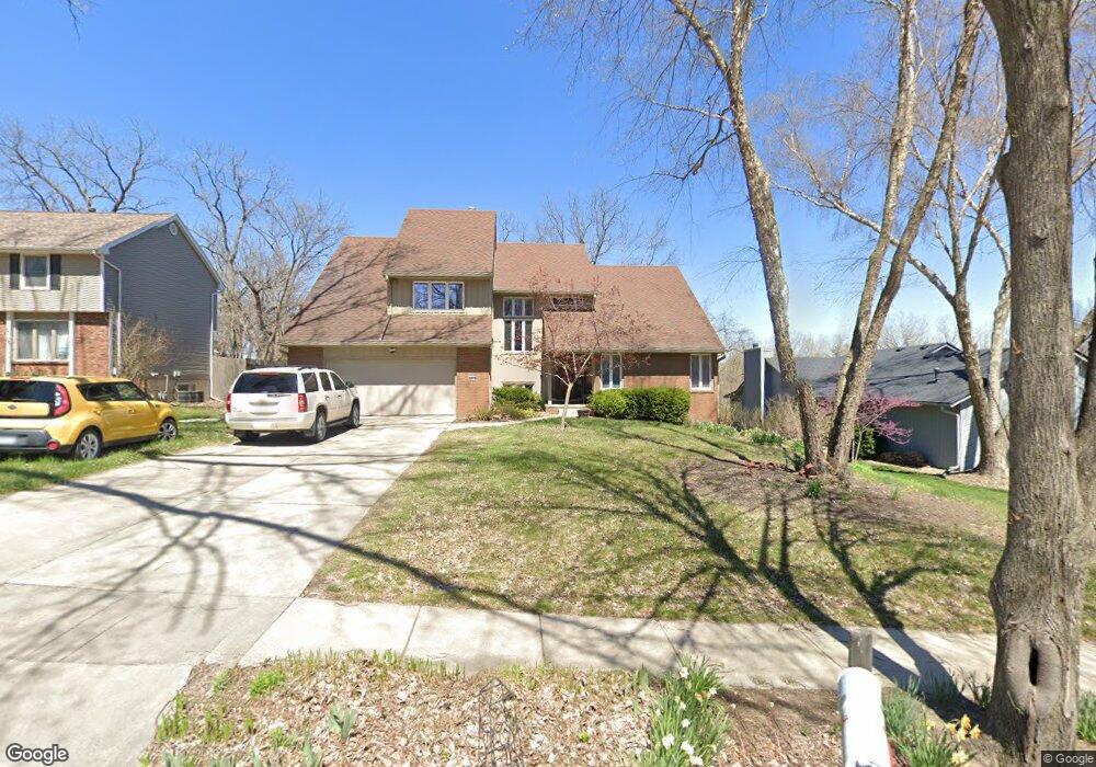
2915 Thornton Ave Des Moines, IA 50321
Southwestern Hills NeighborhoodEstimated Value: $463,000 - $528,000
5
Beds
3
Baths
3,235
Sq Ft
$150/Sq Ft
Est. Value
About This Home
This home is located at 2915 Thornton Ave, Des Moines, IA 50321 and is currently estimated at $485,531, approximately $150 per square foot. 2915 Thornton Ave is a home located in Polk County with nearby schools including Jefferson Elementary School, Brody Middle School, and Lincoln High School.
Ownership History
Date
Name
Owned For
Owner Type
Purchase Details
Closed on
Feb 6, 2001
Sold by
Foster Rodney K and Foster Victoria A
Bought by
Mulvihill Nathan G and Mulvihill Cheryl J
Current Estimated Value
Home Financials for this Owner
Home Financials are based on the most recent Mortgage that was taken out on this home.
Original Mortgage
$176,000
Outstanding Balance
$62,863
Interest Rate
7.1%
Estimated Equity
$422,668
Create a Home Valuation Report for This Property
The Home Valuation Report is an in-depth analysis detailing your home's value as well as a comparison with similar homes in the area
Home Values in the Area
Average Home Value in this Area
Purchase History
| Date | Buyer | Sale Price | Title Company |
|---|---|---|---|
| Mulvihill Nathan G | $219,500 | -- |
Source: Public Records
Mortgage History
| Date | Status | Borrower | Loan Amount |
|---|---|---|---|
| Open | Mulvihill Nathan G | $176,000 | |
| Closed | Mulvihill Nathan G | $22,000 |
Source: Public Records
Tax History Compared to Growth
Tax History
| Year | Tax Paid | Tax Assessment Tax Assessment Total Assessment is a certain percentage of the fair market value that is determined by local assessors to be the total taxable value of land and additions on the property. | Land | Improvement |
|---|---|---|---|---|
| 2025 | $9,184 | $508,700 | $52,800 | $455,900 |
| 2024 | $9,184 | $484,300 | $49,600 | $434,700 |
| 2023 | $8,658 | $484,300 | $49,600 | $434,700 |
| 2022 | $8,590 | $376,200 | $39,900 | $336,300 |
| 2021 | $8,664 | $376,200 | $39,900 | $336,300 |
| 2020 | $8,996 | $355,800 | $37,700 | $318,100 |
| 2019 | $8,834 | $355,800 | $37,700 | $318,100 |
| 2018 | $8,744 | $328,700 | $32,700 | $296,000 |
| 2017 | $7,960 | $328,700 | $32,700 | $296,000 |
| 2016 | $7,756 | $294,300 | $28,900 | $265,400 |
| 2015 | $7,756 | $294,300 | $28,900 | $265,400 |
| 2014 | $7,730 | $301,900 | $29,200 | $272,700 |
Source: Public Records
Map
Nearby Homes
- 3407 SW 31st St
- 2900 Caulder Ave
- 3500 SW 28th St
- 3200 Park Ave
- 2802 Park Ave
- 2614 Caulder Ave
- 3921 SW 29th St
- 3619 SW 34th St
- 3618 SW 34th St
- 2822 Cheyenne Cir
- 3700 SW 34th Place
- 5815 Rose Cir
- 5821 Rose Cir
- 5817 Rose Cir
- 5822 Rose Cir
- 5813 Rose Cir
- 3009 Fox Hollow Cir
- 4440 SW 23rd St
- 3706 SW 36th St
- 3400 SW 37th St
- 2907 Thornton Ave
- 3001 Thornton Ave
- 3007 Thornton Ave
- 3540 SW 29th St
- 2901 Thornton Ave
- 3550 SW 29th St
- 2914 Thornton Ave
- 3000 Thornton Ave
- 2908 Thornton Ave
- 3530 SW 29th St
- 3015 Thornton Ave
- 3008 Thornton Ave
- 3526 SW 29th St
- 3411 SW 31st St
- 3014 Thornton Ave
- 3520 SW 29th St
- 3601 SW 30th St
- 2833 Thornton Ave
- 3419 SW 31st St
- 3547 SW 29th St