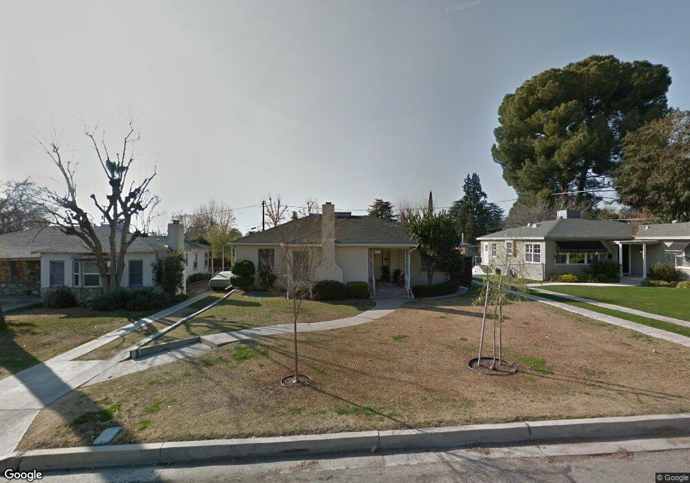
2916 Alta Vista Dr Bakersfield, CA 93305
College Heights NeighborhoodEstimated Value: $293,629 - $348,000
3
Beds
1
Bath
1,576
Sq Ft
$210/Sq Ft
Est. Value
About This Home
This home is located at 2916 Alta Vista Dr, Bakersfield, CA 93305 and is currently estimated at $330,407, approximately $209 per square foot. 2916 Alta Vista Dr is a home located in Kern County with nearby schools including Myra A. Noble Elementary School, Washington Middle School, and East Bakersfield High School.
Ownership History
Date
Name
Owned For
Owner Type
Purchase Details
Closed on
Mar 17, 1995
Sold by
Bernstein Beverly C and The Yevnike M Chuchian Living
Bought by
Martinez Robert L and Martinez Stephanie L
Current Estimated Value
Home Financials for this Owner
Home Financials are based on the most recent Mortgage that was taken out on this home.
Original Mortgage
$87,400
Interest Rate
8.86%
Create a Home Valuation Report for This Property
The Home Valuation Report is an in-depth analysis detailing your home's value as well as a comparison with similar homes in the area
Home Values in the Area
Average Home Value in this Area
Purchase History
| Date | Buyer | Sale Price | Title Company |
|---|---|---|---|
| Martinez Robert L | $92,000 | First American Title Company |
Source: Public Records
Mortgage History
| Date | Status | Borrower | Loan Amount |
|---|---|---|---|
| Closed | Martinez Robert L | $87,400 |
Source: Public Records
Tax History Compared to Growth
Tax History
| Year | Tax Paid | Tax Assessment Tax Assessment Total Assessment is a certain percentage of the fair market value that is determined by local assessors to be the total taxable value of land and additions on the property. | Land | Improvement |
|---|---|---|---|---|
| 2025 | $2,685 | $154,491 | $41,974 | $112,517 |
| 2024 | $2,685 | $151,462 | $41,151 | $110,311 |
| 2023 | $2,610 | $148,494 | $40,345 | $108,149 |
| 2022 | $2,512 | $145,583 | $39,554 | $106,029 |
| 2021 | $2,407 | $142,729 | $38,779 | $103,950 |
| 2020 | $2,369 | $141,267 | $38,382 | $102,885 |
| 2019 | $2,297 | $141,267 | $38,382 | $102,885 |
| 2018 | $2,236 | $135,784 | $36,893 | $98,891 |
| 2017 | $2,214 | $133,122 | $36,170 | $96,952 |
| 2016 | $1,943 | $130,512 | $35,461 | $95,051 |
| 2015 | $1,940 | $128,553 | $34,929 | $93,624 |
| 2014 | $1,885 | $126,036 | $34,245 | $91,791 |
Source: Public Records
Map
Nearby Homes
- 2928 Elmwood Ave
- 501 Magnolia Ave
- 405 Balsam Ave
- 3010 Elmwood Ave
- 308 Acacia Ave
- 2801 Alta Vista Dr
- 2871 N Inyo St
- 330 Poplar Ave
- 200 El Cielo Dr
- 611 Walnut Ave
- 439 Poplar Ave
- 2704 Alturas Dr
- 2927 Skyline Blvd
- 2860 N Baker St
- 2550 La Siesta Dr
- 418 Crawford St
- 707 Acacia Ave
- 221 Columbus St
- 326 Water St
- 621 Columbus St
- 2920 Alta Vista Dr
- 2912 Alta Vista Dr
- 2917 La Cresta Dr
- 2908 Alta Vista Dr
- 2911 La Cresta Dr
- 2921 La Cresta Dr
- 2900 Linden Ave
- 2905 La Cresta Dr
- 2900 Alta Vista Dr
- 262 Monte Vista Dr
- 2914 La Cresta Dr
- 2912 La Cresta Dr
- 2902 Linden Ave
- 256 Monte Vista Dr
- 2920 La Cresta Dr
- 300 Balsam Ave
- 2908 La Cresta Dr
- 2904 La Cresta Dr
- 250 Monte Vista Dr