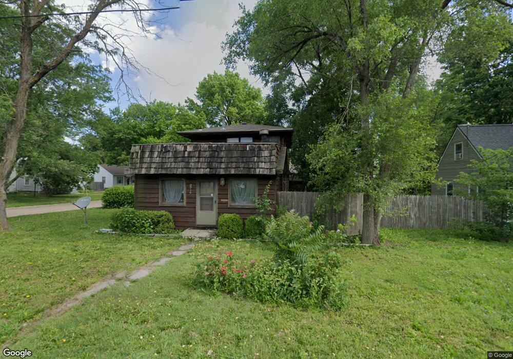
2916 SW 17th St Topeka, KS 66604
Central Topeka NeighborhoodEstimated Value: $108,968 - $148,000
2
Beds
2
Baths
1,360
Sq Ft
$94/Sq Ft
Est. Value
About This Home
This home is located at 2916 SW 17th St, Topeka, KS 66604 and is currently estimated at $128,492, approximately $94 per square foot. 2916 SW 17th St is a home located in Shawnee County with nearby schools including Buckeye Elementary School, Rosenwald Elementary School, and Martin Park Elementary School.
Ownership History
Date
Name
Owned For
Owner Type
Purchase Details
Closed on
Jun 11, 2024
Sold by
Deters Alex P and Deters Julie L
Bought by
Stone 19 Properties Llc
Current Estimated Value
Purchase Details
Closed on
Sep 23, 2013
Sold by
Deters Larry L and Deters Mary Ellen
Bought by
Deters Larry L and Deters Alex P
Home Financials for this Owner
Home Financials are based on the most recent Mortgage that was taken out on this home.
Original Mortgage
$30,000
Interest Rate
4.46%
Mortgage Type
New Conventional
Purchase Details
Closed on
May 18, 2011
Sold by
The Bank Of New York Mellon
Bought by
Deters Alex P and Deters Larry L
Home Financials for this Owner
Home Financials are based on the most recent Mortgage that was taken out on this home.
Original Mortgage
$40,000
Interest Rate
4.95%
Mortgage Type
Purchase Money Mortgage
Create a Home Valuation Report for This Property
The Home Valuation Report is an in-depth analysis detailing your home's value as well as a comparison with similar homes in the area
Home Values in the Area
Average Home Value in this Area
Purchase History
| Date | Buyer | Sale Price | Title Company |
|---|---|---|---|
| Stone 19 Properties Llc | -- | None Listed On Document | |
| Deters Larry L | -- | Capital Title Ins Company Lc | |
| Deters Alex P | -- | Mokan Title Services Llc |
Source: Public Records
Mortgage History
| Date | Status | Borrower | Loan Amount |
|---|---|---|---|
| Previous Owner | Deters Larry L | $30,000 | |
| Previous Owner | Deters Alex P | $40,000 |
Source: Public Records
Tax History Compared to Growth
Tax History
| Year | Tax Paid | Tax Assessment Tax Assessment Total Assessment is a certain percentage of the fair market value that is determined by local assessors to be the total taxable value of land and additions on the property. | Land | Improvement |
|---|---|---|---|---|
| 2025 | $1,083 | $8,648 | -- | -- |
| 2023 | $1,083 | $7,847 | $0 | $0 |
| 2022 | $963 | $6,823 | $0 | $0 |
| 2021 | $904 | $5,933 | $0 | $0 |
| 2020 | $849 | $5,650 | $0 | $0 |
| 2019 | $854 | $5,650 | $0 | $0 |
| 2018 | $829 | $5,486 | $0 | $0 |
| 2017 | $831 | $5,486 | $0 | $0 |
| 2014 | $986 | $6,394 | $0 | $0 |
Source: Public Records
Map
Nearby Homes
- 1520 SW Oakley Ave
- 1355 SW Medford Ave
- 3100 SW Canterbury Ln
- 1503 SW MacVicar Ave
- 1432 SW MacVicar Ave
- 1625 SW Lakeside Dr
- 1533 SW Stratford Rd
- 2812 SW Huntoon St
- 1610 SW Plass Ave
- 2516 SW Huntoon St
- 3405 SW Huntoon St
- 1225 SW Lakeside Dr
- 2012 SW Westwood Dr
- 1421 SW Jewell Ave
- 3516 SW Avalon Ln
- 3636 SW Stratford Rd
- 2024 SW Stone Ave
- 2028 SW Stone Ave
- 1150 SW Collins Ave
- 1147 SW Webster Ave
- 2912 SW 17th St
- 1624 SW Campbell Ave
- 1620 SW Campbell Ave
- 2910 SW 17th St
- 1635 SW Campbell Ave
- 1629 SW Campbell Ave
- 000 SW Westboro Place
- 1625 SW Campbell Ave
- 1616 SW Campbell Ave
- 1631 SW Collins Ave
- 6 SW Westboro Place
- 1623 SW Campbell Ave
- 1621 SW Collins Ave
- 1621 SW Campbell Ave
- 1612 SW Campbell Ave
- 1701 SW Collins Ave
- 1617 SW Collins Ave
- 1619 SW Campbell Ave
- 1608 SW Campbell Ave
- 1632 SW Oakley Ave