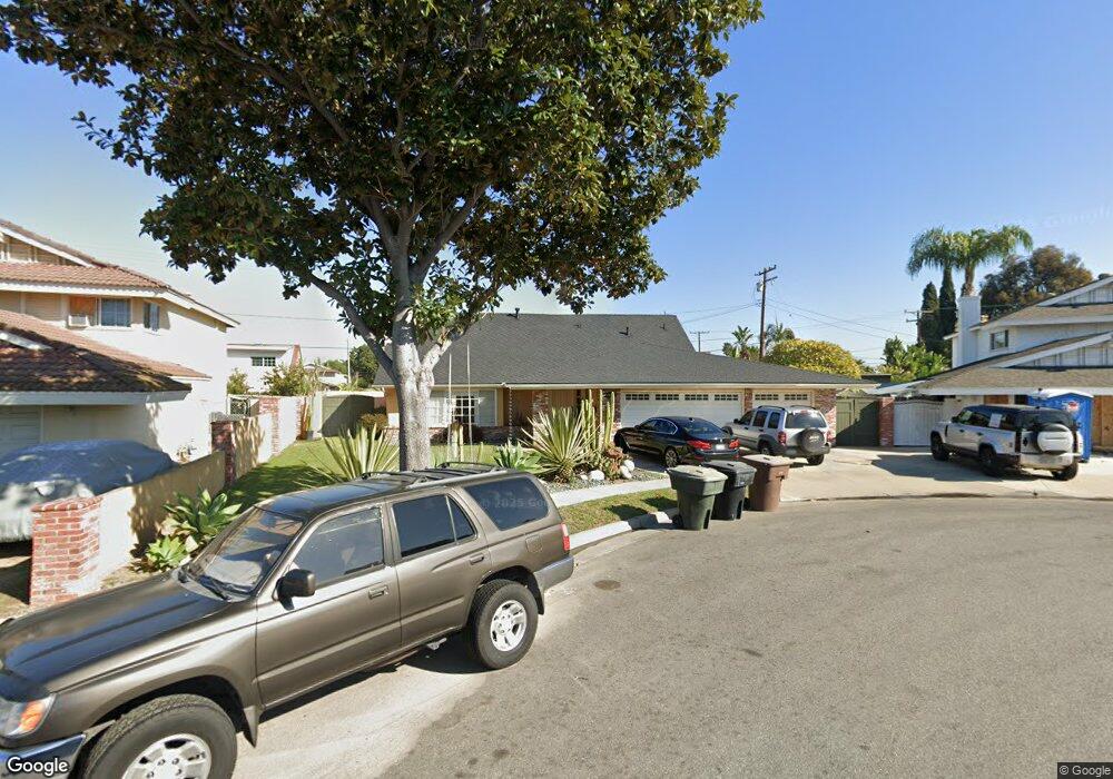
2917 W Westhaven Ct Anaheim, CA 92804
West Anaheim NeighborhoodEstimated Value: $1,045,000 - $1,121,000
4
Beds
3
Baths
1,964
Sq Ft
$550/Sq Ft
Est. Value
About This Home
This home is located at 2917 W Westhaven Ct, Anaheim, CA 92804 and is currently estimated at $1,079,956, approximately $549 per square foot. 2917 W Westhaven Ct is a home located in Orange County with nearby schools including Baden-Powell Elementary School, Dale Jr High School, and Magnolia High.
Ownership History
Date
Name
Owned For
Owner Type
Purchase Details
Closed on
Oct 12, 2015
Sold by
Steen Edwin P and Steen Yolanda T
Bought by
Steen Edwin P and Steen Yolanda T
Current Estimated Value
Home Financials for this Owner
Home Financials are based on the most recent Mortgage that was taken out on this home.
Original Mortgage
$277,800
Outstanding Balance
$112,575
Interest Rate
3.86%
Mortgage Type
New Conventional
Estimated Equity
$967,381
Purchase Details
Closed on
Sep 13, 1999
Sold by
Jill Deckard and Jill Edward Davis
Bought by
Steen Edwin P and Steen Yolanda Turrey
Home Financials for this Owner
Home Financials are based on the most recent Mortgage that was taken out on this home.
Original Mortgage
$200,000
Interest Rate
7.82%
Purchase Details
Closed on
Oct 28, 1994
Sold by
Deckard Jill
Bought by
Decker Jill and Sherman Linda Lee
Create a Home Valuation Report for This Property
The Home Valuation Report is an in-depth analysis detailing your home's value as well as a comparison with similar homes in the area
Home Values in the Area
Average Home Value in this Area
Purchase History
| Date | Buyer | Sale Price | Title Company |
|---|---|---|---|
| Steen Edwin P | -- | Title365 Company Inc | |
| Steen Edwin P | $250,000 | Commonwealth Land Title | |
| Decker Jill | -- | -- |
Source: Public Records
Mortgage History
| Date | Status | Borrower | Loan Amount |
|---|---|---|---|
| Open | Steen Edwin P | $277,800 | |
| Previous Owner | Steen Edwin P | $200,000 | |
| Closed | Steen Edwin P | $25,000 |
Source: Public Records
Tax History Compared to Growth
Tax History
| Year | Tax Paid | Tax Assessment Tax Assessment Total Assessment is a certain percentage of the fair market value that is determined by local assessors to be the total taxable value of land and additions on the property. | Land | Improvement |
|---|---|---|---|---|
| 2025 | $4,463 | $384,235 | $243,230 | $141,005 |
| 2024 | $4,463 | $376,701 | $238,460 | $138,241 |
| 2023 | $4,347 | $369,315 | $233,784 | $135,531 |
| 2022 | $4,304 | $362,074 | $229,200 | $132,874 |
| 2021 | $4,253 | $354,975 | $224,706 | $130,269 |
| 2020 | $4,230 | $351,336 | $222,402 | $128,934 |
| 2019 | $4,127 | $344,448 | $218,042 | $126,406 |
| 2018 | $4,077 | $337,695 | $213,767 | $123,928 |
| 2017 | $3,935 | $331,074 | $209,575 | $121,499 |
| 2016 | $3,916 | $324,583 | $205,466 | $119,117 |
| 2015 | $3,883 | $319,708 | $202,380 | $117,328 |
| 2014 | $3,690 | $313,446 | $198,416 | $115,030 |
Source: Public Records
Map
Nearby Homes
- 2945 W Bridgeport Ave
- 507 S Shields Dr
- 619 S Shields Dr
- 716 S Hayward St Unit 2
- 2942 W Floyd Ave
- 231 S Laxore St
- 235 S Beach Blvd Unit 132
- 900 S Hayward St
- 211 S Beach Blvd Unit 92
- 103 S Laxore St
- 106 S Laxore St Unit 407
- 107 S Laxore St
- 1223 S Dale Ave
- Plan Two at Mason
- Plan Four at Mason
- Plan Three at Mason
- Plan Seven at Mason
- 109 S Laxore St
- 2770 W Lincoln Ave Unit 40
- 2770 W Lincoln Ave Unit 58
- 2918 W Rogers Ct
- 2923 W Westhaven Ct
- 2913 W Westhaven Ct
- 2922 W Rogers Ct
- 2914 W Westhaven Ct
- 2920 W Westhaven Ct
- 627 S Bronwyn Dr
- 2916 W Westhaven Ct
- 633 S Bronwyn Dr
- 623 S Bronwyn Dr
- 637 S Bronwyn Dr
- 627 S Broder St
- 2926 W Westhaven Ct
- 619 S Bronwyn Dr
- 633 S Broder St
- 623 S Broder St
- 2913 W Rogers Ct
- 2923 W Rogers Ct
- 2917 W Rogers Ct
- 641 S Bronwyn Dr