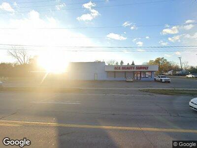
2918 S Dort Hwy Flint, MI 48507
Circle Neighborhood NeighborhoodEstimated Value: $162,023
--
Bed
--
Bath
3,110
Sq Ft
$52/Sq Ft
Est. Value
About This Home
This home is located at 2918 S Dort Hwy, Flint, MI 48507 and is currently estimated at $162,023, approximately $52 per square foot. 2918 S Dort Hwy is a home located in Genesee County with nearby schools including Freeman Elementary School, Flint Southwestern Classical Academy, and Burton Glen Charter Academy.
Ownership History
Date
Name
Owned For
Owner Type
Purchase Details
Closed on
Jan 21, 2022
Sold by
Todd Medwed
Bought by
Brown Montez and Harris Omar
Current Estimated Value
Purchase Details
Closed on
Feb 14, 2019
Sold by
M & T Bank
Bought by
Medwed Todd
Purchase Details
Closed on
Oct 25, 2017
Sold by
Battle Mary
Bought by
M And T Bank
Purchase Details
Closed on
Jun 22, 2007
Sold by
First National Acceptance Co
Bought by
Battle Mary
Home Financials for this Owner
Home Financials are based on the most recent Mortgage that was taken out on this home.
Original Mortgage
$82,400
Interest Rate
6.37%
Mortgage Type
Commercial
Create a Home Valuation Report for This Property
The Home Valuation Report is an in-depth analysis detailing your home's value as well as a comparison with similar homes in the area
Home Values in the Area
Average Home Value in this Area
Purchase History
| Date | Buyer | Sale Price | Title Company |
|---|---|---|---|
| Brown Montez | $25,000 | Transnation Title | |
| Medwed Todd | $16,500 | Fidelity Land Title Agency | |
| M And T Bank | $33,000 | None Available | |
| Battle Mary | $67,000 | None Available |
Source: Public Records
Mortgage History
| Date | Status | Borrower | Loan Amount |
|---|---|---|---|
| Previous Owner | Battle Mary | $82,400 |
Source: Public Records
Tax History Compared to Growth
Tax History
| Year | Tax Paid | Tax Assessment Tax Assessment Total Assessment is a certain percentage of the fair market value that is determined by local assessors to be the total taxable value of land and additions on the property. | Land | Improvement |
|---|---|---|---|---|
| 2024 | $3,828 | $58,300 | $0 | $0 |
| 2023 | $3,677 | $55,500 | $0 | $0 |
| 2022 | $0 | $52,000 | $0 | $0 |
| 2021 | $4,025 | $55,400 | $0 | $0 |
| 2020 | $3,606 | $53,500 | $0 | $0 |
| 2019 | $2,499 | $55,400 | $0 | $0 |
| 2018 | $2,624 | $51,300 | $0 | $0 |
| 2017 | $2,538 | $0 | $0 | $0 |
| 2016 | $2,516 | $0 | $0 | $0 |
| 2015 | -- | $0 | $0 | $0 |
| 2014 | -- | $0 | $0 | $0 |
| 2012 | -- | $36,900 | $0 | $0 |
Source: Public Records
Map
Nearby Homes
- 3205 Cheyenne Ave
- 2910 Shawnee Ave
- 3017 Cherokee Ave
- 2841 Comanche Ave
- 3107 Comanche Ave
- 3210 Cherokee Ave
- 3413 Cherokee Ave
- 3222 Chambers St
- 3505 Comanche Ave
- 2618 Pinetree Dr
- 3610 Dearborn Ave
- 2298 S Term St
- 3277 Sayre Ct
- 2210 S Term St
- 609 Buckingham Ave
- 3102 Ludwig St
- 621 Burroughs Ave
- 541 Buckingham Ave
- 0 Mckinley Ave
- 2240 Morrish St
- 2918 S Dort Hwy Unit 3110
- 2918 S Dort Hwy
- 2917 Menominee Ave
- 2913 Menominee Ave
- 3001 Menominee Ave
- 2909 Menominee Ave
- 3005 Menominee Ave
- 3098 S Dort Hwy
- 1302 Mohawk Ave
- 3009 Menominee Ave
- 3013 Menominee Ave
- 2914 Menominee Ave
- 2918 Menominee Ave
- 1305 Mohawk Ave
- 2913 S Dort Hwy
- 3002 Menominee Ave
- 2910 Menominee Ave
- 3006 Menominee Ave
- 3101 Menominee Ave
- 1210 Mohawk Ave