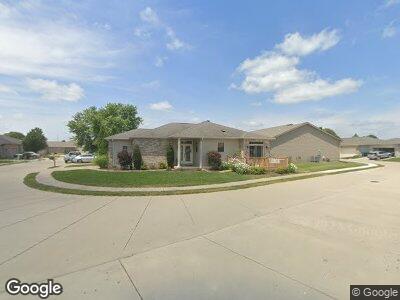
2919 S Meadowbrook Rd Springfield, IL 62711
Cobblestone Estates NeighborhoodEstimated Value: $185,039 - $213,000
2
Beds
2
Baths
1,312
Sq Ft
$151/Sq Ft
Est. Value
About This Home
This home is located at 2919 S Meadowbrook Rd, Springfield, IL 62711 and is currently estimated at $197,760, approximately $150 per square foot. 2919 S Meadowbrook Rd is a home located in Sangamon County with nearby schools including Lindsay School, Benjamin Franklin Middle School, and Springfield High School.
Ownership History
Date
Name
Owned For
Owner Type
Purchase Details
Closed on
Feb 10, 2015
Current Estimated Value
Purchase Details
Closed on
Nov 15, 2013
Purchase Details
Closed on
Mar 26, 2010
Purchase Details
Closed on
May 2, 2008
Purchase Details
Closed on
Feb 29, 2008
Purchase Details
Closed on
Oct 30, 2007
Purchase Details
Closed on
Oct 21, 2007
Purchase Details
Closed on
Jan 3, 2007
Purchase Details
Closed on
Dec 13, 2006
Purchase Details
Closed on
Nov 27, 2006
Purchase Details
Closed on
Nov 10, 2006
Purchase Details
Closed on
Jul 28, 2006
Purchase Details
Closed on
May 3, 2005
Purchase Details
Closed on
Sep 9, 2004
Create a Home Valuation Report for This Property
The Home Valuation Report is an in-depth analysis detailing your home's value as well as a comparison with similar homes in the area
Home Values in the Area
Average Home Value in this Area
Purchase History
| Date | Buyer | Sale Price | Title Company |
|---|---|---|---|
| -- | $116,900 | -- | |
| -- | $123,000 | -- | |
| -- | $114,000 | -- | |
| -- | $75,000 | -- | |
| -- | -- | -- | |
| -- | -- | -- | |
| -- | -- | -- | |
| -- | -- | -- | |
| -- | -- | -- | |
| -- | -- | -- | |
| -- | -- | -- | |
| -- | -- | -- | |
| -- | -- | -- | |
| -- | -- | -- |
Source: Public Records
Tax History Compared to Growth
Tax History
| Year | Tax Paid | Tax Assessment Tax Assessment Total Assessment is a certain percentage of the fair market value that is determined by local assessors to be the total taxable value of land and additions on the property. | Land | Improvement |
|---|---|---|---|---|
| 2023 | $3,587 | $47,186 | $7,760 | $39,426 |
| 2022 | $3,394 | $44,451 | $7,360 | $37,091 |
| 2021 | $3,262 | $42,786 | $7,084 | $35,702 |
| 2020 | $3,198 | $42,851 | $7,095 | $35,756 |
| 2019 | $3,137 | $42,701 | $7,070 | $35,631 |
| 2018 | $2,897 | $40,795 | $7,961 | $32,834 |
| 2017 | $2,831 | $40,267 | $7,858 | $32,409 |
| 2016 | $2,768 | $39,679 | $7,743 | $31,936 |
| 2015 | $2,735 | $39,204 | $7,650 | $31,554 |
| 2014 | $2,858 | $38,951 | $7,601 | $31,350 |
| 2013 | $2,629 | $38,921 | $7,601 | $31,320 |
Source: Public Records
Map
Nearby Homes
- 2919 S Meadowbrook Rd Unit 13
- 12B Westgate Dr
- 12A Westgate Dr
- 11B Westgate Dr
- 11A Westgate Dr
- 10B Westgate Dr
- 10A Westgate Dr
- 9B Westgate Dr
- 9A Westgate Dr
- 2811 Haggard Dr
- 3700 Westgate Dr
- Lots 4-7 Yucan & Mercantile Dr
- 5904 Hedley Rd
- 6013 Hedley Rd
- 3540 Sandwood Dr
- 4204 Lavender Ln
- 3400 Ginger Creek Dr
- 713 Sloan Dr
- 5212 Verdant Ln
- 2866 Reseda Rd