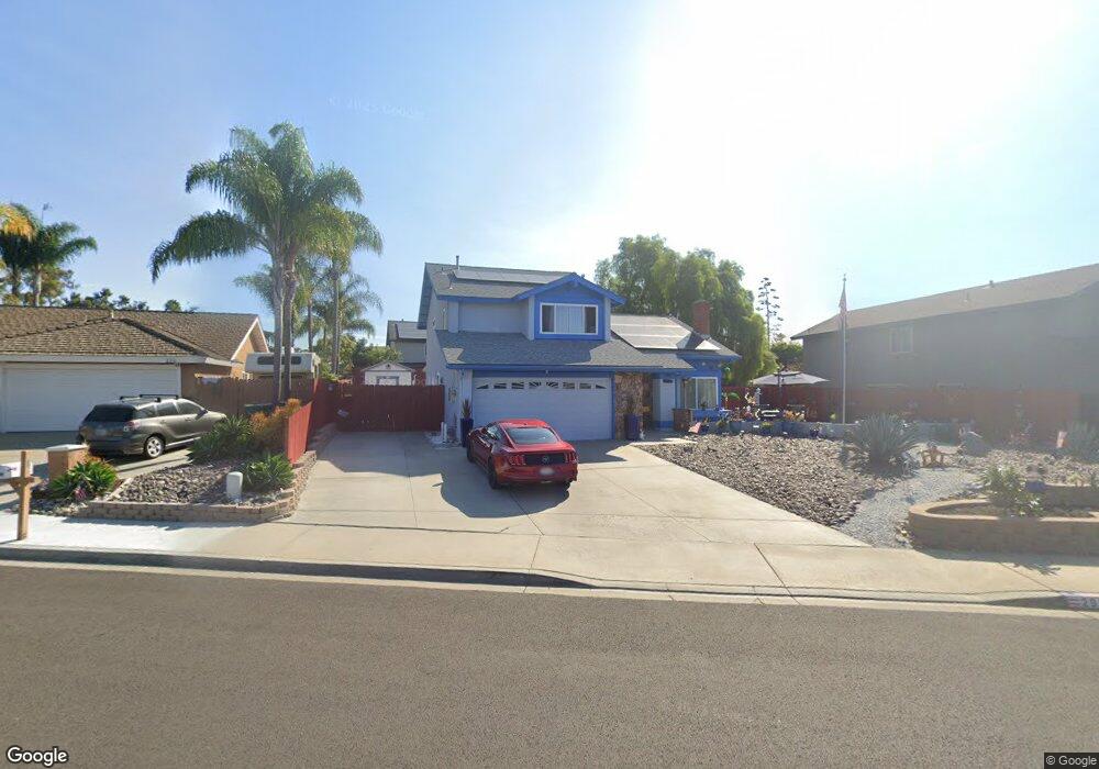
292 Bluff Way Oceanside, CA 92054
Loma Alta NeighborhoodEstimated Value: $1,025,400 - $1,200,000
3
Beds
3
Baths
2,021
Sq Ft
$558/Sq Ft
Est. Value
About This Home
This home is located at 292 Bluff Way, Oceanside, CA 92054 and is currently estimated at $1,126,850, approximately $557 per square foot. 292 Bluff Way is a home located in San Diego County with nearby schools including Lincoln Middle School, Oceanside High School, and Oceanside Adventist Elementary School.
Ownership History
Date
Name
Owned For
Owner Type
Purchase Details
Closed on
Jan 24, 2026
Sold by
Baker Guy A and Baker Francoise S
Bought by
Guy Baker And Francoise Baker Revocable Livin and Baker
Current Estimated Value
Purchase Details
Closed on
Feb 15, 2000
Sold by
Hydro Equipment Co
Bought by
Baker Guy A and Baker Francoise S
Home Financials for this Owner
Home Financials are based on the most recent Mortgage that was taken out on this home.
Original Mortgage
$172,000
Interest Rate
5.2%
Purchase Details
Closed on
Mar 24, 1989
Purchase Details
Closed on
Aug 11, 1988
Create a Home Valuation Report for This Property
The Home Valuation Report is an in-depth analysis detailing your home's value as well as a comparison with similar homes in the area
Home Values in the Area
Average Home Value in this Area
Purchase History
| Date | Buyer | Sale Price | Title Company |
|---|---|---|---|
| Guy Baker And Francoise Baker Revocable Livin | -- | None Listed On Document | |
| Baker Guy A | $215,000 | First American Title | |
| -- | $79,900 | -- | |
| -- | $150,000 | -- |
Source: Public Records
Mortgage History
| Date | Status | Borrower | Loan Amount |
|---|---|---|---|
| Previous Owner | Baker Guy A | $172,000 | |
| Closed | Baker Guy A | $43,000 |
Source: Public Records
Tax History
| Year | Tax Paid | Tax Assessment Tax Assessment Total Assessment is a certain percentage of the fair market value that is determined by local assessors to be the total taxable value of land and additions on the property. | Land | Improvement |
|---|---|---|---|---|
| 2025 | $3,595 | $330,428 | $115,258 | $215,170 |
| 2024 | $3,595 | $323,950 | $112,999 | $210,951 |
| 2023 | $3,483 | $317,599 | $110,784 | $206,815 |
| 2022 | $3,429 | $311,372 | $108,612 | $202,760 |
| 2021 | $3,441 | $305,268 | $106,483 | $198,785 |
| 2020 | $3,334 | $302,139 | $105,392 | $196,747 |
| 2019 | $3,237 | $296,216 | $103,326 | $192,890 |
| 2018 | $3,201 | $290,408 | $101,300 | $189,108 |
| 2017 | $3,141 | $284,714 | $99,314 | $185,400 |
| 2016 | $3,037 | $279,132 | $97,367 | $181,765 |
| 2015 | $2,948 | $274,940 | $95,905 | $179,035 |
| 2014 | $2,834 | $269,555 | $94,027 | $175,528 |
Source: Public Records
Map
Nearby Homes
- 432 Edgehill Ln Unit 169
- 432 Edgehill Ln Unit 165
- 432 Edgehill Ln Unit 95
- 432 Edgehill Ln Unit 74
- 403 Foussat Rd
- 3030 Oceanside Blvd Unit 44
- 3030 Oceanside Blvd Unit 10
- 223 Cottingham Ct
- 540 S Barnwell St
- 519 Camelot Dr
- 3263 Roberta Ln
- 1305 Cornish Dr
- 3218 Carolyn Cir
- 230 Hoover St
- 3592 Boussock Ln
- 139 Ely St
- 2904 E Barnwell St
- 147 Tropicana Dr
- 2937 E Barnwell St
- 3621 Vista Campana S
- 286 Bluff Way
- 298 Bluff Way
- 3537 Voyager Ct
- 3541 Voyager Ct
- 3533 Voyager Ct
- 285 Bluff Way
- 291 Bluff Way
- 3545 Voyager Ct
- 297 Bluff Way
- 304 Bluff Way
- 472 Mainsail Rd
- 467 Mainsail Rd
- 3549 Voyager Ct
- 303 Bluff Way
- 446 Mainsail Rd
- 463 Mainsail Rd
- 392 Islander St
- 459 Mainsail Rd
- 3544 Voyager Ct
- 455 Mainsail Rd
Your Personal Tour Guide
Ask me questions while you tour the home.