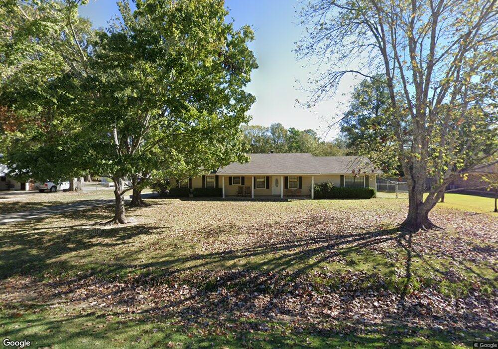
292 Connie Lynne Dr Monroe, LA 71203
Estimated Value: $213,757 - $245,000
3
Beds
3
Baths
2,136
Sq Ft
$105/Sq Ft
Est. Value
About This Home
This home is located at 292 Connie Lynne Dr, Monroe, LA 71203 and is currently estimated at $224,689, approximately $105 per square foot. 292 Connie Lynne Dr is a home located in Ouachita Parish with nearby schools including Lakeshore Elementary School, Ouachita Junior High School, and Ouachita Parish High School.
Ownership History
Date
Name
Owned For
Owner Type
Purchase Details
Closed on
Sep 27, 2005
Sold by
Carraway Jessie and Carraway Kelly Baker
Bought by
Hodges Darrel Wayne and Hodges Cyndi Mcbroom
Current Estimated Value
Home Financials for this Owner
Home Financials are based on the most recent Mortgage that was taken out on this home.
Original Mortgage
$107,200
Interest Rate
5.76%
Mortgage Type
New Conventional
Create a Home Valuation Report for This Property
The Home Valuation Report is an in-depth analysis detailing your home's value as well as a comparison with similar homes in the area
Home Values in the Area
Average Home Value in this Area
Purchase History
| Date | Buyer | Sale Price | Title Company |
|---|---|---|---|
| Hodges Darrel Wayne | $134,000 | None Available |
Source: Public Records
Mortgage History
| Date | Status | Borrower | Loan Amount |
|---|---|---|---|
| Closed | Hodges Darrel Wayne | $107,200 |
Source: Public Records
Tax History Compared to Growth
Tax History
| Year | Tax Paid | Tax Assessment Tax Assessment Total Assessment is a certain percentage of the fair market value that is determined by local assessors to be the total taxable value of land and additions on the property. | Land | Improvement |
|---|---|---|---|---|
| 2024 | $810 | $13,250 | $1,200 | $12,050 |
| 2023 | $810 | $13,250 | $1,200 | $12,050 |
| 2022 | $1,813 | $13,250 | $1,200 | $12,050 |
| 2021 | $1,828 | $13,250 | $1,200 | $12,050 |
| 2020 | $1,828 | $13,250 | $1,200 | $12,050 |
| 2019 | $1,803 | $13,250 | $1,200 | $12,050 |
| 2018 | $748 | $13,250 | $1,200 | $12,050 |
| 2017 | $1,765 | $13,250 | $1,200 | $12,050 |
| 2016 | $1,723 | $13,250 | $1,200 | $12,050 |
| 2015 | $746 | $13,250 | $1,200 | $12,050 |
| 2014 | $746 | $13,250 | $1,200 | $12,050 |
| 2013 | $745 | $13,250 | $1,200 | $12,050 |
Source: Public Records
Map
Nearby Homes
- 284 Connie Lynne Dr
- 261 Henson Ln
- 371 Rowland Dr
- 0 Rowland Rd
- 637 Rowland Rd
- 0 Braebend Dr
- 15 Chauvin Dr
- 1870 Highway 594
- 26 Forest Dr
- 126 Clayton Dr
- 276 Clayton Dr
- 0 Clayton Dr
- 158 Barbara Dr
- 30 Lake Dr
- 63 Forest Dr
- 38 Winchester Cir
- 515 Lincoln Rd Unit 167
- 515 Lincoln Rd Unit 129
- 515 Lincoln Rd Unit 168
- 29 Winchester Cir
- 290 Connie Lynne Dr
- 294 Connie Lynne Dr
- 296 Connie Lynne Dr
- 288 Connie Lynne Dr
- 293 Connie Lynne Dr
- 298 Connie Lynne Dr
- 295 Connie Lynne Dr
- 291 Connie Lynne Dr
- 289 Connie Lynne Dr
- 122 Henson Ln
- 130 Henson Ln
- 97 Margaret Dr
- 112 Henson Ln
- 138 Henson Ln
- 286 Connie Lynne Dr
- 287 Connie Lynne Dr
- 99 Margaret Dr
- 602 Rowland Rd
- 626 Rowland Dr
- 582 Rowland Dr