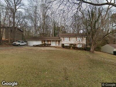
292 Saint Patrick Dr SW Unit 2 Mableton, GA 30126
Estimated Value: $344,000 - $377,000
3
Beds
2
Baths
2,172
Sq Ft
$168/Sq Ft
Est. Value
About This Home
This home is located at 292 Saint Patrick Dr SW Unit 2, Mableton, GA 30126 and is currently estimated at $363,928, approximately $167 per square foot. 292 Saint Patrick Dr SW Unit 2 is a home located in Cobb County with nearby schools including Mableton Elementary School, Floyd Middle School, and Covered Bridge Academy.
Ownership History
Date
Name
Owned For
Owner Type
Purchase Details
Closed on
Mar 30, 1995
Sold by
Bell Greg H Linda M
Bought by
Jones Trinette A and Blue Todd H
Current Estimated Value
Create a Home Valuation Report for This Property
The Home Valuation Report is an in-depth analysis detailing your home's value as well as a comparison with similar homes in the area
Home Values in the Area
Average Home Value in this Area
Purchase History
| Date | Buyer | Sale Price | Title Company |
|---|---|---|---|
| Jones Trinette A | $105,000 | -- |
Source: Public Records
Mortgage History
| Date | Status | Borrower | Loan Amount |
|---|---|---|---|
| Closed | Blue Todd H | $33,000 | |
| Open | Blue Todd H | $133,500 | |
| Closed | Blue Todd H | $36,000 | |
| Closed | Jones Trinette A | $65,400 | |
| Closed | Jones Trinette A | $44,000 | |
| Closed | Blue Todd H | $100,523 | |
| Closed | Jones Trinette A | $100,458 | |
| Closed | Jones Trinette A | $0 |
Source: Public Records
Tax History Compared to Growth
Tax History
| Year | Tax Paid | Tax Assessment Tax Assessment Total Assessment is a certain percentage of the fair market value that is determined by local assessors to be the total taxable value of land and additions on the property. | Land | Improvement |
|---|---|---|---|---|
| 2024 | $3,439 | $136,672 | $28,000 | $108,672 |
| 2023 | $2,700 | $127,584 | $22,000 | $105,584 |
| 2022 | $2,552 | $94,992 | $22,000 | $72,992 |
| 2021 | $2,552 | $94,992 | $22,000 | $72,992 |
| 2020 | $2,678 | $88,240 | $22,000 | $66,240 |
| 2019 | $2,678 | $88,240 | $22,000 | $66,240 |
| 2018 | $2,566 | $84,544 | $20,000 | $64,544 |
| 2017 | $1,957 | $68,068 | $10,400 | $57,668 |
| 2016 | $1,760 | $61,228 | $12,000 | $49,228 |
| 2015 | $1,804 | $61,228 | $12,000 | $49,228 |
| 2014 | $1,551 | $52,208 | $0 | $0 |
Source: Public Records
Map
Nearby Homes
- 4960 Shannon Way SW
- 5000 Northland Rd SW
- 647 Shannon Green Cir SW
- 5219 Maple Valley Rd SW
- 5225 Maple Valley Rd SW
- 26 Flint Ridge Dr SE
- 671 Shannon Green Cir SW
- 620 Shannon Green Cir SW
- 187 Fontaine Rd SW
- 371 Landers Dr SW
- 4720 Timberland Dr SW
- 426 Landers Dr SW
- 542 Oak Hills Rd SW
- 429 Landers Dr SW
- 706 Briarleigh Ct SW
- 470 Pineland Rd SW
- 4754 Kelley Ct SE
- 4812 Lismoor Trace SW
- 292 Saint Patrick Dr SW Unit 2
- 304 Saint Patrick Dr SW
- 280 Saint Patrick Dr SW
- 0 Shamrock Ct SW Unit 8481801
- 0 Shamrock Ct SW Unit 8132633
- 0 Shamrock Ct SW
- 279 Saint Patrick Dr SW Unit 2
- 291 Saint Patrick Dr SW
- 305 St Patrick Dr
- 305 Saint Patrick Dr SW
- 268 Saint Patrick Dr SW
- 269 Saint Patrick Dr SW
- 4929 Shamrock Ct SW
- 315 Saint Patrick Dr SW
- 5002 Shannon Way SW Unit 2
- 5006 Shannon Way SW
- 4998 Shannon Way SW
- 4918 Shamrock Ct SW
- 261 Saint Patrick Dr SW Unit 2
- 327 Saint Patrick Dr SW Unit 2