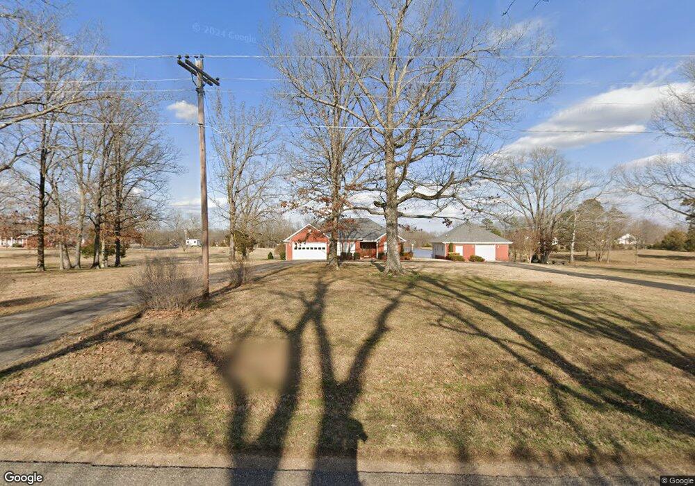
2920 Caney Branch Rd Adamsville, TN 38310
Estimated Value: $367,000 - $450,823
--
Bed
2
Baths
1,953
Sq Ft
$217/Sq Ft
Est. Value
About This Home
This home is located at 2920 Caney Branch Rd, Adamsville, TN 38310 and is currently estimated at $423,956, approximately $217 per square foot. 2920 Caney Branch Rd is a home located in Hardin County with nearby schools including Hardin County High School.
Ownership History
Date
Name
Owned For
Owner Type
Purchase Details
Closed on
May 19, 2008
Sold by
Dunlop Robert G
Bought by
Churchwell W G
Current Estimated Value
Purchase Details
Closed on
May 24, 2007
Sold by
Bird Darrell E
Bought by
Churchwell W G
Purchase Details
Closed on
Jul 11, 2005
Sold by
City Of Crump
Bought by
Hardin County
Purchase Details
Closed on
Apr 26, 2004
Sold by
Old South Estates
Bought by
Bird Darrell L
Purchase Details
Closed on
May 3, 2002
Sold by
Hanson Darrell J
Bought by
Old South Estates
Purchase Details
Closed on
Aug 4, 1998
Sold by
Cagle Hazel
Bought by
Hansen Darrell and Hansen Karen
Purchase Details
Closed on
Jan 4, 1995
Sold by
Cagle H C
Bought by
Lipford Charles R
Purchase Details
Closed on
Apr 12, 1982
Bought by
Blanton Leonard and Wife Ova
Purchase Details
Closed on
Sep 23, 1964
Create a Home Valuation Report for This Property
The Home Valuation Report is an in-depth analysis detailing your home's value as well as a comparison with similar homes in the area
Home Values in the Area
Average Home Value in this Area
Purchase History
| Date | Buyer | Sale Price | Title Company |
|---|---|---|---|
| Churchwell W G | $4,900 | -- | |
| Churchwell W G | $228,000 | -- | |
| Hardin County | -- | -- | |
| Bird Darrell L | $29,900 | -- | |
| Old South Estates | $37,500 | -- | |
| Hansen Darrell | $258,500 | -- | |
| Lipford Charles R | $12,000 | -- | |
| Blanton Leonard | -- | -- | |
| -- | -- | -- |
Source: Public Records
Tax History Compared to Growth
Tax History
| Year | Tax Paid | Tax Assessment Tax Assessment Total Assessment is a certain percentage of the fair market value that is determined by local assessors to be the total taxable value of land and additions on the property. | Land | Improvement |
|---|---|---|---|---|
| 2024 | $1,787 | $102,125 | $14,300 | $87,825 |
| 2023 | $1,787 | $102,125 | $14,300 | $87,825 |
| 2022 | $1,404 | $68,150 | $10,175 | $57,975 |
| 2021 | $1,355 | $68,150 | $10,175 | $57,975 |
| 2020 | $1,355 | $65,775 | $10,175 | $55,600 |
| 2019 | $1,355 | $65,775 | $10,175 | $55,600 |
| 2018 | $1,310 | $65,775 | $10,175 | $55,600 |
| 2017 | $1,246 | $59,900 | $10,175 | $49,725 |
| 2016 | $1,246 | $59,900 | $10,175 | $49,725 |
| 2015 | $1,090 | $59,900 | $10,175 | $49,725 |
| 2014 | $1,090 | $59,900 | $10,175 | $49,725 |
Source: Public Records
Map
Nearby Homes
- 200 Grandview Cir
- 205 Pauline Dr
- 385 Pauline Dr
- 90 Columbus Ln
- 874 Old Shiloh Rd
- 705 Twelve Oaks Dr
- 335 Hardy Rd
- 971 Twelve Oaks Dr
- 10 Hardy Rd
- 0 Lynnwood Cove Unit 10194254
- 606 Duren Dr
- 3360 Coffee Landing Rd
- 125 S Palmer St
- 629 Hillside Dr
- 651 Pine St
- 55 Columbus Ln
- 0 Old Morris Chapel Rd Unit 10201483
- 211 E Main St
- 240 S Oak St
- 230 S Oak St
- 0 Albert Sidney Johnston Dr Unit 3129472
- 0 Albert Sidney Johnston Dr Unit 3248828
- 0 Albert Sidney Johnston Dr Unit 10055405
- 61 Albert Sydney Johnson Dr
- 2990 Caney Branch Rd
- 50 A S Johnston Dr
- 2855 Caney Branch Rd
- 2995 Caney Branch Rd
- 80 Albert Sidney Johnston Rd
- 3035 Caney Branch Rd
- 2915 Caney Branch Rd
- 40 Beauregard Cove
- 160 Albert Sidney Johnston Rd
- 55 Beauregard Cove
- 3070 Caney Branch Rd
- 70 Beauregard Cove
- 2760 Caney Branch Rd
- 125 Jm Peery Cove
- 140 James Matthew Perry Cove
- 105 Beauregard Cove