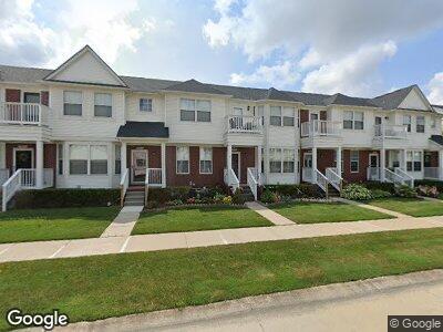
29200 Philadelphia Dr Unit 52 Chesterfield, MI 48051
Estimated Value: $216,000 - $231,235
2
Beds
2
Baths
1,506
Sq Ft
$151/Sq Ft
Est. Value
About This Home
This home is located at 29200 Philadelphia Dr Unit 52, Chesterfield, MI 48051 and is currently estimated at $227,059, approximately $150 per square foot. 29200 Philadelphia Dr Unit 52 is a home located in Macomb County with nearby schools including Francis A. Higgins Elementary School, L'Anse Creuse High School - North, and Merritt Academy.
Ownership History
Date
Name
Owned For
Owner Type
Purchase Details
Closed on
Sep 3, 2010
Sold by
Bell Monica S
Bought by
Federal Home Loan Mortgage Corp
Current Estimated Value
Purchase Details
Closed on
Dec 3, 2008
Sold by
Bell Robert L
Bought by
Bell Monica S
Purchase Details
Closed on
Jan 30, 2003
Sold by
Lombardo & Merlini Of Chesterfield Llc
Bought by
Bell Robert L and Bell Monica S
Create a Home Valuation Report for This Property
The Home Valuation Report is an in-depth analysis detailing your home's value as well as a comparison with similar homes in the area
Home Values in the Area
Average Home Value in this Area
Purchase History
| Date | Buyer | Sale Price | Title Company |
|---|---|---|---|
| Federal Home Loan Mortgage Corp | $142,625 | None Available | |
| Bell Monica S | -- | None Available | |
| Bell Robert L | $163,695 | -- |
Source: Public Records
Mortgage History
| Date | Status | Borrower | Loan Amount |
|---|---|---|---|
| Open | Myles Oscar | $22,300 | |
| Open | Myles Oscar | $56,529 | |
| Previous Owner | Bell Robert L | $25,000 | |
| Previous Owner | Bell Robert | $138,400 | |
| Previous Owner | Bell Robert L | $138,400 | |
| Previous Owner | Bell Robert | $130,950 | |
| Previous Owner | Bell Robert | $24,550 |
Source: Public Records
Tax History Compared to Growth
Tax History
| Year | Tax Paid | Tax Assessment Tax Assessment Total Assessment is a certain percentage of the fair market value that is determined by local assessors to be the total taxable value of land and additions on the property. | Land | Improvement |
|---|---|---|---|---|
| 2024 | $1,156 | $103,100 | $0 | $0 |
| 2023 | $1,096 | $91,900 | $0 | $0 |
| 2022 | $1,528 | $80,300 | $0 | $0 |
| 2021 | $1,486 | $74,400 | $0 | $0 |
| 2020 | $1,006 | $72,300 | $0 | $0 |
| 2019 | $1,313 | $65,400 | $0 | $0 |
| 2018 | $1,343 | $62,900 | $7,500 | $55,400 |
| 2017 | $1,315 | $57,250 | $7,500 | $49,750 |
| 2016 | $1,313 | $57,250 | $0 | $0 |
| 2015 | $443 | $50,900 | $0 | $0 |
| 2014 | $443 | $42,100 | $4,250 | $37,850 |
| 2012 | -- | $0 | $0 | $0 |
Source: Public Records
Map
Nearby Homes
- 53925 Andrew Dr
- 29696 Kevin Dr
- 53302 Elysia Dr
- 53989 Connor Dr
- 53064 Barberry Cir
- 52879 Schafers Run Ct Unit 3
- 53153 Gratiot Ave
- 30024 Camden Cir
- N W Corner 24 Mile & Gratiot Ave
- 53095 Windham Dr
- 30449 Hickey Rd
- 50425 Corey Ave Unit 60
- 29691 Georgetown Dr
- 52239 Landsdowne Cir
- 52203 Oxford Ln
- 52263 Landsdowne Cir
- 0 Gratiot Ave
- 29310 Jamestown Dr
- 29620 Jamestown Dr
- 31390 Rowland Ln
- 29200 Philadelphia Dr Unit 52
- 29196 Philadelphia Dr Unit Bldg-Unit
- 29204 Philadelphia Dr Unit 51
- 29192 Philadelphia Dr Unit 7 54
- 29192 Philadelphia Dr Unit 54
- 29208 Philadelphia Dr Unit 50
- 29212 Philadelphia Dr Unit 49
- 29188 Philadelphia Dr Unit 28
- 29216 Philadelphia Dr Unit 48
- 29169 Philadelphia Dr
- 29220 Philadelphia Dr Unit 47
- 29184 Philadelphia Dr Unit 8 29
- 29184 Philadelphia Dr Unit 29
- 29180 Philadelphia Dr Unit 30
- 29180 Philadelphia Dr
- 29224 Philadelphia Dr Unit 46
- 29176 Philadelphia Dr Unit 31
- 29193 Philadelphia Dr Unit 43
- 29185 Philadelphia Dr Unit 41
- 29181 Philadelphia Dr Unit 40