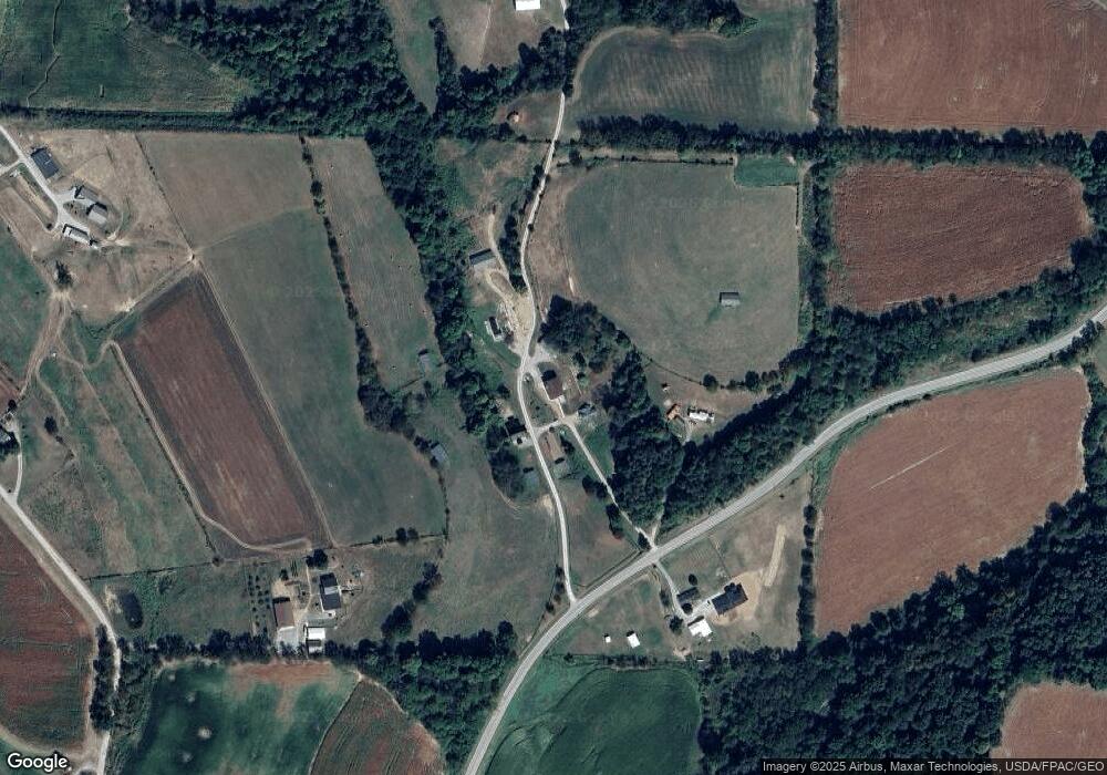
29211 Ohio 643 Fresno, OH 43824
Estimated Value: $379,000 - $606,000
3
Beds
1
Bath
1,798
Sq Ft
$291/Sq Ft
Est. Value
About This Home
This home is located at 29211 Ohio 643, Fresno, OH 43824 and is currently estimated at $523,623, approximately $291 per square foot. 29211 Ohio 643 is a home located in Coshocton County with nearby schools including River View High School and White Oak School.
Ownership History
Date
Name
Owned For
Owner Type
Purchase Details
Closed on
Oct 30, 2015
Sold by
Washington David E and Washington Heidi
Bought by
Nisley Reuben J and Nisley Rebecca
Current Estimated Value
Purchase Details
Closed on
Mar 2, 2004
Sold by
Lundsten John M Jlrs
Bought by
Washington David E
Purchase Details
Closed on
Jan 21, 2000
Sold by
Lundsten John M
Bought by
Lundsten John M
Purchase Details
Closed on
Aug 12, 1999
Sold by
Wolfe Deborah I
Bought by
Lundsten John M
Purchase Details
Closed on
Aug 5, 1998
Sold by
Hothem Robert J 3 and Int 4
Bought by
Hothem Robert J 3 and Int 4
Purchase Details
Closed on
Jul 31, 1998
Bought by
Hothem Robert J 3 and Int 4
Create a Home Valuation Report for This Property
The Home Valuation Report is an in-depth analysis detailing your home's value as well as a comparison with similar homes in the area
Home Values in the Area
Average Home Value in this Area
Purchase History
| Date | Buyer | Sale Price | Title Company |
|---|---|---|---|
| Nisley Reuben J | $320,000 | Monroe Street Title Co Ltd | |
| Washington David E | $310,000 | -- | |
| Lundsten John M | -- | -- | |
| Lundsten John M Jlrs | -- | -- | |
| Lundsten John M | $21,000 | -- | |
| Hothem Robert J 3 | $160,000 | -- | |
| Hothem Robert J 3 | -- | -- |
Source: Public Records
Tax History Compared to Growth
Tax History
| Year | Tax Paid | Tax Assessment Tax Assessment Total Assessment is a certain percentage of the fair market value that is determined by local assessors to be the total taxable value of land and additions on the property. | Land | Improvement |
|---|---|---|---|---|
| 2024 | $4,136 | $178,270 | $81,980 | $96,290 |
| 2023 | $4,136 | $157,602 | $61,310 | $96,292 |
| 2022 | $4,115 | $157,602 | $61,310 | $96,292 |
| 2021 | $5,993 | $157,602 | $61,310 | $96,292 |
| 2020 | $4,887 | $127,817 | $58,492 | $69,325 |
| 2019 | $3,361 | $86,468 | $58,492 | $27,976 |
| 2018 | $3,152 | $86,468 | $58,492 | $27,976 |
| 2017 | $3,047 | $79,531 | $49,865 | $29,666 |
| 2016 | $2,889 | $79,531 | $49,865 | $29,666 |
| 2015 | $3,033 | $79,531 | $49,865 | $29,666 |
| 2014 | $4,291 | $58,199 | $29,719 | $28,480 |
Source: Public Records
Map
Nearby Homes
- 28427 Ohio 83
- 30945 County Road 126
- 32469 Township Road 219
- 31509 Township Road 227
- 0 County Road 1
- 26938 County Road 1
- 26929 County Road 1
- 0 Township Road 219
- 0 Township Road 219
- 23900 Airport Rd
- 0 State Rd 93 Unit 23494832
- 54972 Township Road 90
- 0 Tr-88 Unit 5165275
- 31705 Township Road 236
- 217 E Liberty St
- 0 Ohio 93
- 230 Rivercrest Dr
- 53320 County Road 425
- 23749 County Road 621
- 29466 Ohio 93
- 29265 State Route 643
- 29180 State Route 643
- 29100 Township Road 212
- 29217 State Route 643
- 29260 Township Road 212
- 50016 T R 189 Rd NE
- 29432 Township Road 212
- 29652 Tr 212
- 28907 State Route 643
- 49813 Tr 195
- 49713 Tr 195
- 49881 Township Road 195 Unit 195
- 49819 Tr 195
- 50122 Township Road 189
- 30031 Township Road 212
- 50162 Township Road 195
- 28877 Township Road 194
- 50016 Township Road 189
- 30204 Township Road 213
