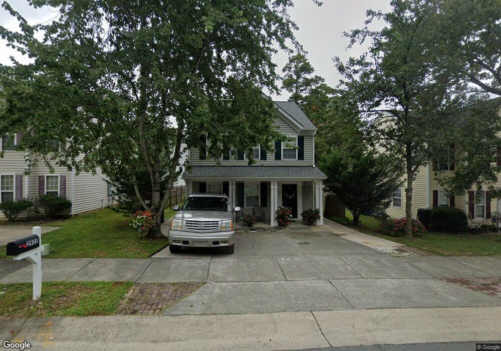
2922 Forrestal Dr Durham, NC 27703
Eastern Durham NeighborhoodEstimated Value: $280,000 - $324,000
3
Beds
3
Baths
1,632
Sq Ft
$190/Sq Ft
Est. Value
About This Home
This home is located at 2922 Forrestal Dr, Durham, NC 27703 and is currently estimated at $309,581, approximately $189 per square foot. 2922 Forrestal Dr is a home located in Durham County with nearby schools including Bethesda Elementary School, John W Neal Middle School, and Southern School of Energy & Sustainability.
Ownership History
Date
Name
Owned For
Owner Type
Purchase Details
Closed on
Feb 4, 2004
Sold by
Anderson Homes Inc
Bought by
Garcia Joel Serrano and Serrano Maria Felix
Current Estimated Value
Home Financials for this Owner
Home Financials are based on the most recent Mortgage that was taken out on this home.
Original Mortgage
$140,891
Outstanding Balance
$65,158
Interest Rate
5.63%
Mortgage Type
FHA
Estimated Equity
$244,423
Create a Home Valuation Report for This Property
The Home Valuation Report is an in-depth analysis detailing your home's value as well as a comparison with similar homes in the area
Home Values in the Area
Average Home Value in this Area
Purchase History
| Date | Buyer | Sale Price | Title Company |
|---|---|---|---|
| Garcia Joel Serrano | $143,500 | -- |
Source: Public Records
Mortgage History
| Date | Status | Borrower | Loan Amount |
|---|---|---|---|
| Open | Garcia Joel Serrano | $140,891 |
Source: Public Records
Tax History
| Year | Tax Paid | Tax Assessment Tax Assessment Total Assessment is a certain percentage of the fair market value that is determined by local assessors to be the total taxable value of land and additions on the property. | Land | Improvement |
|---|---|---|---|---|
| 2025 | $1,098 | $312,483 | $77,000 | $235,483 |
| 2024 | $2,364 | $169,502 | $41,400 | $128,102 |
| 2023 | $2,220 | $169,502 | $41,400 | $128,102 |
| 2022 | $2,169 | $169,502 | $41,400 | $128,102 |
| 2021 | $2,159 | $169,502 | $41,400 | $128,102 |
| 2020 | $2,108 | $169,502 | $41,400 | $128,102 |
| 2019 | $2,108 | $169,502 | $41,400 | $128,102 |
| 2018 | $1,958 | $144,352 | $24,840 | $119,512 |
| 2017 | $1,944 | $144,352 | $24,840 | $119,512 |
| 2016 | $1,878 | $144,352 | $24,840 | $119,512 |
| 2015 | $1,936 | $139,838 | $19,242 | $120,596 |
| 2014 | $1,936 | $139,838 | $19,242 | $120,596 |
Source: Public Records
Map
Nearby Homes
- 3211 Ivey Wood Ln
- 818 Lynn Rd
- 1218 Kendall Dr
- 3111 Ivey Wood Ln
- 1316 Kendall Dr
- 305 Kendall Dr Unit 203
- 806 Lindley Dr
- 519 Pleasant Dr
- 2055 Tanners Mill Dr
- 1030 Thoughtful Spot Ln
- 1015 Sora Way
- 428 Walton St
- 426 Walton St
- 404 Lynn Rd
- 509 Walton St
- 706 Carter Ave
- 3301 Delmar Dr
- 3307 Delmar Dr
- 3309 Delmar Dr
- 709 Carter Ave
- 2924 Forrestal Dr
- 2920 Forrestal Dr
- 3204 Oriskony Way
- 2918 Forrestal Dr
- 3206 Oriskony Way
- 2916 Forrestal Dr
- 3002 Forrestal Dr
- 3302 Oriskony Way
- 2914 Forrestal Dr
- 2925 Forrestal Dr
- 2923 Forrestal Dr
- 2927 Forrestal Dr
- 1 Intrepid Ct
- 2921 Forrestal Dr
- 3304 Oriskony Way
- 2912 Forrestal Dr
- 2919 Forrestal Dr
- 3001 Forrestal Dr
- 3 Intrepid Ct
- 2917 Forrestal Dr
Your Personal Tour Guide
Ask me questions while you tour the home.