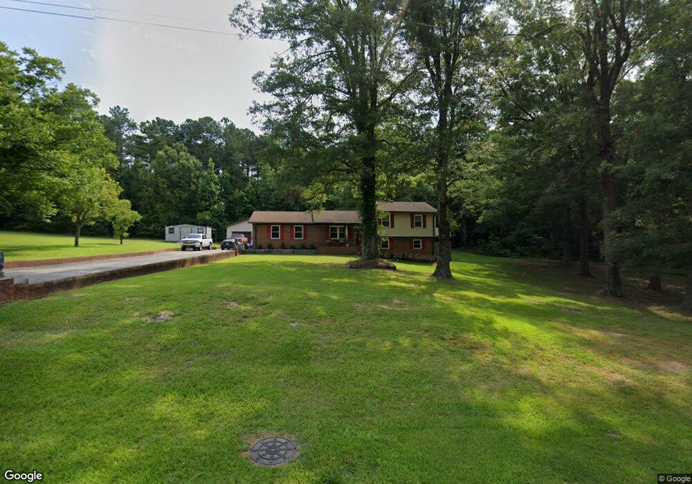
2923 Brendale Dr Lancaster, SC 29720
Estimated Value: $191,000 - $326,000
Studio
2
Baths
1,625
Sq Ft
$166/Sq Ft
Est. Value
About This Home
This home is located at 2923 Brendale Dr, Lancaster, SC 29720 and is currently estimated at $270,127, approximately $166 per square foot. 2923 Brendale Dr is a home located in Lancaster County with nearby schools including McDonald Green Elementary School, South Middle School, and Lancaster High School.
Ownership History
Date
Name
Owned For
Owner Type
Purchase Details
Closed on
Nov 3, 2021
Sold by
Dutton Kenneth
Bought by
Dutton Kenneth and Dutton Samantha
Current Estimated Value
Home Financials for this Owner
Home Financials are based on the most recent Mortgage that was taken out on this home.
Original Mortgage
$60,000
Outstanding Balance
$54,424
Interest Rate
2.88%
Mortgage Type
New Conventional
Estimated Equity
$215,703
Purchase Details
Closed on
Mar 20, 2014
Sold by
Estate Denny Ken Helms Sr
Bought by
Helms Patricia Anne
Create a Home Valuation Report for This Property
The Home Valuation Report is an in-depth analysis detailing your home's value as well as a comparison with similar homes in the area
Home Values in the Area
Average Home Value in this Area
Purchase History
| Date | Buyer | Sale Price | Title Company |
|---|---|---|---|
| Dutton Kenneth | -- | None Available | |
| Dutton Kenneth | $80,000 | None Available | |
| Helms Patricia Anne | -- | -- |
Source: Public Records
Mortgage History
| Date | Status | Borrower | Loan Amount |
|---|---|---|---|
| Open | Dutton Kenneth | $60,000 |
Source: Public Records
Tax History Compared to Growth
Tax History
| Year | Tax Paid | Tax Assessment Tax Assessment Total Assessment is a certain percentage of the fair market value that is determined by local assessors to be the total taxable value of land and additions on the property. | Land | Improvement |
|---|---|---|---|---|
| 2024 | $2,920 | $8,808 | $2,412 | $6,396 |
| 2023 | $2,917 | $8,808 | $2,412 | $6,396 |
| 2022 | $2,906 | $8,808 | $2,412 | $6,396 |
| 2021 | $2,862 | $8,808 | $2,412 | $6,396 |
| 2020 | $2,745 | $8,466 | $2,412 | $6,054 |
| 2019 | $2,712 | $8,019 | $2,285 | $5,734 |
| 2018 | $1,741 | $5,346 | $1,523 | $3,823 |
| 2017 | $502 | $0 | $0 | $0 |
| 2016 | $489 | $0 | $0 | $0 |
| 2015 | $548 | $0 | $0 | $0 |
| 2014 | $548 | $0 | $0 | $0 |
| 2013 | $548 | $0 | $0 | $0 |
Source: Public Records
Map
Nearby Homes
- 2895 Courtside Dr
- 1139 Merribrook Ln
- 1976 McIlwain Rd
- 5142 Sedgefield Dr
- 2908 Woodland Way
- 5114 Sedgefield Dr
- 3065 Georgetown Rd
- 1411 Foxbrook Cir
- 2599 State Road S-29-503
- 2131 Robert H Kirk Rd
- 2375 Ellison Cir
- 00 Bath Ln
- 2417 Lynwood Dr
- TBD Sunnyside Dr Unit 14 & 15
- Lot 24 Avalon Ln Unit 24
- 2795 Cane Mill Rd
- 2644 Downey Dr
- 2636 Downey Dr
- 1.18 acres McIlwain Rd
- 2526 Country Club Dr
- 2903 Brendale Dr
- 2914 Brendale Dr
- 2944 Brendale Dr
- 2896 Brendale Dr
- 2889 Brendale Dr
- 2961 Brendale Dr
- 2953 Courtside Dr
- 2964 Brendale Dr
- 0000 Brendale Dr Unit 15
- 2983 Brendale Dr
- 2980 Brendale Dr
- 2864 Brendale Dr
- 1107 Merribrook Ln
- 2853 Brendale Dr
- 3005 Brendale Dr
- 2848 Brendale Dr
- 1123 Merribrook Ln
- 1121 Wrenwood Dr
- 2841 Brendale Dr
- 00 Courtside Dr