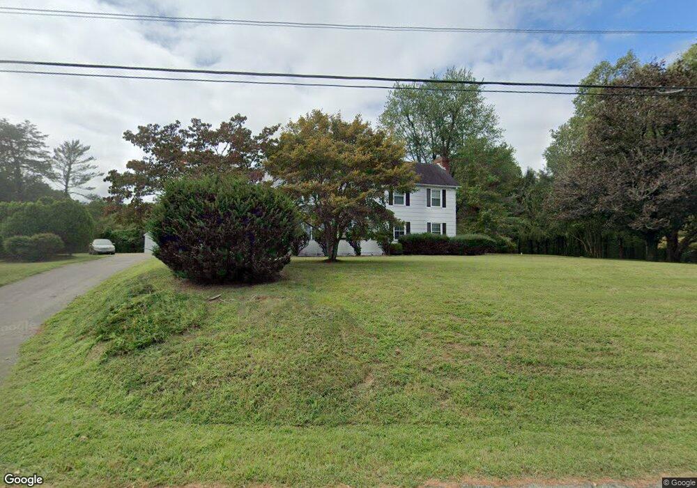
2925 Yoes Corner Ln Port Republic, MD 20676
Port Republic NeighborhoodEstimated Value: $671,000 - $1,029,000
--
Bed
2
Baths
2,368
Sq Ft
$359/Sq Ft
Est. Value
About This Home
This home is located at 2925 Yoes Corner Ln, Port Republic, MD 20676 and is currently estimated at $849,384, approximately $358 per square foot. 2925 Yoes Corner Ln is a home located in Calvert County with nearby schools including Mutual Elementary School, Calvert Middle School, and Calvert High School.
Ownership History
Date
Name
Owned For
Owner Type
Purchase Details
Closed on
Jun 22, 2023
Sold by
Estabrook Jane Yoe
Bought by
Estabrook Jane Yoe and Branche Drucilla
Current Estimated Value
Purchase Details
Closed on
Nov 29, 2020
Sold by
Estabrook Jane Yoe and Estabrook David A
Bought by
Sunderland Bryan Edward and Sunderland Jacob Steven
Purchase Details
Closed on
Nov 10, 2011
Sold by
Estabrook David A and Estabrook Jane Yoe
Bought by
Potomac Electric Power Company
Create a Home Valuation Report for This Property
The Home Valuation Report is an in-depth analysis detailing your home's value as well as a comparison with similar homes in the area
Home Values in the Area
Average Home Value in this Area
Purchase History
| Date | Buyer | Sale Price | Title Company |
|---|---|---|---|
| Estabrook Jane Yoe | -- | None Listed On Document | |
| Sunderland Bryan Edward | $7,500 | None Available | |
| Potomac Electric Power Company | $350,000 | Commonwealth Land Title Ins |
Source: Public Records
Tax History Compared to Growth
Tax History
| Year | Tax Paid | Tax Assessment Tax Assessment Total Assessment is a certain percentage of the fair market value that is determined by local assessors to be the total taxable value of land and additions on the property. | Land | Improvement |
|---|---|---|---|---|
| 2025 | $4,040 | $383,700 | $0 | $0 |
| 2024 | $4,040 | $354,300 | $0 | $0 |
| 2023 | $3,415 | $324,900 | $134,500 | $190,400 |
| 2022 | $3,322 | $315,833 | $0 | $0 |
| 2021 | $3,157 | $306,767 | $0 | $0 |
| 2020 | $3,157 | $311,500 | $135,100 | $176,400 |
| 2019 | $3,273 | $308,200 | $0 | $0 |
| 2018 | $3,225 | $304,900 | $0 | $0 |
| 2017 | $3,228 | $301,600 | $0 | $0 |
| 2016 | -- | $301,533 | $0 | $0 |
| 2015 | $3,460 | $301,467 | $0 | $0 |
| 2014 | $3,460 | $301,400 | $0 | $0 |
Source: Public Records
Map
Nearby Homes
- 3199 Broomes Island Rd
- 3005 Blackberry Ln
- 1525 Sharpes Ct
- 2683 Sequoia Way
- 2409 Senate Ct
- 2412 Comptrollers Ct
- 130 Kinsey Dr
- 126 Kinsey Dr
- 134 Kinsey Dr
- 118 Kinsey Dr
- 105 Kinsey Dr
- 2105 Millstone Ct
- 2836 Allspice Rd
- 2011 North Ave
- 4035 Saint Leonard Rd
- 3325 First St
- 4450 Lancaster Dr
- 115 Austyn Ct
- 1928 Elm Rd
- 4360 August Dr
- 2570 Solomons Island Rd S
- 2560 Solomons Island Rd S
- 2430 Abigail Ct
- 2440 Abigail Ct
- 2424 Abigail Ct
- 2450 Abigail Ct
- 2431 Abigail Ct
- 2580 Solomons Island Rd S
- 2460 Abigail Ct
- 2420 Abigail Ct
- 2425 Abigail Ct
- 2540 Solomons Island Rd S
- 3015 Broomes Island Rd
- 3015 Broomes Island Rd Unit 2
- 3015 Broomes Island Rd Unit 1
- 2441 Abigail Ct
- 2700 Saint Leonard Rd
- 2419 Abigail Ct
- 2550 Solomons Island Rd S
- 2471 Abigail Ct