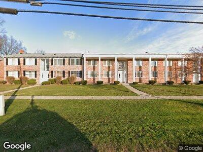
29252 Hoover Rd Unit 182 Warren, MI 48093
Northeast Warren NeighborhoodEstimated Value: $78,000 - $103,000
--
Bed
1
Bath
767
Sq Ft
$113/Sq Ft
Est. Value
About This Home
This home is located at 29252 Hoover Rd Unit 182, Warren, MI 48093 and is currently estimated at $86,909, approximately $113 per square foot. 29252 Hoover Rd Unit 182 is a home located in Macomb County with nearby schools including Warren Woods Tower High School, Michigan Mathematics and Science Academy, and Frontier International Academy Elementary.
Ownership History
Date
Name
Owned For
Owner Type
Purchase Details
Closed on
Jul 14, 2004
Sold by
Weed Joseph G
Bought by
Landon Sherry L
Current Estimated Value
Home Financials for this Owner
Home Financials are based on the most recent Mortgage that was taken out on this home.
Original Mortgage
$10,200
Outstanding Balance
$5,610
Interest Rate
6.4%
Mortgage Type
Credit Line Revolving
Purchase Details
Closed on
Jul 28, 1997
Sold by
Farrell P
Bought by
Weed J
Create a Home Valuation Report for This Property
The Home Valuation Report is an in-depth analysis detailing your home's value as well as a comparison with similar homes in the area
Home Values in the Area
Average Home Value in this Area
Purchase History
| Date | Buyer | Sale Price | Title Company |
|---|---|---|---|
| Landon Sherry L | $67,900 | Metropolitan Title Company | |
| Weed J | $41,600 | -- |
Source: Public Records
Mortgage History
| Date | Status | Borrower | Loan Amount |
|---|---|---|---|
| Open | Landon Sherry L | $10,200 | |
| Open | Landon Sherry L | $54,300 |
Source: Public Records
Tax History Compared to Growth
Tax History
| Year | Tax Paid | Tax Assessment Tax Assessment Total Assessment is a certain percentage of the fair market value that is determined by local assessors to be the total taxable value of land and additions on the property. | Land | Improvement |
|---|---|---|---|---|
| 2024 | $950 | $32,410 | $0 | $0 |
| 2023 | $900 | $32,090 | $0 | $0 |
| 2022 | $853 | $25,010 | $0 | $0 |
| 2021 | $844 | $23,490 | $0 | $0 |
| 2020 | $817 | $21,200 | $0 | $0 |
| 2019 | $790 | $18,010 | $0 | $0 |
| 2018 | $0 | $13,210 | $0 | $0 |
| 2017 | $758 | $13,140 | $2,450 | $10,690 |
| 2016 | $754 | $13,140 | $0 | $0 |
| 2015 | -- | $12,520 | $0 | $0 |
| 2013 | $2,203 | $10,600 | $0 | $0 |
Source: Public Records
Map
Nearby Homes
- 29364 Hoover Rd
- 11916 Geoffry Dr
- 29329 Bonnie Dr
- 29103 Wagner Dr
- 11473 Edgeton Dr
- 29027 Gilbert Dr
- 11203 Birchcrest Dr
- 28677 Gilbert Dr
- 29540 Pinto Dr
- 28646 Aline Dr
- 11116 Racine Rd
- 11161 Meadowbrook Dr
- 30141 Wagner Dr
- 28961 Palomino Dr
- 29444 Geraldine Dr
- 28679 Palm Beach Dr
- 29829 Newport Dr
- 28443 Campbell Dr
- 28733 Newport Dr
- 28463 Palm Beach Dr
- 29258 Hoover Rd Unit 183
- 29260 Hoover Rd
- 29258 Hoover Rd
- 29252 Hoover Rd Unit 182
- 29250 Hoover Rd
- 29244 Hoover Rd
- 29242 Hoover Rd
- 29234 Hoover Rd
- 29230 Hoover Rd Unit 176
- 29232 Hoover Rd Unit 175
- 29238 Hoover Rd Unit 174
- 29240 Hoover Rd
- 29246 Hoover Rd Unit 172
- 29248 Hoover Rd Unit 171
- 29254 Hoover Rd
- 29256 Hoover Rd
- 29260 Hoover Rd Unit 260
- 29236 Hoover Rd Unit 178, Building 0
- 29252 Hoover #182
- 29268 Hoover Rd Unit N 167