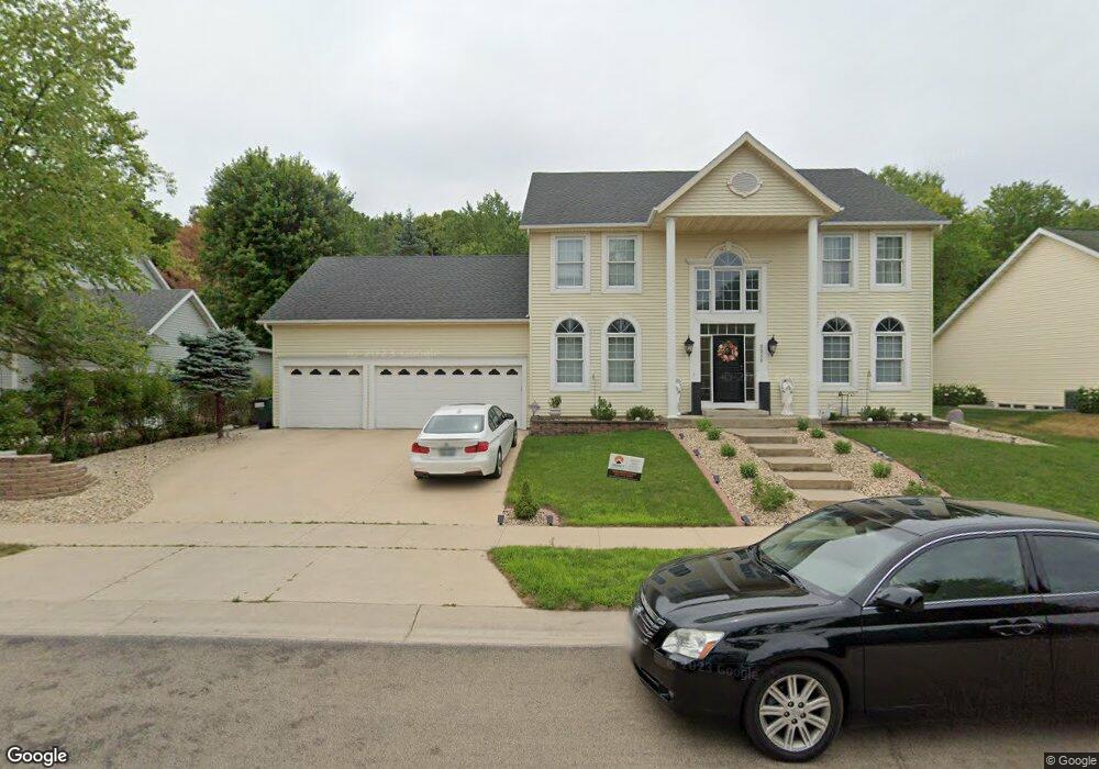
2926 Mayowood Common Cir SW Rochester, MN 55902
Estimated Value: $552,000 - $629,000
3
Beds
3
Baths
4,098
Sq Ft
$145/Sq Ft
Est. Value
About This Home
This home is located at 2926 Mayowood Common Cir SW, Rochester, MN 55902 and is currently estimated at $594,407, approximately $145 per square foot. 2926 Mayowood Common Cir SW is a home located in Olmsted County with nearby schools including Bamber Valley Elementary School, John Adams Middle School, and Mayo Senior High School.
Ownership History
Date
Name
Owned For
Owner Type
Purchase Details
Closed on
Aug 22, 2018
Sold by
Harris Marni L and Harris Robert A
Bought by
Huynh Trinh Thao
Current Estimated Value
Home Financials for this Owner
Home Financials are based on the most recent Mortgage that was taken out on this home.
Original Mortgage
$203,500
Outstanding Balance
$176,732
Interest Rate
4.5%
Mortgage Type
New Conventional
Estimated Equity
$417,676
Purchase Details
Closed on
May 25, 2006
Sold by
Husser Casey S and Husser Tina M
Bought by
Harris Robert A and Harris Marni L
Home Financials for this Owner
Home Financials are based on the most recent Mortgage that was taken out on this home.
Original Mortgage
$288,000
Interest Rate
6.12%
Mortgage Type
Adjustable Rate Mortgage/ARM
Create a Home Valuation Report for This Property
The Home Valuation Report is an in-depth analysis detailing your home's value as well as a comparison with similar homes in the area
Home Values in the Area
Average Home Value in this Area
Purchase History
| Date | Buyer | Sale Price | Title Company |
|---|---|---|---|
| Huynh Trinh Thao | $370,000 | Rochester Title | |
| Harris Robert A | $360,000 | Rochester Title |
Source: Public Records
Mortgage History
| Date | Status | Borrower | Loan Amount |
|---|---|---|---|
| Open | Huynh Trinh Thao | $203,500 | |
| Previous Owner | Harris Robert A | $288,000 |
Source: Public Records
Tax History Compared to Growth
Tax History
| Year | Tax Paid | Tax Assessment Tax Assessment Total Assessment is a certain percentage of the fair market value that is determined by local assessors to be the total taxable value of land and additions on the property. | Land | Improvement |
|---|---|---|---|---|
| 2024 | $7,248 | $511,900 | $60,000 | $451,900 |
| 2023 | $6,264 | $497,400 | $50,000 | $447,400 |
| 2022 | $5,610 | $454,100 | $50,000 | $404,100 |
| 2021 | $5,324 | $408,200 | $50,000 | $358,200 |
| 2020 | $5,422 | $388,400 | $35,000 | $353,400 |
| 2019 | $5,492 | $377,600 | $35,000 | $342,600 |
| 2018 | $5,264 | $386,500 | $36,000 | $350,500 |
| 2017 | $5,200 | $373,500 | $36,000 | $337,500 |
| 2016 | $4,694 | $355,700 | $35,500 | $320,200 |
| 2015 | $4,334 | $313,500 | $35,100 | $278,400 |
| 2014 | $4,266 | $307,800 | $35,000 | $272,800 |
| 2012 | -- | $309,200 | $35,026 | $274,174 |
Source: Public Records
Map
Nearby Homes
- 2944 Mayowood Common Cir SW
- 3018 Mayowood Common Cir SW
- 1650 Mayowood Ct SW
- 1658 Mayowood Ct SW
- 1702 Mayowood Ct SW
- 1710 Mayowood Ct SW
- 1726 Mayowood Rd SW
- 1739 Mayowood Ct SW
- 1750 Mayowood Rd SW
- 1975 Waterford Place SW
- 1758 Mayowood Rd SW
- 1987 Waterford Place SW
- 1787 Mayowood Rd SW
- 1782 Mayowood Ct SW
- 1851 Mayowood Ct SW
- 1835 Mayowood Rd SW
- 2630 Wild Rose Ln SW
- 1798 Mayowood Rd SW
- 1806 Mayowood Rd SW
- 1822 Mayowood Rd SW
- 2932 Mayowood Common Cir SW
- 2920 Mayowood Common Cir SW
- 2938 Mayowood Common Cir SW
- 2914 Mayowood Common Cir SW
- 2908 Mayowood Common Cir SW
- 2950 Mayowood Common Cir SW
- 2828 Mayowood Common St SW
- 3000 Mayowood Common Cir SW
- 3004 Mayowood Hills Dr SW
- 2829 Mayowood Common St SW
- 2121 Alice Ln SW
- 2933 Mayowood Common Cir SW
- 2939 Mayowood Common Cir SW
- 2927 Mayowood Common Cir SW
- 2113 Alice Ln SW
- 2915 Mayowood Common Cir SW
- 2945 Mayowood Common Cir SW
- 2818 Mayowood Common St SW
- 3006 Mayowood Common Cir SW
- 2921 Mayowood Common Cir SW