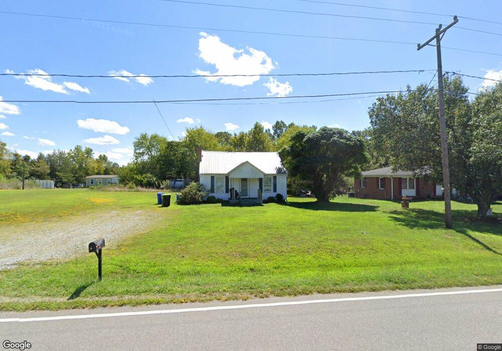
2926 Upper Lake Rd Thomasville, NC 27360
Estimated Value: $134,000 - $150,072
2
Beds
1
Bath
1,188
Sq Ft
$119/Sq Ft
Est. Value
About This Home
This home is located at 2926 Upper Lake Rd, Thomasville, NC 27360 and is currently estimated at $141,268, approximately $118 per square foot. 2926 Upper Lake Rd is a home located in Davidson County with nearby schools including Pilot Elementary School, E. Lawson Brown Middle School, and East Davidson High School.
Ownership History
Date
Name
Owned For
Owner Type
Purchase Details
Closed on
Oct 6, 2025
Sold by
Lowe Billy R and Lowe Donna Renee
Bought by
Edwards Ralph Thomas and Edwards Ann Elmore
Current Estimated Value
Home Financials for this Owner
Home Financials are based on the most recent Mortgage that was taken out on this home.
Original Mortgage
$15,000
Outstanding Balance
$15,000
Interest Rate
6.58%
Mortgage Type
Seller Take Back
Estimated Equity
$126,268
Purchase Details
Closed on
Sep 8, 2025
Sold by
Lowe Leslie N and Faw Timothy
Bought by
Lowe Billy R and Lowe Donna Renee
Home Financials for this Owner
Home Financials are based on the most recent Mortgage that was taken out on this home.
Original Mortgage
$15,000
Outstanding Balance
$15,000
Interest Rate
6.58%
Mortgage Type
Seller Take Back
Estimated Equity
$126,268
Purchase Details
Closed on
Nov 23, 2011
Sold by
Lowe Billy R and Lowe Donna Renee
Bought by
Lowe Leslie N and Lowe Taylor R
Purchase Details
Closed on
Jun 4, 2004
Sold by
Curry Bower M and Curry Faye M
Bought by
Lowe Billy R
Purchase Details
Closed on
Nov 19, 2002
Sold by
Curry Bower M and Curry Faye M
Bought by
Curry Bower M and Curry Faye M
Purchase Details
Closed on
Dec 22, 2000
Bought by
Curry Bower
Purchase Details
Closed on
Jul 1, 1996
Purchase Details
Closed on
Feb 1, 1992
Create a Home Valuation Report for This Property
The Home Valuation Report is an in-depth analysis detailing your home's value as well as a comparison with similar homes in the area
Home Values in the Area
Average Home Value in this Area
Purchase History
| Date | Buyer | Sale Price | Title Company |
|---|---|---|---|
| Edwards Ralph Thomas | $135,000 | None Listed On Document | |
| Lowe Billy R | -- | None Listed On Document | |
| Lowe Billy R | -- | None Listed On Document | |
| Lowe Leslie N | -- | Chicago Title Insurance Co | |
| Lowe Billy R | $12,000 | -- | |
| Curry Bower M | -- | -- | |
| Curry Bower | -- | -- | |
| -- | -- | -- | |
| -- | $13,000 | -- |
Source: Public Records
Mortgage History
| Date | Status | Borrower | Loan Amount |
|---|---|---|---|
| Open | Edwards Ralph Thomas | $15,000 |
Source: Public Records
Tax History
| Year | Tax Paid | Tax Assessment Tax Assessment Total Assessment is a certain percentage of the fair market value that is determined by local assessors to be the total taxable value of land and additions on the property. | Land | Improvement |
|---|---|---|---|---|
| 2025 | $440 | $69,300 | $0 | $0 |
| 2024 | $426 | $67,080 | $0 | $0 |
| 2023 | $413 | $67,080 | $0 | $0 |
| 2022 | $413 | $67,080 | $0 | $0 |
| 2021 | $413 | $67,080 | $0 | $0 |
| 2020 | $369 | $59,910 | $0 | $0 |
| 2019 | $374 | $59,910 | $0 | $0 |
| 2018 | $374 | $59,910 | $0 | $0 |
| 2017 | $374 | $59,910 | $0 | $0 |
| 2016 | $374 | $59,910 | $0 | $0 |
| 2015 | $374 | $59,910 | $0 | $0 |
| 2014 | $284 | $45,370 | $0 | $0 |
Source: Public Records
Map
Nearby Homes
- 3622 Lower Lake Rd
- 189 Panther Ln
- 189 Panther Ln Unit 94-97
- 827 Shell Rd
- 0 Hillcrest Dr Unit 90 CAR4240649
- 1125 Hillcrest Dr
- 170 Garrett Ln
- 328 Conrad Cir
- 596 Colleen Dr
- 186 Holland Ln
- 164 Holland Ln
- 6919 E Holly Grove Rd
- 205 Bethlehem Ave
- 104 Black Ave
- 380 Cedarland Dr
- 113 Circle Dr
- 115 Circle Dr
- 311 Pebble Dr
- 125 Linden Dr
- 122 Linden Dr
- 2906 Upper Lake Rd
- 2954 Upper Lake Rd
- 2917 Upper Lake Rd
- 2957 Upper Lake Rd
- 2802 Upper Lake Rd
- 2877 Upper Lake Rd
- 2998 Upper Lake Rd
- 2841 Upper Lake Rd
- 3040 Upper Lake Rd
- 147 Wayside Dr
- 251 E Thomas Dr
- 161 Wayside Dr
- 3041 Upper Lake Rd
- 3072 Upper Lake Rd
- 235 E Thomas Dr
- 175 Wayside Dr
- 209 E Thomas Dr
- 191 Wayside Dr
- 172 Wayside Dr
- 191 E Thomas Dr
Your Personal Tour Guide
Ask me questions while you tour the home.