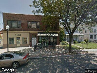
2929 Fairfield Ave Bridge Port, CT 06605
Black Rock NeighborhoodEstimated Value: $1,141,048
--
Bed
--
Bath
11,024
Sq Ft
$104/Sq Ft
Est. Value
About This Home
This home is located at 2929 Fairfield Ave, Bridge Port, CT 06605 and is currently estimated at $1,141,048, approximately $103 per square foot. 2929 Fairfield Ave is a home located in Fairfield County with nearby schools including Black Rock School, Bassick High School, and Great Oaks Charter School Bridgeport.
Ownership History
Date
Name
Owned For
Owner Type
Purchase Details
Closed on
Oct 1, 2014
Sold by
Fairfield Jetland Llc
Bought by
Fairfield Jetland Llc
Current Estimated Value
Purchase Details
Closed on
Nov 2, 2006
Sold by
Horvath Katarin
Bought by
Fairfield Jetland Llc
Home Financials for this Owner
Home Financials are based on the most recent Mortgage that was taken out on this home.
Original Mortgage
$680,000
Interest Rate
6.47%
Mortgage Type
Commercial
Create a Home Valuation Report for This Property
The Home Valuation Report is an in-depth analysis detailing your home's value as well as a comparison with similar homes in the area
Home Values in the Area
Average Home Value in this Area
Purchase History
| Date | Buyer | Sale Price | Title Company |
|---|---|---|---|
| Fairfield Jetland Llc | -- | -- | |
| Fairfield Jetland Llc | -- | -- | |
| Fairfield Jetland Llc | $850,000 | -- | |
| Fairfield Jetland Llc | $850,000 | -- |
Source: Public Records
Mortgage History
| Date | Status | Borrower | Loan Amount |
|---|---|---|---|
| Previous Owner | Fairfield Jetland Llc | $680,000 |
Source: Public Records
Tax History Compared to Growth
Tax History
| Year | Tax Paid | Tax Assessment Tax Assessment Total Assessment is a certain percentage of the fair market value that is determined by local assessors to be the total taxable value of land and additions on the property. | Land | Improvement |
|---|---|---|---|---|
| 2024 | $27,779 | $639,330 | $248,710 | $390,620 |
| 2023 | $27,779 | $639,330 | $248,710 | $390,620 |
| 2022 | $27,779 | $639,330 | $248,710 | $390,620 |
| 2021 | $27,779 | $639,330 | $248,710 | $390,620 |
| 2020 | $32,010 | $592,890 | $152,870 | $440,020 |
| 2019 | $32,010 | $592,890 | $152,870 | $440,020 |
| 2018 | $32,235 | $592,890 | $152,870 | $440,020 |
| 2017 | $32,235 | $592,890 | $152,870 | $440,020 |
| 2016 | $31,131 | $572,580 | $152,870 | $419,710 |
| 2015 | $27,600 | $654,020 | $163,050 | $490,970 |
| 2014 | $21,417 | $507,500 | $124,370 | $383,130 |
Source: Public Records
Map
Nearby Homes
- 2937 Fairfield Ave Unit 2939
- 525 Midland St
- 409 Brewster St
- 2811 Fairfield Ave Unit 1
- 26 Rowsley St Unit 5
- 80 Fox St
- 61 Rowsley St Unit 2
- 106 Nash Ln Unit 108
- 356-358 Midland St
- 592 Courtland Ave Unit 594
- 362 Grovers Ave
- 525 Courtland Ave Unit 527
- 15 Ellsworth St Unit 22
- 271 Seaside Ave
- 344 Lake Ave
- 3250 Fairfield Ave Unit 302
- 3250 Fairfield Ave Unit 200
- 61 Anchorage Dr
- 167 Scofield Ave
- 245 Sailors Ln
- 2929 Fairfield Ave
- 2916 Fairfield Ave
- 39 Jetland Place Unit 41
- 41 Jetland Place Unit 2
- 41 Jetland Place Unit PLACE
- 41 Jetland Place
- 2949 Fairfield Ave
- 35 Jetland Place Unit 37
- 35-37 Jetland Place
- 35 Jetland Place Unit 2
- 35 Jetland Place Unit 3
- 37 Jetland Place Unit 3rd floor
- 2908 Fairfield Ave Unit 2FF
- 2908 Fairfield Ave Unit 3
- 58 School St
- 29 Jetland Place Unit 31
- 29 Jetland Place Unit 2
- 29 Jetland Place Unit 1
- 29-31 Jetland Place Unit 2
- 29-31 Jetland Place Unit 1 (29)