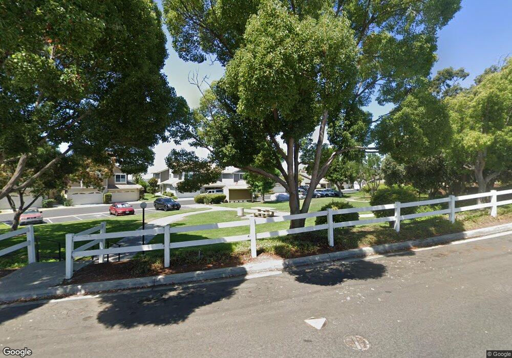
2929 Lancaster Rd Carlsbad, CA 92010
Calavera Hills NeighborhoodEstimated Value: $773,876 - $849,000
2
Beds
2
Baths
1,119
Sq Ft
$720/Sq Ft
Est. Value
About This Home
This home is located at 2929 Lancaster Rd, Carlsbad, CA 92010 and is currently estimated at $805,469, approximately $719 per square foot. 2929 Lancaster Rd is a home located in San Diego County with nearby schools including Hope Elementary School, Calavera Hills Middle, and Sage Creek High.
Ownership History
Date
Name
Owned For
Owner Type
Purchase Details
Closed on
Jan 13, 2025
Sold by
Buchanan Family Trust and Buchanan Richard M
Bought by
Buchanan Barbara
Current Estimated Value
Purchase Details
Closed on
Jan 13, 2016
Sold by
Buchanan Richard M and Buchanan Barbara S
Bought by
Buchanan Family Trust and Buchanan Barbara Sue
Purchase Details
Closed on
Jul 20, 2006
Sold by
Buchanan Richard M and Buchanan Barbara S
Bought by
Buchanan Richard M and Buchanan Barbara S
Home Financials for this Owner
Home Financials are based on the most recent Mortgage that was taken out on this home.
Original Mortgage
$18,000
Interest Rate
6.57%
Mortgage Type
Credit Line Revolving
Purchase Details
Closed on
Oct 29, 1984
Create a Home Valuation Report for This Property
The Home Valuation Report is an in-depth analysis detailing your home's value as well as a comparison with similar homes in the area
Home Values in the Area
Average Home Value in this Area
Purchase History
| Date | Buyer | Sale Price | Title Company |
|---|---|---|---|
| Buchanan Barbara | -- | None Listed On Document | |
| Buchanan Family Trust | -- | None Available | |
| Buchanan Richard M | -- | New Century Title Co | |
| -- | $98,900 | -- |
Source: Public Records
Mortgage History
| Date | Status | Borrower | Loan Amount |
|---|---|---|---|
| Previous Owner | Buchanan Richard M | $18,000 |
Source: Public Records
Tax History
| Year | Tax Paid | Tax Assessment Tax Assessment Total Assessment is a certain percentage of the fair market value that is determined by local assessors to be the total taxable value of land and additions on the property. | Land | Improvement |
|---|---|---|---|---|
| 2025 | $2,142 | $200,843 | $41,409 | $159,434 |
| 2024 | $2,142 | $196,906 | $40,598 | $156,308 |
| 2023 | $2,130 | $193,046 | $39,802 | $153,244 |
| 2022 | $2,097 | $189,262 | $39,022 | $150,240 |
| 2021 | $2,082 | $185,552 | $38,257 | $147,295 |
| 2020 | $2,068 | $183,650 | $37,865 | $145,785 |
| 2019 | $2,031 | $180,050 | $37,123 | $142,927 |
| 2018 | $1,947 | $176,521 | $36,396 | $140,125 |
| 2017 | $1,914 | $173,061 | $35,683 | $137,378 |
| 2016 | $1,837 | $169,669 | $34,984 | $134,685 |
| 2015 | $1,830 | $167,121 | $34,459 | $132,662 |
| 2014 | $1,800 | $163,848 | $33,784 | $130,064 |
Source: Public Records
Map
Nearby Homes
- 2972 Lancaster Rd
- 4682 Meadow Dr
- 2835 Hillsboro Ct
- 3441 Rich Field Dr
- 4375 Stanford St
- 2816 Fairfield Ave
- 2808 Winthrop Ave
- 3609 Buck Ridge Ave
- 2755 Victoria Ave
- 3593 Granite Ct
- 3595 Glen Ave
- 2736 Victoria Ave
- 2543 Glasgow Dr
- 4459 Dorchester Place
- 4829 Portola Ct
- 4825 Portola Ct
- 3485 Corvallis St
- 3918 Rill Ct
- 2591 Regent Rd Unit 52
- 4439 Salisbury Dr
- 2931 Lancaster Rd
- 2925 Lancaster Rd
- 2933 Lancaster Rd
- 2935 Lancaster Rd
- 2923 Lancaster Rd
- 2921 Lancaster Rd
- 2939 Lancaster Rd
- 2932 Lancaster Rd
- 2919 Lancaster Rd
- 2941 Lancaster Rd
- 2930 Lancaster Rd
- 2928 Lancaster Rd
- 2943 Lancaster Rd
- 2915 Lancaster Rd Unit 2
- 2926 Lancaster Rd
- 2942 Lancaster Rd
- 2913 Lancaster Rd
- 2945 Lancaster Rd
- 2922 Lancaster Rd
- 2920 Lancaster Rd
