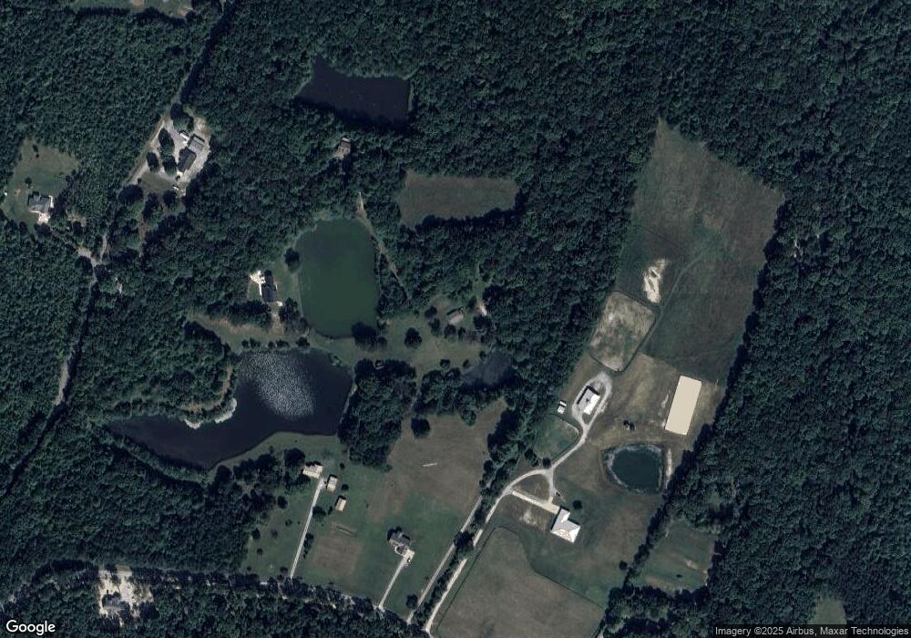
2929 Mowbray Pike Soddy Daisy, TN 37379
Estimated Value: $319,507 - $848,000
--
Bed
--
Bath
2,084
Sq Ft
$279/Sq Ft
Est. Value
About This Home
This home is located at 2929 Mowbray Pike, Soddy Daisy, TN 37379 and is currently estimated at $581,169, approximately $278 per square foot. 2929 Mowbray Pike is a home located in Hamilton County.
Ownership History
Date
Name
Owned For
Owner Type
Purchase Details
Closed on
Aug 4, 2020
Sold by
Ezell Linda F and Ezell Billy J
Bought by
Ezell Linda F and Lewis Philip A
Current Estimated Value
Purchase Details
Closed on
May 13, 2014
Sold by
Ezell Linda F and Burt Daniel L
Bought by
Ezell Linda F
Purchase Details
Closed on
Mar 7, 2007
Sold by
Milligan Reynolds Guaranty Title Agency
Bought by
Ezell Billy J and Ezell Linda F
Purchase Details
Closed on
Mar 6, 2007
Sold by
Ezell Billy J and Ezell Linda F
Bought by
Milligan Reynolds Guaranty Title Agency
Create a Home Valuation Report for This Property
The Home Valuation Report is an in-depth analysis detailing your home's value as well as a comparison with similar homes in the area
Home Values in the Area
Average Home Value in this Area
Purchase History
| Date | Buyer | Sale Price | Title Company |
|---|---|---|---|
| Ezell Linda F | -- | Title Services Of Tn Inc | |
| Ezell Linda F | -- | None Available | |
| Ezell Billy J | -- | None Available | |
| Milligan Reynolds Guaranty Title Agency | -- | None Available |
Source: Public Records
Tax History Compared to Growth
Tax History
| Year | Tax Paid | Tax Assessment Tax Assessment Total Assessment is a certain percentage of the fair market value that is determined by local assessors to be the total taxable value of land and additions on the property. | Land | Improvement |
|---|---|---|---|---|
| 2024 | $1,047 | $46,800 | $0 | $0 |
| 2023 | $1,047 | $46,800 | $0 | $0 |
| 2022 | $1,047 | $46,800 | $0 | $0 |
| 2021 | $1,047 | $46,800 | $0 | $0 |
| 2020 | $1,058 | $38,250 | $0 | $0 |
| 2019 | $1,058 | $38,250 | $0 | $0 |
| 2018 | $1,058 | $38,250 | $0 | $0 |
| 2017 | $1,058 | $38,250 | $0 | $0 |
| 2016 | $1,001 | $0 | $0 | $0 |
| 2015 | $1,001 | $36,200 | $0 | $0 |
| 2014 | $1,001 | $0 | $0 | $0 |
Source: Public Records
Map
Nearby Homes
- 2907 Mowbray Pike
- 3069 Poe Rd
- 3057 Poe Rd
- 2996 Mowbray Pike
- 3087 Poe Rd
- 2740 Mowbray Pike
- 3086 Poe Rd
- 100 Henson Gap Rd
- 112 Henson Gap Rd
- 2664 Mowbray Pike
- 2796 Mowbray Pike
- 2772 Mowbray Pike
- 3075 Poe Rd
- 10600 Skyridge Trail
- Highway 111
- 9844 Granny Walker Cemetery Rd
- 9963 Huckleberry Ln
- 00 Worley Rd
- 00000 Worley Rd
- 406 Green Brier Ln
- 9864 Evans Rd
- 9876 Evans Rd
- 3007 Mowbray Pike
- 2981 Mowbray Pike
- 555 Evans Rd
- 2906 Poe Rd
- 141 Evans Rd
- 3103 Poe Rd
- 97 Evans Rd
- 2809 Mowbray Pike
- 2940 Poe Rd
- 2940 Poe Rd Unit Lot 3
- 2940 Poe Rd Unit Lot 2
- 2940 Poe Rd Unit Lot 1
- 37 Evans Rd
- 3022 Mowbray Pike
- 2804 Poe Rd
- 2723 Mowbray Pike
- 2718 Mowbray Pike
- 62 Henson Gap Rd
