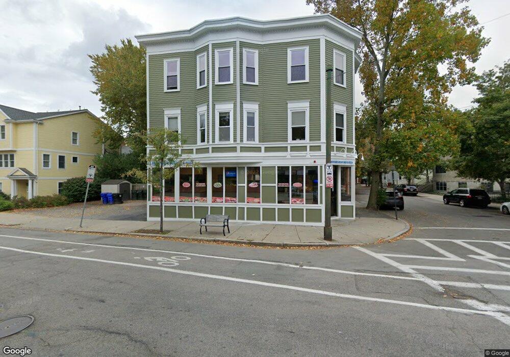
293 Cypress St Brookline, MA 02445
Brookline Village Neighborhood
6
Beds
3
Baths
4,000
Sq Ft
3,485
Sq Ft Lot
About This Home
This home is located at 293 Cypress St, Brookline, MA 02445. 293 Cypress St is a home located in Norfolk County with nearby schools including William H. Lincoln School and Maimonides School.
Ownership History
Date
Name
Owned For
Owner Type
Purchase Details
Closed on
Feb 28, 2022
Sold by
293-301 Cypress St Rt
Bought by
293 Cypress Street Rt
Purchase Details
Closed on
May 19, 2015
Sold by
Stameris John
Bought by
293-301 Cypress St Rt and Stameris Michael A
Purchase Details
Closed on
Apr 30, 2013
Sold by
293 Cypress St Nt and Stameris Michael
Bought by
Stameris John
Create a Home Valuation Report for This Property
The Home Valuation Report is an in-depth analysis detailing your home's value as well as a comparison with similar homes in the area
Home Values in the Area
Average Home Value in this Area
Purchase History
| Date | Buyer | Sale Price | Title Company |
|---|---|---|---|
| 293 Cypress Street Rt | -- | None Available | |
| 293-301 Cypress St Rt | -- | -- | |
| Stameris John | -- | -- |
Source: Public Records
Tax History Compared to Growth
Tax History
| Year | Tax Paid | Tax Assessment Tax Assessment Total Assessment is a certain percentage of the fair market value that is determined by local assessors to be the total taxable value of land and additions on the property. | Land | Improvement |
|---|---|---|---|---|
| 2025 | -- | $1,946,500 | $1,056,000 | $890,500 |
| 2024 | -- | $1,850,400 | $1,056,000 | $794,400 |
| 2023 | $0 | $1,665,200 | $1,408,000 | $257,200 |
| 2022 | $0 | $1,587,900 | $1,408,000 | $179,900 |
| 2021 | $0 | $1,654,300 | $1,408,000 | $246,300 |
| 2020 | $0 | $1,617,700 | $1,408,000 | $209,700 |
| 2019 | $0 | $1,524,700 | $1,345,900 | $178,800 |
| 2018 | $0 | $1,431,700 | $1,035,300 | $396,400 |
| 2017 | $0 | $1,298,900 | $1,035,300 | $263,600 |
| 2016 | -- | $1,268,700 | $911,000 | $357,700 |
| 2015 | -- | $1,117,900 | $828,200 | $289,700 |
| 2014 | -- | $952,700 | $567,300 | $385,400 |
Source: Public Records
Map
Nearby Homes
- 105 Franklin St Unit 1
- 20 Rice St Unit 2
- 18 Chestnut Place
- 241 Perkins St Unit C306
- 241 Perkins St Unit C402
- 241 Perkins St Unit D405
- 81 Glen Rd Unit S2
- 60 Glen Rd Unit 101
- 21 Sargent Crossway
- 18 Cushing Rd
- 111 Perkins St Unit 108
- 111 Perkins St Unit 282
- 111 Perkins St Unit 121
- 111 Perkins St Unit 152
- 36 Allerton St
- 371 Walnut St
- 99 Pond Ave Unit 608
- 332 Jamaicaway Unit 406
- 77 Pond Ave Unit 1103
- 65-67 Halifax St
- 96 Franklin St
- 96 Franklin St Unit 2
- 96 Franklin St Unit 3
- 100 Franklin St Unit 3
- 100 Franklin St
- 100 Franklin St Unit 2
- 299 Cypress St Unit 303
- 102 Franklin St
- 102 Franklin St Unit 2
- 102 Franklin St Unit 1
- 301 Cypress St
- 303 Cypress St Unit Street
- 303 Cypress St
- 104 Franklin St
- 20 Henry St Unit 22
- 20 Henry St Unit 1
- 106 Franklin St Unit 3
- 106 Franklin St Unit 2
- 106 Franklin St Unit 1
- 101 Franklin St Unit 3