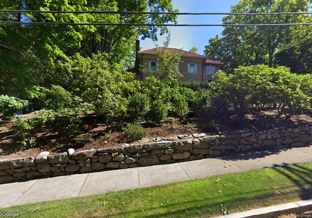
293 Fuller St West Newton, MA 02465
West Newton NeighborhoodEstimated Value: $5,104,000 - $6,186,000
5
Beds
6
Baths
6,123
Sq Ft
$922/Sq Ft
Est. Value
About This Home
This home is located at 293 Fuller St, West Newton, MA 02465 and is currently estimated at $5,642,689, approximately $921 per square foot. 293 Fuller St is a home located in Middlesex County with nearby schools including Peirce Elementary School, F.A. Day Middle School, and Newton North High School.
Ownership History
Date
Name
Owned For
Owner Type
Purchase Details
Closed on
Nov 16, 1994
Sold by
Ferlauto Dominic A and Ferlauto Diane
Bought by
Cantor Stefanie D and Cable Stuart M
Current Estimated Value
Home Financials for this Owner
Home Financials are based on the most recent Mortgage that was taken out on this home.
Original Mortgage
$900,000
Interest Rate
8.9%
Mortgage Type
Purchase Money Mortgage
Purchase Details
Closed on
Nov 6, 1991
Sold by
Rosenberg Jason and Rosenberg Naomi
Bought by
Ferlauto Dominic A and Ferlauto Diane
Home Financials for this Owner
Home Financials are based on the most recent Mortgage that was taken out on this home.
Original Mortgage
$500,000
Interest Rate
8.85%
Mortgage Type
Purchase Money Mortgage
Create a Home Valuation Report for This Property
The Home Valuation Report is an in-depth analysis detailing your home's value as well as a comparison with similar homes in the area
Home Values in the Area
Average Home Value in this Area
Purchase History
| Date | Buyer | Sale Price | Title Company |
|---|---|---|---|
| Cantor Stefanie D | $1,200,000 | -- | |
| Ferlauto Dominic A | $918,500 | -- |
Source: Public Records
Mortgage History
| Date | Status | Borrower | Loan Amount |
|---|---|---|---|
| Closed | Ferlauto Dominic A | $900,000 | |
| Previous Owner | Ferlauto Dominic A | $500,000 |
Source: Public Records
Tax History Compared to Growth
Tax History
| Year | Tax Paid | Tax Assessment Tax Assessment Total Assessment is a certain percentage of the fair market value that is determined by local assessors to be the total taxable value of land and additions on the property. | Land | Improvement |
|---|---|---|---|---|
| 2025 | $52,994 | $5,407,500 | $2,548,900 | $2,858,600 |
| 2024 | $51,240 | $5,250,000 | $2,474,700 | $2,775,300 |
| 2023 | $49,680 | $4,880,200 | $2,059,000 | $2,821,200 |
| 2022 | $47,537 | $4,518,700 | $1,906,500 | $2,612,200 |
| 2021 | $45,869 | $4,262,900 | $1,798,600 | $2,464,300 |
| 2020 | $44,505 | $4,262,900 | $1,798,600 | $2,464,300 |
| 2019 | $43,249 | $4,138,700 | $1,746,200 | $2,392,500 |
| 2018 | $41,706 | $3,854,500 | $1,511,200 | $2,343,300 |
| 2017 | $40,436 | $3,636,300 | $1,425,700 | $2,210,600 |
| 2016 | $38,674 | $3,398,400 | $1,332,400 | $2,066,000 |
| 2015 | $36,875 | $3,176,100 | $1,245,200 | $1,930,900 |
Source: Public Records
Map
Nearby Homes
- 10 Ruane Rd
- 40 Sewall St
- 1754 Washington St
- 1639 Washington St
- 18 Sewall St
- 222 Prince St
- 283 Woodland Rd
- 17 Gilbert St
- 51 Bourne St
- 39 Valentine Park
- 1488 Washington St Unit 1488
- 0 Duncan Rd Unit 72925240
- 115 Windsor Rd
- 513 Chestnut St
- 157 Stanton Ave
- 12 Inis Cir
- 308 Prince St
- 36 Troy Ln
- 13 Weir St
- 79 Chestnut St Unit 2
- 305 Fuller St
- 279 Fuller St
- 1592 Commonwealth Ave
- 1580 Commonwealth Ave
- 5 Pickwick Rd
- 1600 Commonwealth Ave
- 6 Pickwick Rd
- 1572 Commonwealth Ave
- 8 Pickwick Rd
- 1564 Commonwealth Ave
- 21 Pickwick Rd
- 16 Pickwick Rd
- 110 Pickwick Rd
- 255 Fuller St
- 1548 Commonwealth Ave
- 111 Exeter St
- 1585 Commonwealth Ave
- 1595 Commonwealth Ave
- 100 Pickwick Rd
- 24 Pickwick Rd