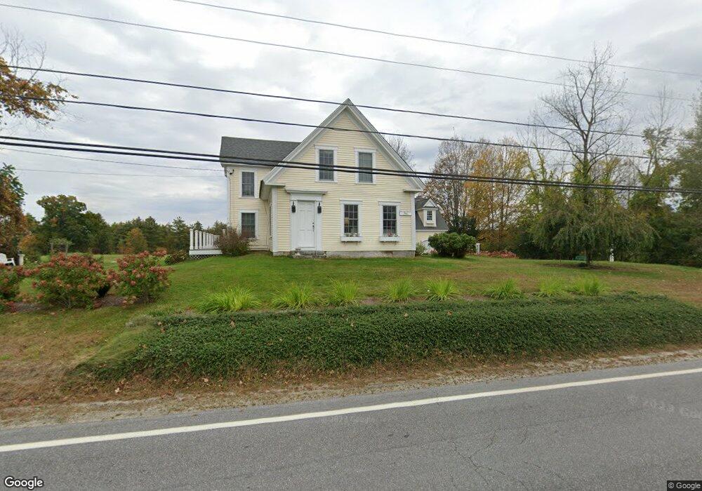
293 Stark Hwy N Dunbarton, NH 03046
Estimated Value: $505,459 - $668,000
3
Beds
2
Baths
3,419
Sq Ft
$170/Sq Ft
Est. Value
About This Home
This home is located at 293 Stark Hwy N, Dunbarton, NH 03046 and is currently estimated at $582,115, approximately $170 per square foot. 293 Stark Hwy N is a home located in Merrimack County with nearby schools including Dunbarton Elementary School, Bow Memorial School, and Bow High School.
Ownership History
Date
Name
Owned For
Owner Type
Purchase Details
Closed on
Jun 30, 1999
Sold by
Mcmillan Scott E
Bought by
Eastman Eric J and Eastman Abigael D
Current Estimated Value
Home Financials for this Owner
Home Financials are based on the most recent Mortgage that was taken out on this home.
Original Mortgage
$103,500
Interest Rate
7.19%
Mortgage Type
Purchase Money Mortgage
Create a Home Valuation Report for This Property
The Home Valuation Report is an in-depth analysis detailing your home's value as well as a comparison with similar homes in the area
Home Values in the Area
Average Home Value in this Area
Purchase History
| Date | Buyer | Sale Price | Title Company |
|---|---|---|---|
| Eastman Eric J | $109,000 | -- |
Source: Public Records
Mortgage History
| Date | Status | Borrower | Loan Amount |
|---|---|---|---|
| Previous Owner | Eastman Eric J | $229,364 | |
| Previous Owner | Eastman Eric J | $103,500 |
Source: Public Records
Tax History Compared to Growth
Tax History
| Year | Tax Paid | Tax Assessment Tax Assessment Total Assessment is a certain percentage of the fair market value that is determined by local assessors to be the total taxable value of land and additions on the property. | Land | Improvement |
|---|---|---|---|---|
| 2024 | $8,270 | $313,500 | $52,800 | $260,700 |
| 2023 | $8,016 | $313,500 | $52,800 | $260,700 |
| 2022 | $7,009 | $305,000 | $52,800 | $252,200 |
| 2021 | $7,140 | $305,000 | $52,800 | $252,200 |
| 2020 | $6,795 | $305,000 | $52,800 | $252,200 |
| 2018 | $5,139 | $228,100 | $41,900 | $186,200 |
| 2017 | $5,842 | $228,100 | $41,900 | $186,200 |
| 2016 | $5,470 | $228,100 | $41,900 | $186,200 |
| 2015 | $5,381 | $228,100 | $41,900 | $186,200 |
| 2014 | $5,171 | $244,600 | $46,500 | $198,100 |
| 2013 | $5,139 | $244,600 | $46,500 | $198,100 |
Source: Public Records
Map
Nearby Homes
- I3-03-05 Clinton St
- 250 Grapevine Rd
- 40 N Woods Rd
- 490 Page Rd
- 167 Branch Londonderry Turnpike
- 8 Longview Dr
- 5 Longview Dr
- 256-0-17 Jewett Rd
- 0 Farrington Corner Rd Unit 14
- 70 Gile Hill Rd
- 27 Brushwood Dr
- 57 Lyndsey Ln
- 1003 School St
- 15 Robert Rogers Rd
- 0 Brown Hill Rd Unit 5032600
- 0 Als Dr Unit 196
- 43 Sterling Place
- 1 Hop Kiln Rd
- 541 South Rd
- 464 Irish Hill Rd
- 291 Stark Hwy N
- 291A Stark Hwy N
- 294 Stark Hwy N
- 261 Stark Hwy N
- 300 Stark Hwy N
- 301 Stark Hwy N
- 285 Stark Hwy N
- 282 Stark Hwy N
- 310 Stark Hwy N
- 281 Stark Hwy N
- 275 Stark Hwy N
- 311 Stark Hwy N
- 273 Stark Hwy N
- 315 Stark Hwy N
- 324 Stark Highway Hwy N
- 312 Stark Hwy N
- 326 Stark Hwy N
- 260 Stark Hwy N
- 259 Stark Hwy N
- 328 Stark Hwy N