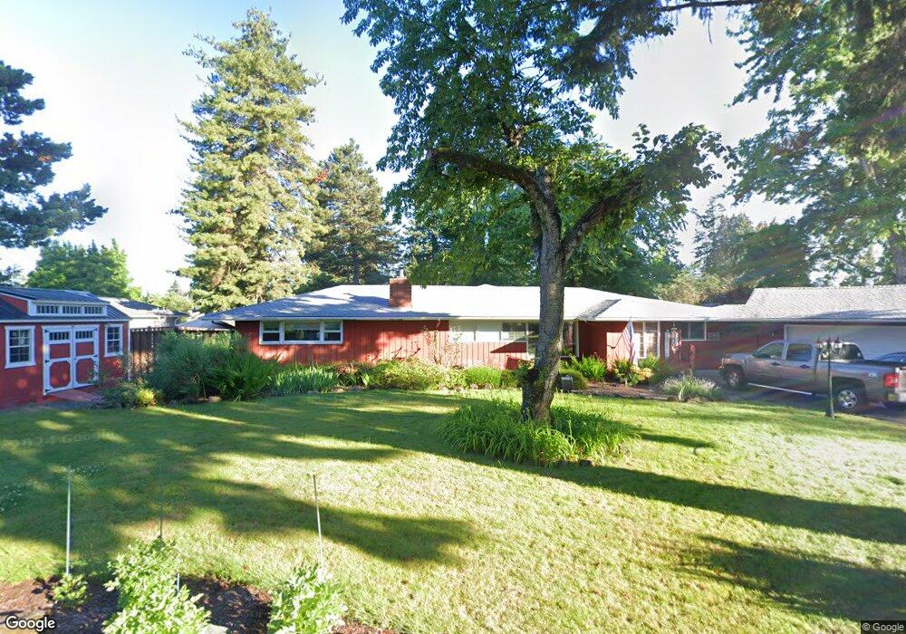
2930 Wayside Loop Springfield, OR 97477
North Springfield NeighborhoodEstimated Value: $430,000 - $472,000
3
Beds
2
Baths
1,593
Sq Ft
$285/Sq Ft
Est. Value
About This Home
This home is located at 2930 Wayside Loop, Springfield, OR 97477 and is currently estimated at $454,521, approximately $285 per square foot. 2930 Wayside Loop is a home located in Lane County with nearby schools including Guy Lee Elementary School, Hamlin Middle School, and Springfield High School.
Ownership History
Date
Name
Owned For
Owner Type
Purchase Details
Closed on
Feb 13, 2014
Sold by
Borchers Thomas R and Borchers Lorilee I
Bought by
Strubel Elizabeth A and Strubel Derek G
Current Estimated Value
Home Financials for this Owner
Home Financials are based on the most recent Mortgage that was taken out on this home.
Original Mortgage
$207,100
Outstanding Balance
$156,947
Interest Rate
4.49%
Mortgage Type
New Conventional
Estimated Equity
$297,574
Create a Home Valuation Report for This Property
The Home Valuation Report is an in-depth analysis detailing your home's value as well as a comparison with similar homes in the area
Home Values in the Area
Average Home Value in this Area
Purchase History
| Date | Buyer | Sale Price | Title Company |
|---|---|---|---|
| Strubel Elizabeth A | $218,000 | First American Title |
Source: Public Records
Mortgage History
| Date | Status | Borrower | Loan Amount |
|---|---|---|---|
| Open | Strubel Elizabeth A | $207,100 |
Source: Public Records
Tax History
| Year | Tax Paid | Tax Assessment Tax Assessment Total Assessment is a certain percentage of the fair market value that is determined by local assessors to be the total taxable value of land and additions on the property. | Land | Improvement |
|---|---|---|---|---|
| 2025 | $3,901 | $266,340 | -- | -- |
| 2024 | $3,795 | $258,583 | -- | -- |
| 2023 | $3,795 | $251,052 | $0 | $0 |
| 2022 | $3,608 | $243,740 | $0 | $0 |
| 2021 | $3,530 | $236,641 | $0 | $0 |
| 2020 | $3,317 | $222,336 | $0 | $0 |
| 2019 | $3,201 | $215,861 | $0 | $0 |
| 2018 | $3,079 | $203,470 | $0 | $0 |
| 2017 | $2,987 | $203,470 | $0 | $0 |
| 2016 | $2,920 | $197,544 | $0 | $0 |
| 2015 | $2,828 | $191,790 | $0 | $0 |
| 2014 | $2,713 | $186,204 | $0 | $0 |
Source: Public Records
Map
Nearby Homes
- 40 Allen Ave
- 472 Springdale Ave
- 212 Hayden Bridge Way
- 126 Woodlane Dr
- 590 Flamingo Ave
- 3198 Pheasant Blvd
- 3215 Pheasant Blvd
- 624 Tinamou Ln
- 3227 Partridge Way
- 421 Woodlane Dr
- 2150 Laura (#57) St Unit 57
- 2150 Laura St Unit 119
- 2150 Laura St Unit 111
- 2150 Laura St Unit 39
- 2150 Laura St Unit 57
- 2150 Laura St Unit 83
- 2150 Laura St Unit 44
- 520 Ethan Ct
- 2240 5th St
- 77 Shady Loop
- 2910 Wayside Loop
- 2980 Wayside Loop
- 2931 Wayside Loop
- 2890 Wayside Loop
- 2947 Wayside Loop
- 2963 Wayside Loop
- 65 Lorie Ct
- 2899 Wayside Loop
- 3024 Wayside Loop
- 3184 Wayside Loop
- 2999 Wayside Loop
- 2995 Wayside Loop
- 3076 Wayside Loop
- 3150 Wayside Loop
- 2885 Wayside Loop
- 55 Lorie Ct
- 3098 Wayside Loop
- 2936 Manor Dr
- 2918 Manor Dr
- 15 Lorie Ct
Your Personal Tour Guide
Ask me questions while you tour the home.