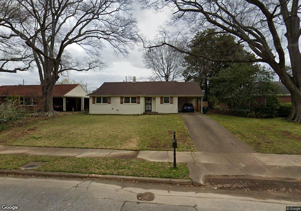
294 Mcelroy Rd Memphis, TN 38120
East Memphis NeighborhoodEstimated Value: $192,779 - $253,000
3
Beds
2
Baths
1,339
Sq Ft
$171/Sq Ft
Est. Value
About This Home
This home is located at 294 Mcelroy Rd, Memphis, TN 38120 and is currently estimated at $228,695, approximately $170 per square foot. 294 Mcelroy Rd is a home located in Shelby County with nearby schools including Richland Elementary School, White Station Middle, and White Station High.
Ownership History
Date
Name
Owned For
Owner Type
Purchase Details
Closed on
Aug 1, 2018
Sold by
Branch William K
Bought by
Branch David
Current Estimated Value
Purchase Details
Closed on
Apr 30, 1998
Sold by
Buchalter Beverly B
Bought by
Chandler Jason B
Home Financials for this Owner
Home Financials are based on the most recent Mortgage that was taken out on this home.
Original Mortgage
$90,000
Interest Rate
7.03%
Create a Home Valuation Report for This Property
The Home Valuation Report is an in-depth analysis detailing your home's value as well as a comparison with similar homes in the area
Home Values in the Area
Average Home Value in this Area
Purchase History
| Date | Buyer | Sale Price | Title Company |
|---|---|---|---|
| Branch David | $139,525 | None Available | |
| Chandler Jason B | $100,000 | -- | |
| Chandler Jason B | $100,000 | -- |
Source: Public Records
Mortgage History
| Date | Status | Borrower | Loan Amount |
|---|---|---|---|
| Previous Owner | Chandler Jason B | $90,000 |
Source: Public Records
Tax History
| Year | Tax Paid | Tax Assessment Tax Assessment Total Assessment is a certain percentage of the fair market value that is determined by local assessors to be the total taxable value of land and additions on the property. | Land | Improvement |
|---|---|---|---|---|
| 2025 | $1,462 | $49,775 | $12,000 | $37,775 |
| 2024 | $1,462 | $43,125 | $9,200 | $33,925 |
| 2023 | $2,627 | $43,125 | $9,200 | $33,925 |
| 2022 | $2,627 | $43,125 | $9,200 | $33,925 |
| 2021 | $2,658 | $43,125 | $9,200 | $33,925 |
| 2020 | $2,464 | $34,000 | $9,200 | $24,800 |
| 2019 | $2,464 | $34,000 | $9,200 | $24,800 |
| 2018 | $2,464 | $34,000 | $9,200 | $24,800 |
| 2017 | $1,397 | $34,000 | $9,200 | $24,800 |
| 2016 | $1,489 | $34,075 | $0 | $0 |
| 2014 | $1,489 | $34,075 | $0 | $0 |
Source: Public Records
Map
Nearby Homes
- 379 Mcelroy Rd
- 5382 Bentley Place
- 5313 Chickasaw Rd
- 5312 Brenton Ave
- 5347 Denwood Ave
- 438 Mcelroy Rd
- 296 N White Station Rd
- 407 Meadvale Rd
- 5557 Mason Rd
- 258 N White Station Rd
- 5524 Fountain Bay Dr
- 416 Rosser Rd
- 226 N White Station Rd
- 5572 Mason Rd
- 182 Brenrich Cove S
- 186 N White Station Rd
- 446 Rosser Rd
- 5219 Sequoia Rd
- 506 Mcdermitt Rd
- 5585 Milford Rd
- 300 Mcelroy Rd
- 286 Mcelroy Rd
- 280 Mcelroy Rd
- 299 Mcelroy Rd
- 314 Mcelroy Rd
- 5392 Brenton Ave
- 315 Mcelroy Rd
- 5402 Brenton Ave
- 5376 Chickasaw Rd
- 322 Mcelroy Rd
- 5375 Chickasaw Rd
- 5375 Wilton Ave
- 5368 Chickasaw Rd
- 5376 Brenton Ave
- 328 Mcelroy Rd
- 5367 Chickasaw Rd
- 5367 Wilton Ave
- 5362 Chickasaw Rd
- 5368 Brenton Ave
- 5391 Denwood Ave
Your Personal Tour Guide
Ask me questions while you tour the home.